Routes south of Labrit

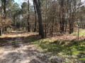
A walk amongst pine trees of various ages, away from major built-up areas. Peace and quiet guaranteed.

In the practical information section, you’ll find the waypoints to follow for three alternative routes, to shorten your walk.

Details

n°987632
Creation:
Last update:
Last review:
  • Walking
    Activity: Walking
  • ↔
    Distance: 6.35 mi
  • ◔
    Average duration: 2h 55 
  • ▲
    Difficulty: Easy

  • ⚐
    Back to start: Yes
  • ↗
    Ascent: + 33 ft
  • ↘
    Descent: - 33 ft

  • ▲
    Highest point: 308 ft
  • ▼
    Lowest point: 253 ft

Photos

Description of the walk

Car park at Labrit secondary school.

(S/E) Head towards the verge of the tarmac path (due west), follow it to the right and continue straight on along the Chemin de Navarre.

(1) Turn left, walk past the airials and continue along the sandy path; at Moulin du Roi, keep to the left.

(2) At a place called Marions, turn right, walk alongside the lagoons and carry on straight ahead through the pine trees. Cross the first junction.

(3) Turn left at the second junction.

(4) Turn right (going against the direction of the FFrandonnée’s Blue Rectangle signposts).

(5) At the fork in the road, turn sharply left (north-east) onto this very sandy track.

(6) Just before the D651, turn right and cross the Ruisseau de la Bernède.

(7) Cross the D651. Take the path opposite. Stay on this path and do not take the tracks to the right or left. Pass close to La Bernède and cross the Ruisseau de la Bernède.

(8) Turn right and walk alongside the fence of the Hougnet farmyard, through the fields. At the Castandet clearing, take the road.

(9) At the end of the road, turn left at Pioc. Stay on this small country road (Route des Plantons). Walk past the house known as Le Tailleur (Tailleurs on the IGN map).

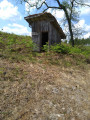
(10) Almost directly opposite this house, on the left, enter the “Château de Terre” area; keep to the right and walk round the site between the ditch and the property fences. Walk past the footbridge leading into the site (which you can visit). Continue straight on towards the hunters’ lodge, and on your right, take the Chemin de Villenave. At the D651, turn left (take care), then take the first right and return to your original car park (S/E).

Waypoints

  1. S/E : mi 0 - alt. 285 ft - Labrit Secondary School car park
  2. 1 : mi 0.16 - alt. 285 ft - Turn left onto Chemin de La Grange. Pass close to the - Estrigon (ruisseau) - Affluent de la Midouze
  3. 2 : mi 0.97 - alt. 269 ft - Turn right at Marions
  4. 3 : mi 1.73 - alt. 259 ft - Turn left at the four-way junction
  5. 4 : mi 1.96 - alt. 256 ft - Turn right, going in the opposite direction to the signposts
  6. 5 : mi 2.17 - alt. 256 ft - Turn left at the fork
  7. 6 : mi 2.64 - alt. 266 ft - Turn right before the D651
  8. 7 : mi 3.03 - alt. 269 ft - Crossing the D651
  9. 8 : mi 4.04 - alt. 282 ft - Hougnet, on the right
  10. 9 : mi 5.01 - alt. 295 ft - Turn left at Pioc
  11. 10 : mi 5.79 - alt. 302 ft - Le Tailleur: enter the area
  12. S/E : mi 6.35 - alt. 285 ft - Labrit Secondary School car park

Notes

Further information:
Landes Department Hiking Guide 14: Landes de Gascogne Regional Nature Park, Sheet 14.4

In the centre of the village
Behind the church: toilet facilities with a water tap and WC.
All shops and services.

Alternative Route 01:
5.5 km route (WaypointsD 1, 2, 3, 4): at this junction, turn left and follow the FFr signposts back to the starting car park (E)
Option 02:
6 km route (WptsD 1, 2, 3, 4, 5, 6): before the D 651, turn left and carry on straight ahead until you reach the FFr signposts, which will lead you back to your starting point (E)
Option 03:
8.5 km route (WptsD 1 2 3 4 5 6 7 8): go straight on along the fence, following a path that turns into a road until you reach the house ‘Le Tailleur’ (10).

Worth a visit

Reviews and comments

4.7 / 5
Based on 1 review

Reliability of the description
5 / 5
Ease of following the route
5 / 5
Route interest
4 / 5
PPC5740
PPC5740

@diskilly,

thanks for these comments – they’re always appreciated by those taking part.

Enjoy your walks.

Machine-translated

diskilly
diskilly

Overall rating : 4.7 / 5

Date of your route : Jul 08, 2018
Reliability of the description : ★★★★★ Very good
Ease of following the route : ★★★★★ Very good
Route interest : ★★★★☆ Good

Hello,

A lovely little walk, well described and very accessible.

Machine-translated

Other walks in the area

For more walks, use our search engine .

The GPS track and description are the property of this route's author. Please do not copy them without permission.