On the way to Le Gué de Caucourt

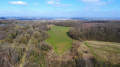
A short walk in the Artois region, featuring these two charming wine cellars and a plateau offering a lovely view.

Details

n°2668685
Creation:
Last update:
Last review:
  • Walking
    Activity: Walking
  • ↔
    Distance: 7.51 mi
  • ◔
    Average duration: 3h 40 
  • ▲
    Difficulty: Moderate

  • ⚐
    Back to start: Yes
  • ↗
    Ascent: + 256 ft
  • ↘
    Descent: - 230 ft

  • ▲
    Highest point: 512 ft
  • ▼
    Lowest point: 295 ft
  • ⚐ Country: France
  • ⚐ City: Caucourt (62150)
  • ⚑
    Start/End: N 50.399517° / E 2.5711°
  • ❏
    IGN map(s): Ref. 2405O, 2406O
  • Hour-by-hour weather

Photos

Description of the walk

Park in the car park by the church and town hall in Caucourt.

(S/E) From the car park, head north-west along Rue Carre, follow it to the first junction and turn left into Rue de Magnicourt.

(1) Leave the cul-de-sac on your right and continue along the path opposite heading south-west; follow it to the next path and turn left. After 10 metres, take the path on the right heading west.

(2) At the crossroads, turn left heading south-west. When you reach the small road, take the path on the right heading north-north-west, pass a mast and head towards the wind turbine.

(3) At the junction by the wind turbine, turn left towards the west; at the next T-junction, turn left towards the second wind turbine and leave the track on your left as it curves.

(4) At this third wind turbine, turn left, pass the last wind turbine and, at the junction with the D72, turn right. After 100 m, take the path on the right heading north-east.

(5) At the end of the path, turn left and, immediately, take the path on the right. When you reach the road, follow it and, at the T-junction, turn left into Rue Basse to enter Hermin.

(6) At the Y-junction, turn right onto Rue du Calvaire, heading south-east. 100 m past the wayside cross, take the path on the left, heading north-east, and follow it to the D73. Turn left to enter Gauchin-Légal.

(7) Once on Chaussée Brunehaut, turn right for 50 metres and then veer right onto Rue Bocquet, then follow the road to the left, heading south-east, leaving the path on your right.

(8) Turn left onto Rue du Château and, at the next junction, turn right onto Rue Petite, heading east.

(9) At this T-junction, turn right onto Rue des Blattier, heading south, and at the Y-junction, take a sharp right.

(10) Cross the Gué de Caucourt and follow the road to the next junction. Turn right onto Rue du Parc, towards a wayside cross.

(11) At the wayside cross, take the road on the left, Rue du Calvaire, and at the first junction, turn left onto Rue Guedin.

(12) At the T-junction, turn right towards the church and return to the starting point (S/E).
Waypoints

  1. S/E : mi 0 - alt. 344 ft - Place de l’Église
  2. 1 : mi 0.25 - alt. 367 ft - Path opposite
  3. 2 : mi 1.15 - alt. 436 ft - Trail junction
  4. 3 : mi 2.27 - alt. 505 ft - Wind turbine No. 1
  5. 4 : mi 2.9 - alt. 476 ft - Wind turbine No. 3
  6. 5 : mi 3.94 - alt. 371 ft - Crossroads
  7. 6 : mi 4.37 - alt. 328 ft - Hermin Stream
  8. 7 : mi 5.41 - alt. 295 ft - Chaussée Brunehaut
  9. 8 : mi 5.72 - alt. 299 ft - Rue du Château
  10. 9 : mi 5.88 - alt. 338 ft - Calvaire
  11. 10 : mi 6.48 - alt. 318 ft - Le Gué de Caucourt
  12. 11 : mi 7.08 - alt. 367 ft - Calvaire
  13. 12 : mi 7.44 - alt. 344 ft - T-junction
  14. S/E : mi 7.51 - alt. 344 ft - Place de l’Église

Notes

Wearing high-top, waterproof walking boots in wet weather is highly recommended, as are walking poles and gaiters.
Bring drinks and snacks with you.

Worth a visit

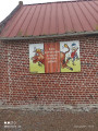
(7) In Gauchin-Légal, you’ll come across Le Gal, who had a rather unfortunate habit of knocking on the doors of unfaithful women. He was chained up in 1925.

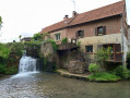
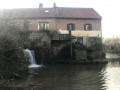
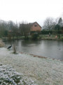
(10) The Gué de Caucourt, with its mill and restaurant.

Reviews and comments

5 / 5
Based on 1 review

Reliability of the description
5 / 5
Ease of following the route
5 / 5
Route interest
5 / 5
capauri
capauri

Overall rating : 5 / 5

Date of your route : Jun 05, 2021
Reliability of the description : ★★★★★ Very good
Ease of following the route : ★★★★★ Very good
Route interest : ★★★★★ Very good
Very busy route : No

A lovely walk. Not much in the way of towns. Quite shady. However, it’s best to be well equipped – some of the paths are rutted and overgrown with grass.

Machine-translated

Other walks in the area

For more walks, use our search engine .

The GPS track and description are the property of this route's author. Please do not copy them without permission.