Country:

 City:
City:


Start from the church car park.
(Out and back) With the church on your right, head towards the Chaussée Brunehaut and turn right, then take the first left onto Rue de Béthune and follow it to the end.
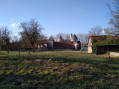
(1) Turn left onto the D57 to enter Olhain, heading straight ahead at the roundabout. Continue to the castle.
(2) Keep to the right and continue uphill, ignoring the paths to the right and left. Carry on to a crossroads at the edge of the forest.
(3) Go straight ahead and continue straight on until you reach the edge of the forest.
(4) Keep to the right, then take the first right and continue along this wide path, passing the leisure park. Carry on to the junction after the swimming pool.
(5) Head straight ahead and, at the end, turn left twice and carry on straight ahead
(6) Carry on to the left until you reach the next junction.
(7) Turn left until you reach the road. Follow it to the left, then take the first right until you reach Rue d’Hermin in the hamlet of Barafles (which gives this route its name).
(8) Turn right onto this road and carry on straight ahead until you reach the Chaussée Brunehaut (D341).
(9) Cross the Chaussée Brunehaut to reach Hermin.
(10) Turn left onto Rue du Château. Then turn left twice to rejoin Rue du Calvaire until you leave the residential area. Take the first left, Chemin de Caucourt. At the end, keep left onto Route de Caucourt (D73) and head for the car park (S/E).
 Association / Club / Walk leader

 Visorando Member
 Difficult
 Easy
Easy