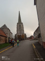
“La Charbonnière” route from Villers-Châtel

A pleasant walk through the Arrageois plain and the Bois Gauchin, passing through the villages of Caucourt, Béthonval and Mingoval.

Details

64297347
Creation:
Last update:
Last review:
  • Walking
    Activity: Walking
  • ↔
    Distance: 7.34 mi
  • ◔
    Average duration: 3h 30 
  • ▲
    Difficulty: Moderate

  • ⚐
    Back to start: Yes
  • ↗
    Ascent: + 171 ft
  • ↘
    Descent: - 171 ft

  • ▲
    Highest point: 522 ft
  • ▼
    Lowest point: 312 ft

Photos

Description of the walk

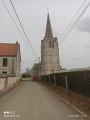
Start from the square by the monument opposite the church.

(S/E) Opposite the church, turn right onto Rue Émile Delaire. At the junction, keep left and continue until you reach a Fork in the road.

(1) Turn left, then carry on until you reach the second path on the right.

(2) Follow this path and carry on straight ahead towards the Bois de Gauchin.

(3) Carry on to the left along the track until you reach the junction for Caucourt at the entrance to Gauchin-Légal.

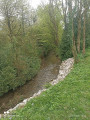
(4) Turn left towards Caucourt and follow the stream on your left until you reach the church.

(5) Turn left onto Rue du Marais and carry on straight ahead, ignoring two Forks in the road, to reach Fond de Béthonsart.

(6) At the third junction, carry on straight ahead until you reach the entrance to the village of Béthonsart.

(7) Turn left onto the Grande Rue and carry on until you reach the third turning on the left.

(8) Turn left onto Rue de l’Église, then left again at Rue de l’Impasse, then turn right onto Rue de Mingoval. At the end, turn right and carry on straight ahead. At the main road, carry on straight ahead until you reach a junction.

(9) Turn right onto Rue du Rietz Hecquet, then veer slightly left onto Rue de la Red Cross, then left onto Rue de l’Église and carry on straight ahead until you reach the second street on the right.

(10) Turn right onto Rue de Mingoval and continue straight on to reach the car park (S/E).

Waypoints

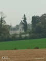
  1. S/E : mi 0 - alt. 479 ft - Monument Square - Château de Villiers-Châtel
  2. 1 : mi 0.83 - alt. 512 ft - Four-way junction
  3. 2 : mi 1.43 - alt. 453 ft - Path on the right
  4. 3 : mi 2.01 - alt. 344 ft - Gauchin Wood
  5. 4 : mi 2.34 - alt. 338 ft - Caucourt
  6. 5 : mi 3.1 - alt. 348 ft - Church
  7. 6 : mi 3.89 - alt. 367 ft - Fond de Béthonsart
  8. 7 : mi 4.99 - alt. 466 ft - Béthonsart, Grande Rue
  9. 8 : mi 5.23 - alt. 472 ft - Path on the left
  10. 9 : mi 6.18 - alt. 453 ft - Junction with Rue du Rietz Hecquet
  11. 10 : mi 6.77 - alt. 463 ft - Rue de Mingoval
  12. S/E : mi 7.34 - alt. 479 ft - Monument Square - Château de Villiers-Châtel

Notes

No water

Worth a visit

Villers Church and Castle
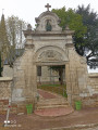
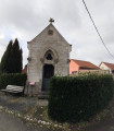
Caucourt Oratory

Reviews and comments

5 / 5
Based on 2 reviews

Reliability of the description
5 / 5
Ease of following the route
5 / 5
Route interest
5 / 5
souchez rando
souchez rando

thank you for your feedback and enjoy your future hiking trips

Machine-translated

Ellzup
Ellzup

Overall rating : 5 / 5

Date of your route : Aug 05, 2025
Reliability of the description : ★★★★★ Very good
Ease of following the route : ★★★★★ Very good
Route interest : ★★★★★ Very good
Very busy route : No

Hike done in the morning, very few people around, very pleasant

Machine-translated

souchez rando
souchez rando

Thank you for your feedback

Machine-translated

Uranie
Uranie

Overall rating : 5 / 5

Date of your route : Apr 21, 2025
Reliability of the description : ★★★★★ Very good
Ease of following the route : ★★★★★ Very good
Route interest : ★★★★★ Very good
Very busy route : No

I’m a member of the Souchez Rando club and we’ve been doing these routes for several years now....
It’s interesting to do them at different times of year....

Machine-translated

Other walks in the area

For more walks, use our search engine .

The GPS track and description are the property of this route's author. Please do not copy them without permission.