Country:
 City:
City:


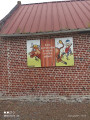
Start at the church square opposite the town hall.
(S/E) With the church on your right, leave the car park and turn right onto Rue Bocquet until you reach Chemin d’Héripre.
(1) Turn left and, at the end, first turn left then right to follow Rue Petite until you reach Chemin des Blattiers.
(2) Turn right onto it and carry on straight ahead until the next junction.
(3) Turn sharply right, cross the ford and carry on straight ahead until you reach Rue Fidèle.
(4) Turn left, then immediately right onto Rue d’en Haut, then cross a footpath on the right, just before No. 10.
(5) Follow it down and carry on straight ahead along Rue Carré until you reach Rue de Magnicourt.
(6) Turn left onto Rue de Magnicourt and carry on to the next junction.
(7) Take the path on the right and carry on straight ahead until you reach the tarmac.
(8) Turn right (Rue de la Chaudière) then take the first left. Pass to the right of the first wind turbine and carry on to the next junction.
(9) Turn left, then right after the second wind turbine to reach a Fork in the road near the third one, at a place called “Sole d’Aubigny”.
(10) Head right and continue to the next junction.
(11) Take a sharp left-hand bend and you’ll reach a road (Rue de Frevillers).
(12) Turn right onto this road and continue along the first track on the left until you reach the next crossroads at a place called Les Terrages.
(13) Turn right and carry on straight ahead along the track until you reach the houses and the junction with the Chaussée Brunehaut (C1).
(14) Follow it to the right, then at the junction, keep right onto the D72. You’ll come to a track with a water tank on your right (elevation 104).
(15) Leave the D72 and take the path on the right. At the foot of the water tower, continue to the left (Rue de Frévillers) until you reach the town hall and the church.
(16) Turn right between the town hall and the church onto Rue Basse, then take Rue du Calvaire on the left and continue to the next junction. Carry on to the left until you reach the junction at the entrance to Gauchin le Gal (Gauchin-Légal on the IGN map).
(17) Turn left onto the D73, enter the village and head for the Place de l’Église (S/E).

 Visorando Member

 Difficult
  Association / Club / Walk leader
 Easy
Easy