Country:
 City:
City:



Park in the car park by the church.
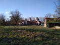
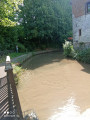
(S/E) Leave the car park with the church on your right, turn right onto Rue Bocquet, then left onto Chemin d’Héripre. Cross the Ruisseau de Rieucourt and you’ll come to a junction near the Château stables.
(1) Turn left and then immediately right to follow Rue Petite to the end.
(2) Continue left, crossing the Chaussée Brunehaut (D341), and carry on until you reach a Fork in the road.
(3) Turn right onto the path running alongside the D73, then leave it behind as you head towards the woods until you reach a crossroads.
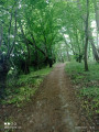
(4) Turn right into the woods and continue straight on until you reach the entrance to Estrée-Cauchy.
(5) Turn right onto Rue du Vieux Dieu, cross the Chaussée Brunehaut (D341) at the pedestrian crossing and take the path opposite, continuing to the end.
(6) Turn left onto Ruelle Annette, then turn right onto Chemin de Mingoval. Pass the sewage treatment plant and continue to the four-way junction at a place called Bois Bridoux.
(7) Turn right and carry on straight ahead, ignoring the three paths on the right, until you reach a junction at Les Quatre du Parcq.
(8) Turn right, then take the first left at a 90° angle. Continue to the crossroads at a place called Bois des Hallumières.
(9) Turn right, then right again at the T-junction. Enter Caucourt and carry on straight ahead until you reach the town hall and the church.
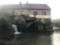
(10) Just after the church, turn right onto Rue du Moulin and continue straight on with the Ruisseau de Caucourt on your right. Keep going in this direction. Cross the ford to reach Chemin des Blattiers.
(11) Turn left onto this path to return to the junction you passed on the way out.
(2) Turn left and follow the route you took on the way there in the opposite direction to return to the car park (S/E).
 Association / Club / Walk leader
 Visorando Member
 Difficult
 Easy
Easy