Country:
 City:
City:


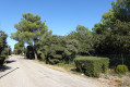
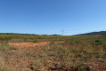
Park at a place called La Castellane, accessible from the D11 between Saint-Paul-lès-Durance and Rians. Turn right to cross a small stone bridge and park at the next junction.
(S/E) Take the small road towards Saint-Paul-lès-Durance, following the red-and-white markings ofthe GR®99A; there are also blue markings.
(1) At the junction, carry on straight ahead along the small road, following the Abéou stream and then past the sports facilities, and continue straight on along the road called “Chemin de la Source”.
(2) Before the traffic lights, turn left at the signpost, towards the Mirabeau Bridge. Turn left at the first junction, then left again.
Keep left at the small signpost to go up to the orienteering table and return to the street. Keep left again; at the next junction, turn right onto Rue du Jas de l’Aire. You will reach a multi-way junction.
(3) Turn left onto the old Chemin de Jonques. The road turns into a track; continue up this track.
(4) At this junction, take the path on the left and carry on straight ahead, still following the red and white markings ofthe GR®99A. You’ll reach another track.
(5) Make a left-right zigzag; leave the blue markings here and continue along this track. At the next junction, turn right onto the descending track. Pass through a barrier to keep cars out and continue straight on, going round a small building on the left and following the more or less tarmac-surfaced track. Pass through the vineyards and under a high-voltage power line to reach the hamlet of La Neuve.
(6) Take the right-hand bend and continue along this small road to join the D11, which also marks the junction with theGR®9.
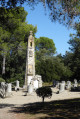
(7) Turn right onto it, continue along this road, passing between the pruned trees and under two high-voltage power lines. You’ll reach the Moument crossroads, dedicated to the Heroes of the Resistance.
(8) Turn right to reach the memorial, then return to the road.
Take the road and theGR® opposite, heading towards La Daouste, and pass in front of fire tank 552.
At the junction, keep to the right on theGR®, walk to the end of the olive grove and continue straight on.
(9) After the vehicle barrier, take the track on the right, which further on becomes a narrow path. At one point, you’ll run alongside the road but carry on along the narrow path, passing alongside the fencing above the motorway. This section is a bit tricky; take care when walking; continue along the narrow path. You’ll reach the motorway emergency access point.
(10) Turn left to join the D96, cross the road with care and turn right, go over the motorway bridge and head for the roundabout.
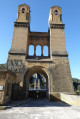
At the roundabout, turn left to reach a viewing point on the bridge overlooking the Durance; leave the red and white markings and cross the D996 to reach the viewing point on the opposite side; turn right then left to take the road towards Saint-Paul-lès-Durance; pass the car park in front of a former pier of the old bridge.
(11) Continue along the road using the protected pavement, cross the motorway emergency access road by leaving the pavement at the barrier, and continue carefully along the road for 300 metres; pass over the motorway tunnel.
(12) Cross the motorway breakdown access road and turn left; walk down the access road to the fence and turn right onto the path leading uphill towards the canal.
(13) Continue along the canal to the road bridge at Saint-Paul-lès-Durance.
(14) At the road bridge, walk up the embankment on the left, cross the road and continue along the small road beside the canal.
Turn right to cross the canal via the footbridge, then cross the D952 at the traffic lights using the pedestrian crossing. Go up the steps opposite the crossing and take the street on the left.
(2) At the next junction, turn right onto “Chemin des Sources” and carry on straight ahead to reach the car park (S/E).

 Visorando Member
 Easy
Easy 
 Moderate