Elz-Allmend Tour

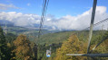
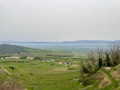
The tour begins in the heart of Emmendingen at the railway station. Walking along the Elz embankment, you can enjoy the riverside landscape with views of the Kandel until you reach the village of Wasser. From the town hall, take the Hirtenweg to reach the large Allmendwald, one of the largest areas of floodplain woodland in the Upper Rhine Plain. The path winds its way through the forest alongside a small stream. Fields, orchards, a group of settlers’ farmsteads, copses and woodland, as well as the Neugraben watercourse, line your route. Passing through fields, you’ll reach the outskirts of Emmendingen once more and end your walk at Emmendingen railway station.

Details

n°29294211
Creation:
Last update:
Last review:
  • Walking
    Activity: Walking
  • ↔
    Distance: 8.58 mi
  • ◔
    Average duration: 4h 00 
  • ▲
    Difficulty: Easy

  • ⚐
    Back to start: Yes
  • ↗
    Ascent: + 98 ft
  • ↘
    Descent: - 98 ft

  • ▲
    Highest point: 728 ft
  • ▼
    Lowest point: 646 ft

Photos

Description of the walk

Start: Emmendingen railway station (Bahnhofstraße 7, 79312 Emmendingen)

(S/E) From the ‘Bahnhof’ (signposted on the walking map), the blue diamond symbol leads through the pedestrian/cyclist underpass to the ‘Festplatz’ (signposted on the walking map).

(1) We cross the road, walk upstream along the Elz embankment (yellow diamond), pass under the B 3 bridge and reach the ‘Wasserer Wiesenbrücke’. Along the way, we enjoy the riverside landscape with a view of the Kandel.

(2) Crossing the bridge, we arrive in the village of Wasser at Basler Straße and turn right towardsthe ‘Rathaus Wasser’ (WaterTown Hall), signpost.

(3) We leave the village via the Hirtenweg, turning left into the countryside; we climb a ramp to the wooden bridge over the main road and enter the large Allmendwald.

(4) We pass the signposts for ‘Schweinsweide’ and‘Wasserwerk’, with the buildings of the Mauracher Berg Water Supply Association.

(5) Atthe ‘Nonnenhölzle’signpost, we turn right onto a lovely narrow path (marked with a ‘red diamond on a yellow background’). Winding its way alongside a small stream, the track meanders through the forest for a good kilometre.

(6) We cross the Wasser-Reute road and, from the ‘Sportplatz Reute’ signpost, follow the signposts for the Schwarzwald-Kaiserstuhl-Rhein cross-country trail. Fields, orchards, a group of farmsteads, copses and woodland, as well as the Neugraben watercourse, run alongside the path.

(7) We pass the signpostsfor “Siedlungshöfe”and “Möslebrücke”.

(8) Atthe ‘Kleiner Dreispitz’, the direction of the walk changes. Following a narrow path, we reach the ‘Allmend Mitte’ crossroads in the middle of the forest.

(9) Here, it’s worth taking a detour to the left towardsthe “Bäckermaidlistein”and the two forest ponds.

Following the blue diamond along forest tracks and paths, the signposts for ‘Forstrat Hof Eiche’ – where we keep to the right – and ‘Roßwinkel’ – where we turn left – lead us to the edge of the forest.

(10) We turn left and then immediately right again. Our destination, Emmendingen, lies ahead of us. We reach the outskirts of the town through fields.

(11) We reach an industrial estate, turn left onto Alfred-Walz-Straße, then right onto Schützenstraße, cross the Elz and the main road, and arrive back at the ‘Festplatz’ and return to the ‘Bahnhof’ (S/E).

Waypoints

  1. S/E : mi 0 - alt. 663 ft - Emmendingen railway station
  2. 1 : mi 0.24 - alt. 659 ft - Elzdamm
  3. 2 : mi 1.69 - alt. 689 ft - Wasserer Wiesenbrücke
  4. 3 : mi 1.94 - alt. 692 ft - Wasser Town Hall / Hirtenweg
  5. 4 : mi 2.65 - alt. 696 ft - Signpost ‘Wasserwerk’
  6. 5 : mi 2.8 - alt. 696 ft - ‘Nonnenhölzle’ signpost
  7. 6 : mi 3.48 - alt. 699 ft - Wasser-Reute Street
  8. 7 : mi 3.93 - alt. 666 ft - Guide to “Siedlungshöfe”
  9. 8 : mi 4.93 - alt. 669 ft - Kleiner Dreispitz
  10. 9 : mi 5.63 - alt. 696 ft - Allmend Mitte crossroads – to the Bäckermaidlistein
  11. 10 : mi 7.08 - alt. 669 ft - Edge of the forest, on the left
  12. 11 : mi 7.73 - alt. 653 ft - Industrial estate
  13. S/E : mi 8.58 - alt. 663 ft - Emmendingen railway station

Notes

Equipment:
Sturdy footwear recommended

ℹ️ Contact:
Emmendingen Tourist Information
In the station building, Bahnhofstr. 8
79312 Emmendingen

Author: Ratold Moriell

Worth a visit

We recommend a short detour from the ‘Allmend Mitte’ crossroads to the Bäckermaidlistein and the forest ponds. This adds a further 1.0 km to the round-trip route. (9)

If you’d like to shorten the walk, head from the ‘Sportplatz Reute’ along a narrow path to the ‘Roßwinkel’ and then follow the main route back to the station. The walking time for the shorter route is 2.5 hours and the walk is reduced to 9.5 km.

ℹ️ Facilities:
Waldsee rest area
79331 Teningen

🍽️ Places to eat:
Waldeck-Straussi Reute
Emmendinger Straße 19
79331 Teningen

Reviews and comments

4.7 / 5
Based on 1 review

Reliability of the description
5 / 5
Ease of following the route
5 / 5
Route interest
4 / 5
Willems Grâce-Hollogne

Overall rating : 4.7 / 5

Date of your route : Jan 11, 2025
Reliability of the description : ★★★★★ Very good
Ease of following the route : ★★★★★ Very good
Route interest : ★★★★☆ Good
Very busy route : No

A very fine walk, fairly easy to do as there are no noticeable gradients.

Machine-translated

Other walks in the area

For more walks, use our search engine .

The GPS track and description are the property of this route's author. Please do not copy them without permission.