


Refine your search for walks in Église Sainte-Geneviève (Montigny-Lencoup)
Église Sainte-Geneviève (Montigny-Lencoup) walks


 Grand tour of Île-de-France in 34 stages on the GR®11
 Visorando Member
 528.35 mi
 +22,037 ft
 -22,156 ft
 34 days
 Difficult
 Departure from Paris
This marked GR® route around the Île-de-France region (with a few forays into neighbouring departments and regions) complements its "little brother", the GR®1, by forming a circular route around Paris, generally with a slightly larger radius.
It follows the same overall pattern: first, a radial section starting from Paris (more precisely from the Pont d'Austerlitz, near the former confluence of the Bièvre and the Seine), going up the entire Bièvre valley, then continuing to Villiers-Saint-Frédéric, in the Yvelines. From there, it is a circular route that loops around the Île-de-France region, close to its borders with neighbouring regions.
The route passes through beautiful regions, often untouched by intensive urbanisation, regional nature parks and other protected natural areas, and takes in some architectural wonders.
From Donnemarie-Dontilly to Montereau-Fault-Yonne in Bassée-Montois
 16.56 mi
+669 ft
-850 ft
8h 10
Difficult
Departure from Donnemarie-Dontilly (Seine-et-Marne)
16.56 mi
+669 ft
-850 ft
8h 10
Difficult
Departure from Donnemarie-Dontilly (Seine-et-Marne)
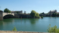
Twenty-fourth stage of the Grand Tour of Île-de-France via the GR®11, starting from Donnemarie-Dontilly after spending the night there at the end ofthe previous stage. This stage connects the Montois region to the Seine Valley and Montereau-Fault-Yonne, the confluence of the Seine and Yonne rivers. It thus transitions from an agricultural landscape to a marshland landscape in the valley, ending in a more urban environment.
Walks near Église Sainte-Geneviève (Montigny-Lencoup)
From Montereau-Fault-Yonne to Pont-sur-Yonne
 Association / Club / Walk leader
 18.24 mi
+62 ft
-16 ft
10 hrs
18.24 mi
+62 ft
-16 ft
10 hrs
 Very difficult
Departure from Montereau-Fault-Yonne (Seine-et-Marne)
Very difficult
Departure from Montereau-Fault-Yonne (Seine-et-Marne)
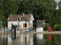
This is the first stage of the Via Burgundia®, which takes you across the whole of Burgundy from Montereau-Fault-Yonne to Mâcon, south of Saône-et-Loire. This major route, covering almost 500 km, is divided into three sections: the Yonne section, the Morvan section and, finally, the Southern Burgundy section.
This first section follows the course of the River Yonne from its confluence with the River Seine to Pont-sur-Yonne. It involves very little elevation gain but remains a fairly long stage if you cover it in a single day. The route winds its way along the River Yonne, past fields of cereals and ponds (or ‘noues’), particularly after Bichain.
From Montereau to Vernou-sur-Seine via the towpath and the plateau
 8.52 mi
+249 ft
-207 ft
4h 10
8.52 mi
+249 ft
-207 ft
4h 10
 Moderate
Departure from Montereau-Fault-Yonne (Seine-et-Marne)
Moderate
Departure from Montereau-Fault-Yonne (Seine-et-Marne)
A three-stage walk from station to station. First, you cross the town of Montereau, the highlight being the Gothic collegiate church and the double bridge at the confluence of the Seine and the Yonne. Next, you follow the towpath, which is mostly shaded. Finally, you climb to a higher elevation before descending to Vernou-sur-Seine station.
(Please note) Just before (9), the underpass beneath the railway line is closed (see the comment posted on 21 July 2026). Until this obstruction is cleared, one option is to turn right to find a level crossing. Once you have crossed the tracks safely, follow the D39 to the left until you reach point (9).
Along the River Yonne from Montereau-Fault-Yonne
11.58 mi
+43 ft
-23 ft
5h 20
Moderate
Departure from Montereau-Fault-Yonne (Seine-et-Marne)
A walking route from station to station, starting at Montereau Fault-Yonne station and ending at Villeneuve-la-Guyard along the River Yonne, allowing you to explore the ponds and marshes near the finish. A peaceful, quiet walk along the water’s edge, passing through the village of Misy-sur-Yonne, which is known for its historic site.
From Montereau-Fault-Yonne to Moret-sur-Loing, from one confluence to another.
 15.76 mi
+492 ft
-456 ft
7h 40
Difficult
Departure from Montereau-Fault-Yonne (Seine-et-Marne)
15.76 mi
+492 ft
-456 ft
7h 40
Difficult
Departure from Montereau-Fault-Yonne (Seine-et-Marne)
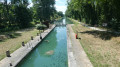
This is the twenty-fifth stage of the Grand Tour of Île-de-France via the GR®11, starting from Montereau station, not far from the confluence of the Seine and the Yonne, and ending at Moret-Veneux-les-Sablons station, not far from the confluence of the Seine and the Loing. The stage, entirely on the GR®11, follows a route on the left bank of the Seine, joining the Orvanne valley a little further south, and returns to Moret-sur-Loing and its beautiful historic centre, following the Canal du Loing on its towpath.
From Longueville to Donnemarie-Dontilly through the Montois
 14.37 mi
+951 ft
-876 ft
7h 25
Difficult
Departure from Longueville (Seine-et-Marne) (Seine-et-Marne)
14.37 mi
+951 ft
-876 ft
7h 25
Difficult
Departure from Longueville (Seine-et-Marne) (Seine-et-Marne)
Twenty-third stage of the Grand Tour of Île-de-France via the GR®11, and the first of a series of two stages, including this one, needed to connect the Longueville and Montereau stations, through the Montois and the Seine Valley.For this first stage of the diptych, we suggest spending the night in a bed and breakfast in Donnemarie-Dontilly, roughly halfway between the two stations, after a beautiful crossing of the Montois, in a landscape that is a little more varied and hilly than the Brie just to the north.
From Longueville to Provins via Chalautre-la-Petite
 6.85 mi
+469 ft
-443 ft
3h 35
Moderate
Departure from Longueville (Seine-et-Marne) (Seine-et-Marne)
6.85 mi
+469 ft
-443 ft
3h 35
Moderate
Departure from Longueville (Seine-et-Marne) (Seine-et-Marne)
A hike from station to station that allows you to reach the town of Provins, a UNESCO World Heritage Site, on foot. From place to place, the route offers increasingly close views of the Upper Town of Provins. In a refreshing setting, the village of Chalautre-la-Petite also boasts an interesting heritage.
From Vernou-sur-Seine to Fontainebleau via Saint-Mamès and Thomery
 10.25 mi
+495 ft
-463 ft
5h 10
Moderate
Departure from Vernou-la-Celle-sur-Seine (Seine-et-Marne)
10.25 mi
+495 ft
-463 ft
5h 10
Moderate
Departure from Vernou-la-Celle-sur-Seine (Seine-et-Marne)
A very varied hike from station to station. The Chemin des Herces, high up, offers beautiful views of the Seine and the town of Saint-Mammès, where you will find a beautiful Romanesque church. After walking along the Seine, you stroll between the old vine walls of Thomery. You return to the banks of the Seine and the hike ends with a detour into the Fontainebleau National Forest.