


Refine your search for walks in Église Saint-Nicolas (Pertuis)
Église Saint-Nicolas (Pertuis) walks


 Tourist office
Walks near Église Saint-Nicolas (Pertuis)
 From Cucuron to Vitrolles-en-Lubéron
 Visorando Member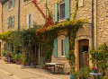
 15.61 mi
 +3,950 ft
 -3,337 ft
 10h 35
 Difficult
 Departure from Cucuron (Vaucluse)
This third stage takes you through the forests on the southern slopes of the Grand Lubéron. From Cucuron, the route climbs gently northwards across fields, then rises steeply up the wooded flank of the Montagne du Grand Lubéron and, following various valleys, reaches the bare ridge at the small pass of Basse Cabrière, east of the Mourre Nègre, the highest point of the massif. It winds along the ridge and, at its end, drops down the northern slope, then, skirting Mont La Grand Colle, returns south via the Vallat de la Combe d’Apt, before reaching Vitrolles-en-Lubéron.
From Vitrolles-en-Lubéron to Oppedette
 16.74 mi
+2,434 ft
-2,405 ft
9h 50
Difficult
Departure from Vitrolles-en-Lubéron (Vaucluse)
16.74 mi
+2,434 ft
-2,405 ft
9h 50
Difficult
Departure from Vitrolles-en-Lubéron (Vaucluse)
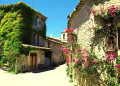
This fourth stage begins with a route halfway up the wooded slope of the Vallat de Pissaire before entering the Ravin du Gancet and then crossing the Aiguebelle valley to reach the hilltop village of Montjustin. The route follows the ridge of the hill separating this valley from that of the Encrême and descends to reach Céreste, situated at their confluence. It crosses the remarkable Pont de la Baou before revealing, nestled in the woods, the medieval Priory of Carluc. It climbs the side of the valley and swings over to that of the Grand Vallat, then ascends its sunny slope towards Sainte-Croix-à-Lauze, from where it reaches the top of the Cavalon valley before descending it to reach the village of Oppedette.
From Vitrolles to Céreste via Montjustin
 9.01 mi
+915 ft
-1,312 ft
4h 55
9.01 mi
+915 ft
-1,312 ft
4h 55
 Moderate
Departure from Vitrolles-en-Lubéron (Vaucluse)
Moderate
Departure from Vitrolles-en-Lubéron (Vaucluse)
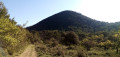
The third stage is the shortest of this route. After a very pleasant walk along a track at the foot of wooded hills, we take a narrow path that allows us to cross from the southern to the northern side of the massif. We then climb up to the pretty village of Montjustin, before descending via a ridge offering superb views.
From Sivergues to Vitrolles via the Luberon ridges
 13.06 mi
+2,159 ft
-2,703 ft
7h 55
Difficult
Departure from Sivergues (Vaucluse)
13.06 mi
+2,159 ft
-2,703 ft
7h 55
Difficult
Departure from Sivergues (Vaucluse)
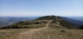
This second stage is both long and superb! First, you climb the highest point of the Luberon, the Mourre Nègre, alternating between steep paths and gently sloping tracks. Then, you follow the ridges from west to east, always on open terrain with sweeping panoramic views. The (long) descent to Vitrolles is shaded.
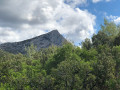
La Sainte Victoire
 6.71 mi
+2,385 ft
-2,169 ft
5h 10
Difficult
Departure from Saint-Marc-Jaumegarde (Bouches-du-Rhône)
6.71 mi
+2,385 ft
-2,169 ft
5h 10
Difficult
Departure from Saint-Marc-Jaumegarde (Bouches-du-Rhône)
Une magnifique promenade sur l'un des plus hauts massifs de Provence qui convient pour une sortie du club de randonnée en autocar (le départ du parking du barrage de Bimont et l'arrivée à Vauvenargues). La montée au Prieuré et à la Croix de Provence se fait par le sentier Imoucha et la descente par le sentier des Venturiers. De sublimes paysages de Paul Cézanne en 3D au sommet : la basse Provence jusqu'à la mer et l'étang de Berre, le sommet du mont Ventoux, les contours des Alpes au Nord.Attention. Un randonneur signale le 17 septembre 2024 :- Fermeture du Sentier Imoucha pour travaux du 01/10/2024 au 31/12/2024 et du 01/10/2025 au 31/10/2025.- Fermeture du Prieuré pour travaux jusqu'au 31/12/2024.
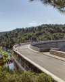
Chemin de Roques Hautes from the Bimont dam
 4.01 mi
+709 ft
-850 ft
2h 30
4.01 mi
+709 ft
-850 ft
2h 30
 Easy
Departure from Saint-Marc-Jaumegarde (Bouches-du-Rhône)
Easy
Departure from Saint-Marc-Jaumegarde (Bouches-du-Rhône)
This short loop from the Bimont dam allows you to visit Roques Hautes. It is very accessible, even for families. You will see a marble quarry, numerous busy meadows and, of course, a beautiful view of the Sainte-Victoire mountain.
There are a few changes to the route in the reserve, see the notices
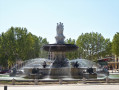
The historic centre of Aix-en-Provence
 4.31 mi
+72 ft
-98 ft
2h 05
Easy
Departure from Aix-en-Provence (Bouches-du-Rhône)
4.31 mi
+72 ft
-98 ft
2h 05
Easy
Departure from Aix-en-Provence (Bouches-du-Rhône)
A family outing, a cultural outing, an architectural outing... and a culinary outing if you like! Fountains, cathedrals, churches, museums, theatres, hotels, squares and other attractions... The main things to discover when you come to Aix-en-Provence, a city of water, art, history and well-being!
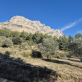
From the Refuge Cézanne to the Deux Aiguilles car park via the Trou
 1.80 mi
+387 ft
-407 ft
1h 10
Easy
Departure from Saint-Antonin-sur-Bayon (Bouches-du-Rhône)
1.80 mi
+387 ft
-407 ft
1h 10
Easy
Departure from Saint-Antonin-sur-Bayon (Bouches-du-Rhône)
This trail is an alternative known to local hikers for reaching the Saint-Antonin car parks when they have just completed a circular in Sainte-Victoire: it avoids following the brown-marked route, passing through the Col de l'Oppidum (alt. 580 m), then descending a very steep and rugged path. There is a 40-metre less elevation gain, and when you are in a hurry to get to the car park or tired, taking this Trou trail is a good option, especially in bad weather.
From Céreste to Apt via the plain, Auribeau and Saignon
 13.87 mi
+1,532 ft
-2,051 ft
7h 45
Difficult
Departure from Céreste (Alpes-de-Haute-Provence)
13.87 mi
+1,532 ft
-2,051 ft
7h 45
Difficult
Departure from Céreste (Alpes-de-Haute-Provence)
The final stage of this route is long and varied. The first section takes place on the plain at the foot of the Luberon ridges, which were traversed in the opposite direction during the second stage. We then gain altitude, climbing successively to the villages of Glorivette, Castellet-en-Lubéron and Auribeau, the latter two boasting a rich heritage. We then descend all the way, passing through the beautiful village of Saignon along the way.