The Balconies of Pertuis

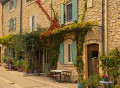
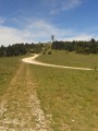
Discover Pertuis’s natural surroundings and venture into the hills to the north-west of the town.

Details

45482008
Creation:
Last update:
Last review:
  • Walking
    Activity: Walking
  • ↔
    Distance: 3.58 mi
  • ◔
    Average duration: 1h 45 
  • ▲
    Difficulty: Easy

  • ⚐
    Back to start: Yes
  • ↗
    Ascent: + 148 ft
  • ↘
    Descent: - 171 ft

  • ▲
    Highest point: 814 ft
  • ▼
    Lowest point: 656 ft
  • ⚐ Country: France
  • ⚐
    Area: Luberon
  • ⚐ City: Pertuis (84120)
  • ⚑
    Start/End: N 43.694419° / E 5.50183°
  • ❏
    IGN map(s): Ref. 3143ET, 3243OT, 3244ET
  • Hour-by-hour weather

Description of the walk

Park at the Mirabeau car park near Saint-Nicolas Church.

(S/E) With your back to the car park, walk around Place de la Fontaine Mirabeau, keeping Rue Danton on your left, and follow the street that joins Rue des Remparts. Turn right onto this street, walk past the house with columns (public granary, 1857) and pass a large car park on your left. Continue along Rue de la Dévalade and cross the bridge over the Èze.

(1) Cross Boulevard Jean Guigues with care and take Chemin Saint-Joseph slightly opposite on the right; follow it straight on until the junction with the D56.

(2) Walk carefully along the left-hand side until you reach the bend where you join Chemin de Boussette.

(3) Turn left and follow this road north-west through farmland until you reach a crossroads.

(4) Turn left, then continue along an unpaved track to a crossroads (elevation 245m). Continue straight on to a fork in the road.

(5) Turn left and go round the hamlet of Mélède, taking a path that descends between vineyards and woods. Pass under a large, distinctive pine tree and continue to the tarmac road.

(6) Turn left towards Saouzé (ignore two junctions). Follow this road until you reach a bend with an old Jewish cemetery planted with olive trees on your right, at the Pertuis sign.

(7) Turn right onto Chemin de la Peyrière and emerge onto Boulevard Jean Guiges. Head left to return to the junction from the outward journey and the bridge.

(1) Turn right, cross the bridge again and follow the outward route in the opposite direction to reach the Mirabeau car park (S/E).

Waypoints

  1. S/E : mi 0 - alt. 712 ft - Mirabeau car park - Église Saint-Nicolas (Pertuis)
  2. 1 : mi 0.3 - alt. 659 ft - Eiffel Bridge at Èze
  3. 2 : mi 0.66 - alt. 696 ft - D56
  4. 3 : mi 0.92 - alt. 725 ft - Chemin de Boussette
  5. 4 : mi 1.33 - alt. 804 ft - Crossroads
  6. 5 : mi 1.72 - alt. 807 ft - Junction to head back down
  7. 6 : mi 2.03 - alt. 741 ft - Tarmac road towards Pertuis
  8. 7 : mi 2.69 - alt. 741 ft - Chemin de la Peyrière junction
  9. S/E : mi 3.58 - alt. 712 ft - Mirabeau car park

Notes

(S/E) Parking is also available at the large Dévalade car park. Walk up to the keep.

Worth a visit

Reviews and comments

3.8 / 5
Based on 2 reviews

Reliability of the description
5 / 5
Ease of following the route
4 / 5
Route interest
2.5 / 5
User 28397697

Overall rating : 3 / 5

Date of your route : Jan 21, 2026
Reliability of the description : ★★★★★ Very good
Ease of following the route : ★★★☆☆ Average
Route interest : ★☆☆☆☆ Very disappointing
Very busy route : No

A stroll through the housing estates of Pertuis. Since this walk was created, the hills of Pertuis have been built up.

Machine-translated

Nicolas-68
Nicolas-68

Overall rating : 4.7 / 5

Date of your route : Nov 03, 2025
Reliability of the description : ★★★★★ Very good
Ease of following the route : ★★★★★ Very good
Route interest : ★★★★☆ Good
Very busy route : No

An easy walk in the hills above Pertuis. A pleasant path through the vineyards in the middle of the route with beautiful views of the mountains in the distance.

Machine-translated

Other walks in the area

For more walks, use our search engine .

The GPS track and description are the property of this route's author. Please do not copy them without permission.