


Refine your search for walks in Église Saint-Maurice (Larringes)
Église Saint-Maurice (Larringes) walks


 The Oratory of Perron
 Visorando Member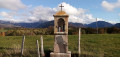
 6.85 mi
 +404 ft
 -417 ft
 3h 30
3h 30
 Moderate
 Departure from Larringes (Haute-Savoie)
The Perron oratory was built on a hillock that is the highest point of the Plateau de Gavot (910 m). From this small summit, as well as from much of the route, you can enjoy extensive views of the northernmost peaks of the Chablais (Mémises, drystone shelter, Oche, Ouzon, Billiat). A family hike that follows paths or small roads with very little traffic.
Circular loop between Champanges and Larringes
 4.36 mi
+318 ft
-335 ft
2h 15
4.36 mi
+318 ft
-335 ft
2h 15
 Easy
Departure from Champanges (Haute-Savoie)
Easy
Departure from Champanges (Haute-Savoie)
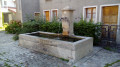
A short walk, the first half of which takes place on quiet roads and the second on pleasantly shaded paths. Two churches, a medieval castle, a few wayside shrines and several beautiful drinking fountains await you.
A circular walk to the Champeillant Chapel from Larringes
 4.36 mi
+344 ft
-351 ft
2h 20
Easy
Departure from Larringes (Haute-Savoie)
4.36 mi
+344 ft
-351 ft
2h 20
Easy
Departure from Larringes (Haute-Savoie)
A short, picturesque walk leading to the Champeillant Chapel, from where you can enjoy sweeping views over Lake Geneva, the neighbouring mountain ranges and Mont Blanc.
Walks near Église Saint-Maurice (Larringes)
From Lugrin to Meillerie via the hamlet of Les Combes
 4.50 mi
+1,115 ft
-1,112 ft
3h 00
Moderate
Departure from Lugrin (Haute-Savoie)
4.50 mi
+1,115 ft
-1,112 ft
3h 00
Moderate
Departure from Lugrin (Haute-Savoie)
A linear hike, which requires careful planning, connecting two landing stages on Lake Geneva at a higher altitude. An often shaded route that nevertheless offers beautiful views of the lake. Oratories, chapels and churches are also along the way.
From Bernex to Les Chalets de Bise
8.24 mi
+4,633 ft
-2,795 ft
7h 50
 Very difficult
Departure from Bernex (Haute-Savoie)
Very difficult
Departure from Bernex (Haute-Savoie)
After a climb through the forest to wake up our muscles, we leave the mountain pastures of the Bas-Chablais Pre-Alps behind us. The route runs alongside several lakes and offers panoramic views stretching from the Jura mountains to the Mont Blanc massif before plunging down below the Cornettes de Bise.
From Bise to Lake Fontaine via Ubine
5.35 mi
+1,742 ft
-2,293 ft
4h 00
Moderate
Departure from La Chapelle-d'Abondance (Haute-Savoie)
If you want to discover the mountains in all their forms, both mineral and human, take this challenging route.
You are in a protected area! See the regulations in the practical information section.
Graydon from the cable car
 Tourist office4.58 mi
+171 ft
-2,018 ft
2h 15
Moderate
Departure from Saint-Jean-d'Aulps (Haute-Savoie)
Tourist office4.58 mi
+171 ft
-2,018 ft
2h 15
Moderate
Departure from Saint-Jean-d'Aulps (Haute-Savoie)
Reach the Graydon mountain pasture and its chapel by first taking the Roc d'Enfer cable car. You will then find yourself in a peaceful environment, surrounded by gentians and grazing cows, with Mont Blanc as a backdrop... The Graydon mountain pasture stretches out at the foot of the majestic Roc d'Enfer, where cows and goats graze peacefully on the lush grass around the small chapel surrounded by a magnificent valley.
From Saint-Gingolph to the Chalets de Bise
 7.66 mi
+5,013 ft
-1,348 ft
7h 55
7.66 mi
+5,013 ft
-1,348 ft
7h 55
 Difficult
Departure from Saint-Gingolph (Haute-Savoie)
Difficult
Departure from Saint-Gingolph (Haute-Savoie)
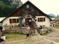
This first stage of the Grande Traversée des Alpes (GTA), from Lake Geneva to the Mediterranean, takes place in the Chablais massif. The path climbs up the Novel valley on the left bank of the Morge, below the hamlet of La Meurtaz, then follows the D30 road, which it overlooks after the hamlet of Jordy. On leaving Novel, the path winds its way above the hairpin bends of the D30 to La Planche. There, it leaves the main valley route to climb due south towards the chalets of Neuteu and on to the Col de Bise, before descending to the Chalets de Bise.
Saint Gingolph - La Chapelle d'Abondance
10.74 mi
+6,010 ft
-3,934 ft
10h 10
Difficult
Departure from Saint-Gingolph (Haute-Savoie)
Itinéraire de la traversée des Alpes. Etape des rives du lac Léman au Val d'Abondance. Franchir les montagnes du Chablais par une longue grimpette de 1850m en traversant les alpages pour passer le Col de Bise puis redescendre à la station de ski de la Chapelle d'Abondance. Cet itinéraire offre de très beaux panoramas sur le plus grand lac d'Europe et sur le sommet des Cornettes de Bise.
La Chapelle d'Abondance - Refuge de Chesery
13.80 mi
+3,907 ft
-745 ft
9h 45
Difficult
Departure from La Chapelle-d'Abondance (Haute-Savoie)
Itinéraire de la traversée des Alpes. De La Chapelle d’Abondance passer par le Haut Giffre pour un intermède suisse. Cette étape domine la Haute Vallée de la Dranse d'Abondance, passe par le domaine skiable des Portes du Soleil.
Vous êtes sur une zone protégée. Voir la réglementation dans les informations pratiques.
From Lac des Plagnes to Lac de Tavaneuse
 5.73 mi
+2,507 ft
-2,677 ft
4h 50
Difficult
Departure from Abondance (Haute-Savoie)
5.73 mi
+2,507 ft
-2,677 ft
4h 50
Difficult
Departure from Abondance (Haute-Savoie)
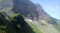
A linear hike from a lake accessible by car to a mountain lake in a wild setting, then back down into the valley. A very beautiful traverse at the foot of the impressive north faces of Pointe de la Chavache and Pointe d'Entre Deux Pertuis.