


 Country:

 City:
City:


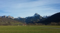
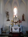
Start from the church in Champanges, Place Anselme Boujon. Park in the car park near the sports grounds, behind the church and opposite the town hall. Champanges is situated about ten kilometres from Thonon-les-Bains or Evian-les-Bains.
(S/E) Head south along Rue de Savoie, keeping to the right-hand side of the tennis courts.
(1) After a left-hand bend, at the junction, turn right onto Route des Hermones. At the Fork in the road, keep left onto the same road. Ignore Chemin des Écureuils on the left.
(2) At the junction, turn right and head downhill past a reservoir on the right-hand side. Take a hairpin bend to the left, then one to the right, and cross a stream. Head uphill and ignore any paths or roads coming from the left.
(3) At the T-junction, turn right. At the ‘Give Way’ sign that follows, turn left onto the D11 towards Thonon. At the next junction, turn left again.
(4) At the ‘Stop’ sign, take the second right-hand turn at an angle and pass a drinking trough on the right-hand side. Immediately afterwards, turn left towards Lesvaux/Le Creux.
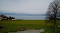
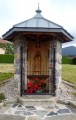
(5) After a left-hand bend (with a wayside shrine on the right-hand side), continue eastwards and pass through the hamlet. At the fork in the road, turn left (ignore the sign for Le Creux on the right) and head uphill. At the next fork in the road (with a traffic mirror), turn left (with a view of Lake Geneva on the left).
(6) At the Stop sign, turn right and enter Féternes. Just before a drinking trough, take the first right onto Rue du Stade. Turn left and walk alongside the stadium on your right.
(7) Carry on straight ahead along Chemin de l’Épineux and head downhill (sign saying ‘No vehicles over 3.5 tonnes’). Cross a stream, head back uphill and cycle between meadows and woodland. At the Stop sign, turn right and enter Vougron.
(8) Take the first left (shrine, bus shelter) towards Sur les Crêts. At the Fork in the road, turn left and, immediately afterwards, ignore a road on the left. Head uphill through the meadows. After a left-hand bend, at a Fork in the road, follow the right-hand path to reach Sur les Crêts.
(9) At the next junction, turn left onto the road closed to heavy goods vehicles towards the Chapelle de Champeillant (incorrectly spelt “Champellant” on the IGN map), which comes into view as you climb (lovely view of Lake Geneva to the left). At the next junction, turn left and you’ll reach the chapel straight away.
(10) Turn round and, at the previous junction, take the left-hand lane. Ignore the Chemin de Nattay on the right, then a road on the left that slopes down slightly. At the ‘Give Way’ sign, turn right and you’ll come to a crossroads.
(11) Take the road opposite (the second on the right) towards Les Clouz. At the first houses, carry straight on.
(12) At the next junction, turn left onto Route de Théry. In Théry, carry on straight ahead.
(13) At the Stop sign, turn left uphill. A little further on, ignore a road on the right.
(14) At the Stop sign, turn right. Drive through the village centre of Vinzier and pass by the foot of the church (on the right-hand side).
(15) At the Stop sign, turn left then immediately right onto the D21 towards Saint-Paul/Évian. After a long straight stretch, turn right towards Chez Bochet. At the T-junction, turn right. Ignore a small road on the right and you’ll come to a junction (with a wayside shrine).
(16) Turn right downhill. Take a hairpin bend to the right, then a bend to the left.
(17) At the first junction, turn left towards Les Faverges and pass through the hamlet of Place. Ride eastwards through the Plaine des Faverges (beautiful view of the Mémises-Oche massif), ignoring the side roads. Pass an electricity substation (on the left), then a school (on the right) and finally a chapel (on the left).
(18) When you reach an oratory, turn right towards Bernex. Cross the Ugine stream and head uphill.
(19) At the Stop sign, follow the D152 to the left as far as the entrance to Bernex. At the junction, turn left towards “Mont Bénand” and cross the Ugine again. Pass by the foot of Bernex church (on the left) and arrive at a crossroads (on the right, towards Trossy/Creusaz).
(20) Turn left. Follow the D52, first uphill then on level ground. Continue uphill and pass the turn-off for La Beunaz. Carry on to the Chapel of La Beunaz.
(21) At the chapel, take a sharp right onto Chemin de la Gottetaz. Take the first left and pass an oratory (on the left-hand side). At the Fork in the road, take the left-hand track, head down alongside Lake La Beunaz (water park) and reach Chez Gaillet.
(22) At the junction, turn right, head down between the houses and then climb slightly. Continue along the small, very shaded road until you reach the Roseires d’Amont wayside shrine (on the right-hand side).
(23) At the fork in the road, turn left towards Thollon (steep descent).
(24) At Roseires d’Aval, carry on straight ahead downhill. At the next junction (large cross on the left-hand side), turn right and head downhill towards Thollon.
(25) At the T-junction, take the main road on the right.
(26) At the Fork in the road, turn right towards the chapel. Turn left at the corner of a house (take care, very narrow passage) and you’ll reach the Chapelle de Laprau.
(27) Continue along the small road and, at the end, turn left onto the D24. After about 150 metres, turn left towards Saint-Paul.
(26) At the junction you passed earlier, turn right, still heading towards Saint-Paul (west).
(25) Carry on straight ahead, enter Les Bossons and ignore the sign for Chez Trincat on the right.
(28) At the next junction, turn left onto the Chemin du Champ des Grives towards Praubert (steep climb). At the T-junction (with a wayside shrine), turn right. Pass through Praubert and come out onto the D52 (with a wayside shrine on the left-hand side).
(29) Cross the D52. At the next junction, turn right and pass through Chez Bouchex.
(30) At the corner by the wayside shrine, turn right. After a left-hand bend and a slight descent, you’ll reach a junction (cross). Turn right and head down to the Saint-Paul cemetery. Then turn left. After about 200 metres, turn right.
(31) At the next crossroads, turn left and pass by the foot of Saint-Paul-en-Chablais Church. At the Fork in the road, veer right, leaving a car park on your left. Walk straight down to the “Grotte” (on the right) and head back up opposite.
(32) At the Stop sign, cross the D21 and head uphill, passing a doctor’s surgery on your right. Climb the steep slope and, at the T-junction, turn right. At the Fork in the road immediately ahead, keep right (ignore the sign for Pré Bandaz).
(33) At the Fork in the road, take the right-hand path (no entry on the left). At the stop sign, turn right towards Évian and, immediately on the left, follow the Chemin de Cumuly towards Chez Burquier. At the next junction, carry on straight ahead.
(34) At Chez Burquier (cross, drinking trough), carry on straight ahead through the woodland. Ignore the road on the right leading to Cumily and continue westwards. At the ‘Give Way’ sign, turn left.
(35) At the corner by the chapel, turn right onto the Route de la Perrouse. Cycle through the meadows until you reach Larringes cemetery. Turn right onto the D32 and head down towards the village of Larringes. At the roundabout, carry straight on.
(36) At the church (on the left-hand side), carry on straight ahead. Leave Larringes behind and pass a football ground on your left. At the next Fork in the road, keep right onto the main road. After a bend to the left, at a Fork in the road, turn left onto the road in the “30km/h” zone. At the next junction, carry straight on along Rue de l’Église and head down to the church (S/E).


 Visorando Member

