


Refine your search for walks in Église Saint-Jean-Baptiste (Quaix-en-Chartreuse)
Église Saint-Jean-Baptiste (Quaix-en-Chartreuse) walks


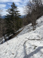
 La Pinéa from Quaix-en-Chartreuse
 Visorando Member
 10.91 mi
 +4,357 ft
 -4,341 ft
 7 hrs
 Very difficult
 Departure from Quaix-en-Chartreuse (Isère)
An original alternative to the usual route up to La Pinéa from the Col de Porte, mainly through woodland and very little used. An ideal hike in summer thanks to the coolness of the forest. The 360° view from the summit of La Pinéa is magnificent, taking in the Chartreuse, Belledonne and the Vercors.
Walks near Église Saint-Jean-Baptiste (Quaix-en-Chartreuse)
Col de Porte – Saint-Pierre-de-Chartreuse
17.45 mi
+5,075 ft
-6,824 ft
12h 25
Very difficult
Departure from Sarcenas (Isère)
This second stage of the Tour of the 10 Highest Peaks of the Chartreuse links the Col de Porte to St-Pierre-de-Chartreuse, via the Charmant Som and then the Grande Sûre. Whilst presenting no particular technical difficulties, this stage is nevertheless one of the longest on the Tour.
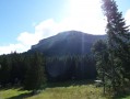
Tour of the two highest peaks in the Chartreuse
 17.39 mi
+6,673 ft
-8,005 ft
7 hrs
Very difficult
Departure from Sarcenas (Isère)
Chamechaude (2,082 m) and the Dent de Crolles (2,062 m) are the two highest peaks in the Chartreuse; allow for a walk of around 30 km – fancy a go?
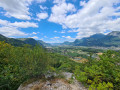
From Sassenage to Noyarey on the slopes of the Vercors
 3.77 mi
+1,125 ft
-1,119 ft
2h 45
 Moderate
Departure from Sassenage (Isère)
This exploratory hike along the paths on the northern flank of the Vercors should be treated as a training session if it is cold higher up. There are three viewpoints, two of which have been developed.
That said, the constant change in gradient along this route is sure to please any hiker or runner hoping to tackle the drovers' road leading to the Sornin plateau at a later date.
This walk is only enjoyable in dry weather, as the slopes become slippery after rain.
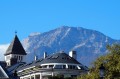
Grenoble and the Isère Greenway
 5.31 mi
+16 ft
-7 ft
2h 25
 Easy
Departure from Grenoble (Isère)
You’ll pass through the narrow streets of Grenoble city centre and on to the wide open green spaces on the northern outskirts of the city. In particular, you’ll pass through the Parc de l’Île d’Amour (suitable for all ages…) and the arboretum at the university campus. You’ll hardly feel as though you’re in an urban setting anymore.
5-day crossing of the Vercors from Grenoble to Châtillon-en-Diois
 54.77 mi
+10,781 ft
-9,482 ft
5 days
 Difficult
Departure from Seyssinet-Pariset (Isère)
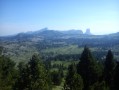
This is a trek across the Vercors via the high plateaus, the wildest and most unspoilt part of the Vercors.
From the north to the south of the Vercors, an 88km hike through spectacular landscapes. You’ll be camping in tents or in the various shelters lining theGR®.
Fountain - Saint-Nizier-du-Moucherotte
 6.11 mi
+3,196 ft
-49 ft
5h 35
Moderate
Departure from Seyssinet-Pariset (Isère)
This first stage takes you on an assault on the Vercors, gradually leaving the urban environment behind you.
Manival - Côte Bonne
 4.52 mi
+1,434 ft
-1,421 ft
3h 20
Easy
Departure from Saint-Ismier (Isère)
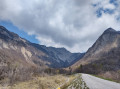
Footprints in the snow for this walk, which can be enjoyed in the summer sun or in the shade of oak and fir trees...
Col du Coq – Col de Porte
7.76 mi
+2,972 ft
-3,219 ft
6h 10
Difficult
Departure from Saint-Pierre-de-Chartreuse (Isère)
This first stage of the Tour of the Ten Highest Peaks of the Chartreuse links the Col du Coq to the Col de Porte, via Chamechaude, the highest point of the Chartreuse massif. However, with the passage through the Double Arche, situated at the foot of Chamechaude, followed by the Rampe de l’Écureuil (or Pas du Lapin), and the canyon on the descent, these gems of the Chartreuse massif do require sure-footedness, combined with a good sense of direction.
From Col du Coq to Sainte-Marie-du-Mont
 14.29 mi
+4,423 ft
-5,938 ft
10h 25
Very difficult
Departure from Saint-Pancrasse (Isère)
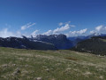
The route runs mainly through the Chartreuse Natural Park, passing through the massif's iconic passes and mountains. The route combines fairly steep climbs, passages through plateaus, mountain pastures and a village.
The Northern Ridges of the Vercors from Autrans to Méaudre
 13.60 mi
+3,143 ft
-4,117 ft
9h 00
Difficult
Departure from Autrans (Isère)
A long, day-long hike that takes you along the northern ridges and high above the cliffs. The first section offers some stunning views. Make arrangements for accommodation for the night as the finish point is different from the starting point. The following day, another route will take you back to your car.
Best undertaken from spring onwards, once the snow has melted.