La Pinéa from Quaix-en-Chartreuse

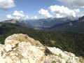
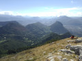
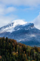
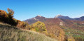
An original alternative to the usual route up to La Pinéa from the Col de Porte, mainly through woodland and very little used. An ideal hike in summer thanks to the coolness of the forest. The 360° view from the summit of La Pinéa is magnificent, taking in the Chartreuse, Belledonne and the Vercors.

Details

26426109
Creation:
Last update:
Last review:
  • Walking
    Activity: Walking
  • ↔
    Distance: 10.91 mi
  • ◔
    Duration according to the author: 7 hrs 
  • ▲
    Difficulty: Very difficult

  • ⚐
    Back to start: Yes
  • ↗
    Ascent: + 4,357 ft
  • ↘
    Descent: - 4,341 ft

  • ▲
    Highest point: 5,728 ft
  • ▼
    Lowest point: 1,732 ft

Photos

Description of the walk

Access is via the D105A, either from Saint-Égrève or from Grenoble.

Park in the car park opposite the town hall in Quaix-en-Chartreuse (several parking spaces available).

(S/E) Take the small flight of steps to the right of the town hall, which passes in front of the church and runs alongside the cemetery. Join the Route de la Jars and follow it to the right as it climbs. About 400 m further on, the road takes a wide bend to the right. Take the path opposite (there is a sign reading ‘Pressure reducer 60 m away’). Follow this path, which climbs steeply and leads past a few houses, then joins the Route de la Jars.

(1) Follow this road to the left, continuing uphill. Cross the bridge over the Coléon and arrive at a fork. Take the road to the left, towards the Aiguille de Quaix. This quickly turns into a track suitable for vehicles.

(2) Carry on straight ahead to a spot called Les Touches. Cross a small scree slope, where the path is very clearly marked, then continue and head into the forest, still climbing.

(3) Ignore the path on the left, which will be your return route at the end of the walk. Continue up the main path.
When you reach the spot known as Les Prés de l’Aiguille, turn slightly to the left, leaving the path on your right that leads to the Aiguille de Quaix, and ignore the path on the far left marked with a Yellow Cross.
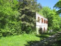
Follow the path through the woods, cross the Ruisseau de Furetas and carry on until you reach a hut.

(4) Go round the hut and turn right onto the path that climbs through the forest. After less than a kilometre, you’ll reach a partly tarmacked forest track, the Route Forestière de Girieu.

(5) Turn right onto it and follow it for about 200 metres.

(6) Leave the track and take the path on the right which climbs into the forest. Follow it for about 1.5 km through the forest – mainly uphill apart from a few flat sections – until you reach the Sentier Vermorel, at a small wooden post indicating the direction.

(7) Take this path to the right; here you’ll also find the yellow-striped markings again. The gradient becomes steeper and, in wet weather, be careful as the path can be very slippery in places. It winds its way up through the forest, beneath the north face of La Pinéa.
After this fairly steep, shaded climb, you’ll finally emerge at the top of the slope, where the view opens out onto Chamechaude directly opposite. Descend down the other side for a few dozen metres.

(8) After this short descent, join the path leading from the Col de Porte to La Pinéa at a point called Sous la Pinéa. Turn right and follow this path to the summit of La Pinéa. A few sections require you to use your hands, although these do not present any particular difficulties. Take care in wet weather, as the rocks can be slippery, particularly as they have been worn smooth by the many hikers who have passed over them.

(9) You will then reach the summit of La Pinéa, where you’ll be treated to a magnificent 360° view. After taking in the scenery, carefully make your way back down the same path to the previous junction.

(8) Turn left onto the path you have already taken, cross over to the other side of the hill and return to the junction at a small wooden post.

(7) Continue straight on along the Sentier Vermorel, following the yellow markings. You’ll soon reach a large clearing and join the Route Forestière de Girieu.

(10) Continue to the left along this track, which descends gradually, and rejoin the route you took on the way up.

(6) Carry on along the track.

(5) At the wide right-hand bend, leave the route you have already taken and follow the track to Planfay le Haut. A few hundred metres after leaving Planfay le Haut, you’ll come to the start of a path on the left at the hairpin bend in the road near Combaleyre.

(11) Follow this path and, after about 50 metres, turn right. Continue along this path for less than a kilometre until you rejoin the path you followed at the start of the walk.

(3) Then take it to the right, heading downhill, and follow the path back towards the Route de la Jars and then to the car park at Quaix-en-Chartreuse Town Hall (S/E).

Waypoints

  1. S/E : mi 0 - alt. 1,732 ft - Town hall car park - Église Saint-Jean-Baptiste (Quaix-en-Chartreuse)
  2. 1 : mi 0.42 - alt. 2,034 ft - Route de la Jars
  3. 2 : mi 1.17 - alt. 2,461 ft - Les Touches
  4. 3 : mi 1.84 - alt. 3,061 ft - Junction of the circular loop
  5. 4 : mi 2.3 - alt. 3,202 ft - Mountain hut
  6. 5 : mi 2.79 - alt. 3,648 ft - Girieu Forest Road
  7. 6 : mi 2.9 - alt. 3,720 ft - Path on the right
  8. 7 : mi 3.85 - alt. 4,534 ft - Vermorel Trail
  9. 8 : mi 4.63 - alt. 5,561 ft - Under the Pinea
  10. 9 : mi 4.77 - alt. 5,725 ft - La Pinéa
  11. 10 : mi 5.97 - alt. 4,170 ft - Girieu
  12. 11 : mi 8.68 - alt. 2,894 ft - Combaleyre
  13. S/E : mi 10.91 - alt. 1,742 ft - Town hall car park

Notes

There are no water sources along the route, but you will cross several small streams.

Walking poles and sturdy footwear are recommended, as the Vermorel Trail is quite steep in places and can be very wet and slippery.

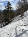
Please note: this walk should be avoided in snowy weather and in early spring, as the north-facing Vermorel Trail can remain snow-covered for a long time and is very difficult to follow when covered in snow. If you still wish to give it a go, crampons are essential.

Worth a visit

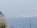
The view from the summit offers a panoramic vista over much of the Chartreuse range; you can admire the Grande Sure, the Charmant Som, the Gand Som, Saint-Pierre de Chartreuse, the Dent de Crolles, Chamechaude, the Néron and the Aiguille de Quaix, amongst others.

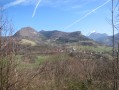
There are also fine views of the Belledonne range and the Taillefer, as well as the Vercors, and of the city of Grenoble and its valley.

Reviews and comments

4.3 / 5
Based on 3 reviews

Reliability of the description
4.7 / 5
Ease of following the route
4 / 5
Route interest
4.3 / 5
User 26502782

Overall rating : 4.7 / 5

Date of your route : Apr 26, 2026
Reliability of the description : ★★★★★ Very good
Ease of following the route : ★★★★☆ Good
Route interest : ★★★★★ Very good
Very busy route : No

The hike is very interesting and scenic, with a large clearing halfway up the ascent where you can stop for a break. We didn’t see a single soul on the climb through the forest, whereas the other route from the Col de Porte was very busy.
However, you need to be careful if you plan to do this hike in late April or early May, as there may still be snow on the north face beyond the plain. This hiking route, rated very difficult due to its distance, can also prove challenging because of the commitment it requires. Over the final 300 metres of ascent, there was in places more than 50 centimetres of snow, which we had to tread carefully on. It seemed stable, but you need to remain vigilant as it could give way in these spring temperatures, and on two-thirds of the route, slipping could be dangerous.

Machine-translated

User 27020747

Overall rating : 3.7 / 5

Date of your route : Aug 18, 2025
Reliability of the description : ★★★★☆ Good
Ease of following the route : ★★★☆☆ Average
Route interest : ★★★★☆ Good
Very busy route : No

The view is superb. We climbed up following a suggested route here. However, to come back down, we tried to follow the paths on the app's maps. It turned out that the paths no longer existed or had never existed. So we ended up on the opposite side of the mountain from where we had left the car. A friend came to pick us up. I therefore recommend following the route indicated in the itinerary to get back down.

Machine-translated

User 20313501

Overall rating : 4.7 / 5

Date of your route : Jun 20, 2025
Reliability of the description : ★★★★★ Very good
Ease of following the route : ★★★★★ Very good
Route interest : ★★★★☆ Good
Very busy route : No

A very pleasant trail in warm weather, with few visitors. Not that difficult, although there is some elevation gain and a few technical sections, but it is manageable with a little experience. In my opinion, it is more interesting to take exactly the same route on the way down. The return via the forest track is not particularly interesting.

Machine-translated

Other walks in the area

For more walks, use our search engine .

The GPS track and description are the property of this route's author. Please do not copy them without permission.