Country:

 City:


At Le Recoin (alt. 1,650 m), park in the large car park at the Le Vernon residential complex.
(S/E) Head towards the Notre-Dame des Neiges Chapel, then turn south onto the old Rue des Alisiers, which runs below the D111. You’ll come to a Y-junction with a footpath.
(1) Turn right onto this path, which descends steadily through raspberry bushes. The path then becomes a track and leads to the Chalet Forestier de Pré Gaudet and its vast clearing. Follow the straight, shaded Chemin Rouast northwards. You’ll reach the Baraque de Boulac and the D111 at an elevation of 1,494 metres.
(2) Walk alongside the D111 and follow the signs for Lac Luitel, indicated by two consecutive signposts. Continue straight on at an elevation of 1,462 metres, then rejoin the D111 at an elevation of 1,311 metres.
(3) Turn right into the stony stream bed. Pass a path on the left (return route).
(4) Return to the D111. Cross the road carefully and follow the signs for the Luitel Nature Reserve. Walk for about 25 metres and look out for a protected crossing.
(5) Cross the road and follow the path heading westwards alongside the road. Cross a small bridge and you’ll come to a Fork in the road.
(6) Take the path furthest to the left, which runs alongside Lake Luitel. You’ll reach a Y-junction at an elevation of 1268.
(7) Turn right, then left about 50 metres further on to rejoin Chemin Vernet. You’ll reach the La Maison de la Réserve visitor centre and some picnic tables.
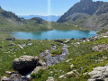
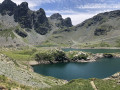
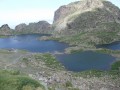
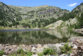
(8) Head towards the road, then enter the Lac Luitel nature reserve via the specially constructed boardwalk. Admire Lac Luitel on your left. At the end of the boardwalk, follow the path back to the road.
(5) Cross the road carefully and start back along the same route you took on the way out.
(4) Turn right onto a track that is barely visible at first. The track becomes clearer further on, marked with rough red markings. Cross the D111 and continue uphill, alternating between grassy sections and woodland. You’ll arrive at the Fontroide Forest Road.
(9) Turn right onto this recently tarmacked road. Walk for about 700 m and look out for a grassy path on the left.
(10) Turn left onto this path, which climbs through the woodland, and further on rejoins the forest road, which you should take to the left.
(11) Enter the Séchilienne Communal Forest, keeping to the left towards the Astragale cross-country ski trail, signposted. After an S-bend, you’ll reach a Y-junction and a signpost.
(12) Turn left and head deeper into the forest. The path climbs slightly before reaching a junction between the Astragale and Lièvre Patineur trails.
(13) Turn left, then, about 20 metres further on, turn left again towards the Nordic Park visitor centre and the D111.
(14) Cross the road carefully and follow the path which joins the Recoin forest track and theGR® 738. You’ll come back to the junction of the circular route that you passed on the way out.
(1) Continue straight on along Rue des Alisiers and return to the starting point at Le Vernon (S/E)

 Visorando Member
 Difficult

 Very difficult