From Puech Baylet to Montaigut Castle via the Croix del Pas

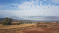
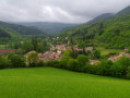
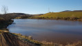
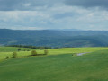
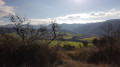
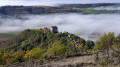
Situated in the commune of Gissac in the Rougier de Camarès, this short walk of less than 5 km offers stunning panoramic views. We did it in the morning and were enchanted by the autumn light. At the end of the walk, you can visit Montaigut Castle, which is well worth a look.

Details

n°110678303
Creation:
Last update:
Last review:
–
  • Walking
    Activity: Walking
  • ↔
    Distance: 2.72 mi
  • ◔
    Average duration: 1h 20 
  • ▲
    Difficulty: Easy

  • ⚐
    Back to start: No
  • ↗
    Ascent: + 75 ft
  • ↘
    Descent: - 735 ft

  • ▲
    Highest point: 2,431 ft
  • ▼
    Lowest point: 1,706 ft
  • ⚐ Country: France
  • ⚐
  • ⚐ City: Gissac (12360)
  • ⚑
    Start: N 43.89686° / E 2.884718°
  • ⚑
    End: N 43.888164° / E 2.880305°
  • ❏
    IGN map(s): Ref. 2542OT
  • Hour-by-hour weather

Photos

Description of the walk

This walk requires at least two cars.

First, drive to the Château de Montaigut car park, where you’ll leave one car. Then continue up the road. After the junction on the left towards Le Rouquet, carry on for about 500 metres and, at the bend, take the hairpin bend on your right which leads to the foot of the masts on Puech Baylet. Park on the lay-by.

(S) Walk back down the tarmac road for 150 m.

(1) Head down the path on the left. The path climbs slightly before descending for most of the route. You’ll reach a junction where five paths meet.

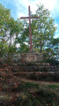
(2) On your left, you’ll see the iron Croix del Pas on its stone plinth. Take the first path leading down to the right. You’ll come to a fork.

(3) Stay on the path on the right until you reach another fork.

(4) Leave the main path on your left. Take the path opposite and, 20 metres further on, take a path on your right. There is a signpost here.

(5) The path forms a circular loop to the left.

(6) A small platform marks the end of the uphill path.

(7) It’s well worth stopping off at La Jasse to see its oven and plaster mills. Continue along the path towards the castle. After crossing the stream, look out for the rock shelter below on the left. You’ll arrive at the castle car park (E).

Waypoints

  1. S : mi 0 - alt. 2,431 ft - Cleared area at the foot of the Puech Baylet masts
  2. 1 : mi 0.06 - alt. 2,408 ft - Start of the trail
  3. 2 : mi 0.9 - alt. 2,172 ft - Croix del Pas
  4. 3 : mi 1.02 - alt. 2,123 ft - Fork in the road
  5. 4 : mi 1.55 - alt. 1,834 ft - Start of the trail
  6. 5 : mi 1.97 - alt. 1,706 ft - Crossing the stream
  7. 6 : mi 2.29 - alt. 1,795 ft - Information platform
  8. 7 : mi 2.5 - alt. 1,768 ft - Plaster mill
  9. E : mi 2.72 - alt. 1,772 ft - Montaigut Castle car park

Notes

Toilets are available in the castle car park.

Although the walk is short and the descent is considerably greater than the ascent, you must take great care as there are some slightly technical sections. For less experienced walkers, allow two hours for the walk.

Worth a visit

Other walks in the area

For more walks, use our search engine .

The GPS track and description are the property of this route's author. Please do not copy them without permission.