Around Mont Bousquet in Montlaur

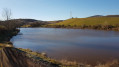
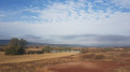
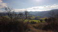
A walk to the west of the pretty village of Montlaur, nestled beside the River Dourdou. The route takes you across the red earth of the Rougier de Camarès. Apart from the first five hundred metres of tarmac road, the rest of the route follows a wide farm track.

Details

n°110016512
Creation:
Last update:
Last review:
–
  • Walking
    Activity: Walking
  • ↔
    Distance: 2.64 mi
  • ◔
    Average duration: 1h 30 
  • ▲
    Difficulty: Easy

  • ⚐
    Back to start: Yes
  • ↗
    Ascent: + 354 ft
  • ↘
    Descent: - 361 ft

  • ▲
    Highest point: 1,634 ft
  • ▼
    Lowest point: 1,273 ft

Description of the walk

On leaving the village of Montlaur towards Briols, cross the bridge and turn left. Opposite the Mas de Privat, there is a small car park with space for two or three cars.

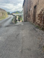
(S/E) Leaving the car park, turn left onto the road towards Passaret. Walk for about 500 m.

(1) Leave the road and take the path on your right. At the junction with another path, carry on straight ahead, heading uphill to reach the highest point of the route.

(2) Continue along the ridge path for about 300 m.

(3) Turn right.

(4) At this point, the track ends and you’ll find yourself facing a ploughed field. A sign on your right indicates that you are entering private property but that pedestrians and mountain bikers are permitted to cross. Carry on straight ahead to cross this relatively long field.

(5) Leave the field and rejoin the path ahead of you, which curves to the right to go round Le Bousquet. You’ll reach a junction.

(6) Ignore the path on your right and carry on straight ahead. Once at the junction, turn right to reach the Mas de Privat. Walk past the buildings to reach the road and turn right to return to the small car park (S/E).

Waypoints

  1. S/E : mi 0 - alt. 1,280 ft - Mas Privat – car park
  2. 1 : mi 0.28 - alt. 1,276 ft - Leave the road, turn right
  3. 2 : mi 1.06 - alt. 1,617 ft - High point
  4. 3 : mi 1.21 - alt. 1,617 ft - Junction, turn right
  5. 4 : mi 1.32 - alt. 1,568 ft - End of trail – permission sign
  6. 5 : mi 1.56 - alt. 1,545 ft - Back on the path
  7. 6 : mi 2.17 - alt. 1,309 ft - Crossroads, go straight on
  8. S/E : mi 2.64 - alt. 1,273 ft - Mas Privat – car park

Notes

Please note: there is very little shade.

Dogs must be kept on a lead when approaching the Mas de Privat (S/E).

Worth a visit

Other walks in the area

For more walks, use our search engine .

The GPS track and description are the property of this route's author. Please do not copy them without permission.