Mas du Claux – Boutavy circular loop

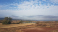
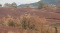
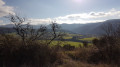
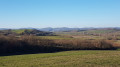
A short, easy circular loop that allows you to discover another side of the Rougier de Camarès and enjoy a beautiful view of Montaigut Castle.

Details

25984878
Creation:
Last update:
Last review:
  • Walking
    Activity: Walking
  • ↔
    Distance: 3.97 mi
  • ◔
    Average duration: 2h 00 
  • ▲
    Difficulty: Easy

  • ⚐
    Back to start: Yes
  • ↗
    Ascent: + 207 ft
  • ↘
    Descent: - 207 ft

  • ▲
    Highest point: 1,565 ft
  • ▼
    Lowest point: 1,319 ft

Photos

Description of the walk

From Camarès, head towards Andabre on the D10, then, at a three-way junction, turn left onto the D101 towards Montlaur. After the first left-hand bend, keep right onto the D101. Continue on the D101 until you reach the junction with the D105, which branches off to the right towards Gissac. Just before this junction, take the short, steep slope on the left which, over 50 metres, leads you onto the Boutavy road. Park on the verge at the top of the slope on the right. Take care not to block access to the field.

(S/E) Set off along the road heading west, leaving the small pond on your left, and walk for about 400 metres.

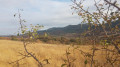
(1) On the right, take the farm track heading north-west. Continue along this track until you reach a copse of shrubs, from where you’ll have a lovely view of Montaigut Castle on your right. Continue along the track, which descends towards a sandy area and then climbs slightly to join a farm track.

(2) Turn left downhill and reach a ruin (the Mas de Claux).

(3) After passing the ruin on your right, the path descends into the bed of the Durre (the most technical part of the route, but nothing dangerous). Carry on until you reach another ruin (Les Bouzigues).

(4) At Les Bouzigues, leave the path on your right and continue to the left. Carry on straight ahead until you reach a junction of farm tracks.

(5) Turn left towards the farm (Boutavy) and join the tarmac road.

(6) Carry on along the tarmac road and pass Boutavy Farm. At the crossroads with a cross, leave the hamlet of Faragous on your right and continue to the left, passing close to the pond.

(1) Turn right onto the road and follow it to the car park (S/E).

Waypoints

  1. S/E : mi 0 - alt. 1,444 ft - Junction of the D101 and D105
  2. 1 : mi 0.14 - alt. 1,430 ft - Junction of the circular loop
  3. 2 : mi 1.67 - alt. 1,503 ft - Junction onto a farm track
  4. 3 : mi 1.99 - alt. 1,434 ft - Mas de Claux
  5. 4 : mi 2.32 - alt. 1,362 ft - Les Bouzigues
  6. 5 : mi 2.72 - alt. 1,322 ft - Crossroads of farm tracks
  7. 6 : mi 2.87 - alt. 1,342 ft - Junction with tarmac road
  8. S/E : mi 3.97 - alt. 1,444 ft - Junction of the D101 and D105

Notes

Bear in mind that there is little shade along the route. Wear a cap, take a drink with you and avoid the hottest part of the day.
Sturdy footwear is recommended.

Worth a visit

The view of Montaigut Castle should encourage you to visit it. .

Reviews and comments

4.7 / 5
Based on 2 reviews

Reliability of the description
5 / 5
Ease of following the route
5 / 5
Route interest
4 / 5
User 28115724

Overall rating : 4.7 / 5

Date of your route : Mar 23, 2026
Reliability of the description : ★★★★★ Very good
Ease of following the route : ★★★★★ Very good
Route interest : ★★★★☆ Good
Very busy route : No

The only real downside is having to return to the starting point along a tarmac road, albeit one with little traffic.
The first part is truly beautiful, with some lovely views.

Machine-translated

jmangles
jmangles

Overall rating : 4.7 / 5

Date of your route : Mar 30, 2023
Reliability of the description : ★★★★★ Very good
Ease of following the route : ★★★★★ Very good
Route interest : ★★★★☆ Good
Very busy route : No

A lovely walk in the Rougier

Machine-translated

Other walks in the area

For more walks, use our search engine .

The GPS track and description are the property of this route's author. Please do not copy them without permission.