From the Pont de la Salce to the Castle, starting from Sainte-Marie

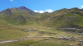
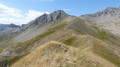
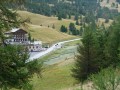
This lovely walk offers a variety of scenery. The route follows the right bank of the Torrent du Chagnon, taking in the villages of Sainte-Catherine and Saint-Marcellin, before climbing up to the castle, which offers a dual panorama (the Écrins massif and the Durance valley on one side, and the Vars valley with a view of the four Vars villages on the other).

Details

37763526
Creation:
Last update:
Last review:
  • Walking
    Activity: Walking
  • ↔
    Distance: 5.65 mi
  • ◔
    Average duration: 3h 40 
  • ▲
    Difficulty: Moderate

  • ⚐
    Back to start: Yes
  • ↗
    Ascent: + 1,237 ft
  • ↘
    Descent: - 1,266 ft

  • ▲
    Highest point: 6,237 ft
  • ▼
    Lowest point: 5,230 ft

Description of the walk

From Guillestre, take the D902 towards Sainte-Marie. Park in the car park on the left as you leave the village heading towards the resort.

(S/E) The walk begins on the path by the municipal garages. With your back to the car park, take the Chemin de Reculas opposite and follow the Torrent de Chagnon along the right bank. Continue to the next track and the Pont de la Salce. Along the way, you’ll come across numerous RTM (mountain land restoration) dams built to prevent flooding. You’ll arrive at the Pont de la Salce.

(1) Turn left onto the path towards Sainte-Catherine and head north-west until you reach the next set of buildings, which mark the start of the Sainte-Catherine walking routes.

(2) Leave the path leading to the Col de la Scie on your right and carry on straight ahead through the village (yellow and red markings). Keep going straight on until you reach the school, then turn sharply left and then right to leave the village.

(3) On leaving the village, turn right onto the path signposted ‘château’. The markings are now yellow and purple. Continue along this path, which climbs to take you up to the plateau where the ruins are located. Carry on to the next junction.

(4) Pass the path leading to the Val d’Escreins on your right and carry on straight ahead.

(5) Walk to the right of the house to reach the castle site, where there are two panoramic viewpoints.

(6) Return to the house.

(5) Take the path on the right to head back down to Saint-Marcellin. Cross a road, then pass by two reservoirs and continue to the D902.

(7) Cross the road carefully and continue to the left until you reach the edge of the village.

(8) Turn right and follow the sign for “Sainte-Marie via the peatland”. The path joins a road, which you continue to follow until the next junction.

(9) Leave the road leading to Lac de Peyrol on your right and continue along the Torrent de Chagne to Sainte-Marie. Head up Rue du Lièvre Blanc on the left and carry on to the Grand-Rue.

(10) Cross the street, walk past the town hall and, at the end of the street, turn left onto Rue de la Cime de Ville and head for the car park (S/E).

Waypoints

  1. S/E : mi 0 - alt. 5,469 ft - Car park at the exit
  2. 1 : mi 0.94 - alt. 6,194 ft - Salce Bridge - Chagnon (Torrent) - Affluent du Torrent de Chagne
  3. 2 : mi 1.84 - alt. 6,056 ft - Starting point for the walks from Sainte-Catherine
  4. 3 : mi 2.35 - alt. 5,814 ft - Sainte-Catherine
  5. 4 : mi 3.51 - alt. 5,981 ft - Crossroads
  6. 5 : mi 3.54 - alt. 5,968 ft - House
  7. 6 : mi 3.62 - alt. 5,991 ft - The castle site with its two panoramic views
  8. 7 : mi 4.4 - alt. 5,374 ft - D902 - Combe de l'Église (torrent) - Affluent du Torrent de Chagne
  9. 8 : mi 4.54 - alt. 5,344 ft - Turn right towards “Ste-Marie on the peatland” - Rivet (Torrent) - Affluent du Torrent de Chagne
  10. 9 : mi 4.88 - alt. 5,240 ft - Junction - Chagne (Torrent) - Affluent du Guil
  11. 10 : mi 5.54 - alt. 5,413 ft - Grand-Rue
  12. S/E : mi 5.65 - alt. 5,469 ft - Car park at the exit

Notes

There are several places to get water along this walk: fountains in Sainte-Catherine, in front of the house near the castle, in Saint-Marcellin and Sainte-Marie.

Worth a visit

On the castle site, there are remains of a watchtower which could have sounded the alarm to defend this crossroads between the Durance, Ubaye and Queyras.
In each village, there is a Queyras-style cross and sundials.

Reviews and comments

4.7 / 5
Based on 2 reviews

Reliability of the description
5 / 5
Ease of following the route
5 / 5
Route interest
4 / 5
Elo&Max38
Elo&Max38

Overall rating : 4.3 / 5

Date of your route : Aug 02, 2025
Reliability of the description : ★★★★★ Very good
Ease of following the route : ★★★★★ Very good
Route interest : ★★★☆☆ Average
Very busy route : No

An easy hike to follow but with limited interest (notably the passage through Ste Catherine and the end of the hike in a narrow valley)
Towards the end, do not rely on the road closure sign indicated on the route. The road is still closed to traffic but is perfectly passable on foot.

Machine-translated

Aparicio José
Aparicio José

Overall rating : 5 / 5

Date of your route : Oct 15, 2024
Reliability of the description : ★★★★★ Very good
Ease of following the route : ★★★★★ Very good
Route interest : ★★★★★ Very good
Very busy route : No

A lovely walk. Stunning views. It’s a shame that, once past the goat farm, the path was closed by prefectural order. We turned back and walked along the road to get back to the starting point, which was very unpleasant and dangerous.

Machine-translated

Other walks in the area

For more walks, use our search engine .

The GPS track and description are the property of this route's author. Please do not copy them without permission.