


Refine your search for walks in Chagnon (Torrent) - Affluent du Torrent de Chagne
Chagnon (Torrent) - Affluent du Torrent de Chagne walks


 La Selle from Vars-Sainte-Marie
 Visorando Member
 11.24 mi
 +2,661 ft
 -2,661 ft
 7h 30
7h 30
 Average
 Departure from Vars (Hautes-Alpes)
A circular route around Vars-Sainte-Marie, offering a beautiful view of the Vars countryside.
From the Pont de la Salce to the Castle, starting from Sainte-Marie
 Association / Club / Walk leader5.65 mi
+1,237 ft
-1,266 ft
3h 40
Average
Departure from Vars (Hautes-Alpes)
Association / Club / Walk leader5.65 mi
+1,237 ft
-1,266 ft
3h 40
Average
Departure from Vars (Hautes-Alpes)
This lovely walk offers a variety of scenery. The route follows the right bank of the Torrent du Chagnon, taking in the villages of Sainte-Catherine and Saint-Marcellin, before climbing up to the castle, which offers a dual panorama (the Écrins massif and the Durance valley on one side, and the Vars valley with a view of the four Vars villages on the other).
Col de Serenne and Crête de la Selle from Vars
10.59 mi
+3,301 ft
-3,301 ft
7h 45
 Difficult
Departure from Vars (Hautes-Alpes)
Difficult
Departure from Vars (Hautes-Alpes)
A long loop passing through two passes and several ridge crossings, traversing mountain pastures. The Couniets and Selle ridges are wild and rarely visited. Magnificent views of the surrounding mountains.
Walks near Chagnon (Torrent) - Affluent du Torrent de Chagne
Trek around Chambeyron Mountain Range (1) Fouillouse - Refuge du Chambeyron
 3.88 mi
+2,470 ft
-36 ft
3h 55
Average
Departure from Saint-Paul-sur-Ubaye (Alpes-de-Haute-Provence)
3.88 mi
+2,470 ft
-36 ft
3h 55
Average
Departure from Saint-Paul-sur-Ubaye (Alpes-de-Haute-Provence)
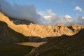
First stage around the Chambeyron Mountain Range which, after a steady climb, takes you to the shelter with the same name. You'll end up in a breath-taking setting, at the foot of Brec de Chambeyron.
Trek around Chambeyron Mountain Range
 36.21 mi
+13,120 ft
-13,783 ft
5 days
Difficult
Departure from Saint-Paul-sur-Ubaye (Alpes-de-Haute-Provence)
36.21 mi
+13,120 ft
-13,783 ft
5 days
Difficult
Departure from Saint-Paul-sur-Ubaye (Alpes-de-Haute-Provence)
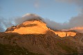
Reaching over 3000 metres in altitude, Aiguilles de Chambeyron and Brec de Chambeyron form an impressive mountain range halfway between Queyras and the Moncantour. This hike offers a trek with no techincal difficulty, with passes over 2700 m in altitude and a summit of over 3000 m. Set in an outstanding landscape and for the most part within a high mountain setting.
Basse Rua - Maljasset
10.62 mi
+4,688 ft
-4,186 ft
9h 00
 Very difficult
Departure from Vars (Hautes-Alpes)
Very difficult
Departure from Vars (Hautes-Alpes)
There is a long crossing before the Col des Houerts, which takes you into the Ubaye Valley.
Trek around Chambeyron Mountain Range (3) Refuge du Chambeyron - Maljasset
 10.64 mi
+2,454 ft
-4,764 ft
8 hrs
Very difficult
Departure from Saint-Paul-sur-Ubaye (Alpes-de-Haute-Provence)
10.64 mi
+2,454 ft
-4,764 ft
8 hrs
Very difficult
Departure from Saint-Paul-sur-Ubaye (Alpes-de-Haute-Provence)
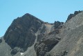
The most demanding stage of the hike during which you'll go through at least 4 passes at over 2700 metres in altitude. Beautiful scenery all along the way! The "Lacs Marinet" offer the opportunity for refreshments before the final descent.
Maljasset - Larche
15.60 mi
+4,199 ft
-4,898 ft
10h 50
Difficult
Departure from Saint-Paul-sur-Ubaye (Alpes-de-Haute-Provence)
Etape de la traversée des Alpes à partir du hameau de Maljasset qui suit la route de la Haute Ubaye avec une vue époustouflante sur les sommets qui bordent le flanc sud du Queyras. Traversée de la Haute Ubaye dans un univers minéral parmi les sommets de plus de 3000m.
Maljasset - Ceillac
9.92 mi
+3,320 ft
-4,242 ft
7h 25
Difficult
Departure from Saint-Paul-sur-Ubaye (Alpes-de-Haute-Provence)
The passage between the two departments of Alpes de Haute Provence and Hautes Alpes is via the famousGR®5, which supports theGRP® of the Tour de la Font Sancte on this section.
Maljasset - Ceillac
 7.50 mi
+2,808 ft
-3,678 ft
5h 55
Difficult
Departure from Saint-Paul-sur-Ubaye (Alpes-de-Haute-Provence)
7.50 mi
+2,808 ft
-3,678 ft
5h 55
Difficult
Departure from Saint-Paul-sur-Ubaye (Alpes-de-Haute-Provence)
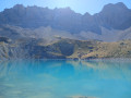
Return to Queyras by crossing the Col Girardin via a path that starts off quite steep but then levels out before ending with large hairpin bends that finish at the pass. This is followed by a long descent past the lakes, which reflect the famous Font Sancte, the highest point in Queyras.
Trek around Chambeyron Mountain Range (4) Maljasset - Refuge Campo Base
 9.28 mi
+2,408 ft
-3,304 ft
6h 20
Difficult
Departure from Saint-Paul-sur-Ubaye (Alpes-de-Haute-Provence)
9.28 mi
+2,408 ft
-3,304 ft
6h 20
Difficult
Departure from Saint-Paul-sur-Ubaye (Alpes-de-Haute-Provence)
Quite a long stage but a steady route. A climb up to Col de Mary then a long downhill hike all the way to the shelter, in Chiaperra, Italy.
Saint-Ours – Larche
 5.26 mi
+1,102 ft
-1,417 ft
3h 25
Average
Departure from Meyronnes (Alpes-de-Haute-Provence)
5.26 mi
+1,102 ft
-1,417 ft
3h 25
Average
Departure from Meyronnes (Alpes-de-Haute-Provence)
Return to the starting point in Larche via theGRP® de la Frontière Fortifiée.
From the Barenghi Bivouac to Larche via the Col du Vallonnet
13.36 mi
+3,953 ft
-7,723 ft
8 hrs
Very difficult
Departure from Saint-Paul-sur-Ubaye (Alpes-de-Haute-Provence)
This route largely followsGRP®® markings (Tour du Chambeyron). A safe option, yet still spectacular.Spectacular, because the route constantly alternates between stark, steep and rocky terrain and lush, rolling and reassuring landscapes.Safe, because it is fully signposted and even offers alternative routes to avoid the most difficult sections in the event of bad weather.