La Selle from Vars-Sainte-Marie

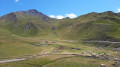
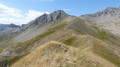
A circular route around Vars-Sainte-Marie, offering a beautiful view of the Vars countryside.

Details

135092
Creation:
Last update:
Last review:
  • Walking
    Activity: Walking
  • ↔
    Distance: 11.24 mi
  • ◔
    Average duration: 7h 30 
  • ▲
    Difficulty: Moderate

  • ⚐
    Back to start: Yes
  • ↗
    Ascent: + 2,661 ft
  • ↘
    Descent: - 2,661 ft

  • ▲
    Highest point: 7,858 ft
  • ▼
    Lowest point: 5,417 ft
  • ⚐ Country: France
  • ⚐
    Areas: Alps, Dauphiné
  • ⚐ City: Vars (05560)
  • ⚑
    Start/End: N 44.592442° / E 6.690449°
  • ❏
    IGN map(s): Ref. 3537ET, 3537ETR, 3538ET, 3538ETR
  • Hour-by-hour weather

Description of the walk

The route starts at the far end of the car park next to the Peynier ski lifts.

(S/E) From this car park, head towards the fire and rescue station. At the end of Chemin de Reculas, take a pleasant path through the woodland, marked in yellow and purple, which climbs and follows the course of the Torrent de Chagnon towards La Selle. This will take you to a path that crosses a bridge.

(1) Before the bridge, take the path that climbs to the left, still heading towards La Selle. Continue along the Torrent de Chagnon.

(2) When the vegetation thins out, the path branches off to the right and reaches the mountain pastures after a climb of a few dozen metres. From there, the path is not always very well marked, so you need to follow the yellow and purple markings on the posts more carefully. The path climbs to reach the summit of the ridge.

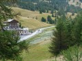
(3) On the descent, it winds its way down, then turns left across the mountain pastures towards a hut and a footbridge visible in the distance. Pass to the left of the Vallon hut.

(4) Cross the footbridge and take the path that descends to the right to the Peynier junction.

(5) Continue straight on to the summit of Peynier.

(6) Return to the junction via the same path.

(5) Turn right and head downhill for several hundred metres until you reach the junction for Vars-Sainte-Marie.

(7) Turn right. Follow the signs for Sainte-Marie, passing under the chairlift, then continue across the ski lift.

(8) The path turns left; continue downhill to the Torrent du Vallon.

(9) Cross a wooden bridge to reach the bridge you passed on the way up.

(1) Carry on straight ahead towards Vars-Sainte-Catherine. You’ll reach the first houses.

(10) Take a tarmac path that descends steeply to the left. Walk through the village, following the signposts for the walking trails (towards Vars-Sainte-Marie). You’ll reach the first Y-junction.

(11) Turn left into Rue du Serret, then at the next junction, cross Rue du Chemin du Preyt and take Rue de la Chalanette.

(12) Take the path that descends to the left and leads you back to Vars Sainte-Marie.
Continue to the starting point (S/E).

Waypoints

  1. S/E : mi 0 - alt. 5,469 ft - Car park located next to the Peynier ski lifts
  2. 1 : mi 0.9 - alt. 6,198 ft - Bridge over the - Chagnon (Torrent) - Affluent du Torrent de Chagne
  3. 2 : mi 2.04 - alt. 7,037 ft - Entry to the mountain pastures
  4. 3 : mi 2.86 - alt. 7,851 ft - Ridge
  5. 4 : mi 3.66 - alt. 7,526 ft - Footbridge
  6. 5 : mi 4.75 - alt. 7,264 ft - Junction towards Peynier
  7. 6 : mi 5.2 - alt. 7,411 ft - Peynier summit
  8. 7 : mi 6.98 - alt. 6,791 ft - Junction towards Sainte-Marie
  9. 8 : mi 8.23 - alt. 6,575 ft - On the left after passing the ski lift
  10. 9 : mi 8.59 - alt. 6,171 ft - Wooden bridge
  11. 10 : mi 9.83 - alt. 6,060 ft - Arrival in Sainte-Catherine
  12. 11 : mi 10.24 - alt. 5,820 ft - Y-junction
  13. 12 : mi 10.42 - alt. 5,768 ft - Start of the trail towards Sainte-Marie
  14. S/E : mi 11.24 - alt. 5,469 ft - Car park located next to the Peynier ski lifts

Reviews and comments

4.6 / 5
Based on 3 reviews

Reliability of the description
4.3 / 5
Ease of following the route
4.3 / 5
Route interest
5 / 5
patembrun
patembrun

Overall rating : 4.3 / 5

Date of your route : Jul 13, 2024
Reliability of the description : ★★★★☆ Good
Ease of following the route : ★★★★☆ Good
Route interest : ★★★★★ Very good
Very busy route : No

A really lovely walk that lies outside the resort’s developed area.

Machine-translated

Pat05340
Pat05340

Overall rating : 5 / 5

Date of your route : Oct 17, 2017
Reliability of the description : ★★★★★ Very good
Ease of following the route : ★★★★★ Very good
Route interest : ★★★★★ Very good

The yellow and purple markings change to yellow only after point 1. There’s a bit of pink after point 2, then yellow again. We took some shortcuts between points 5 and 8, then cut the route short by heading down from point 8 towards the car park where we started (the ski runs are a bit steep for this final stretch).
A varied, very pretty landscape with a lovely view of the Ecrins massif.

Machine-translated

jbrun
jbrun

Overall rating : 4.3 / 5

Date of your route : Jul 31, 2016
Reliability of the description : ★★★★☆ Good
Ease of following the route : ★★★★☆ Good
Route interest : ★★★★★ Very good

The signposting was a bit unclear on the climb up to the pass. A lovely route. We did it in glorious sunshine with magnificent scenery… and loads of flies!

Machine-translated

Other walks in the area

For more walks, use our search engine .

The GPS track and description are the property of this route's author. Please do not copy them without permission.