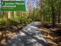
The Verboté walk in Sermamagny

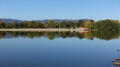
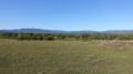
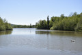
This peaceful walk, with very gentle gradients, offers a varied route taking in streams, ponds and beautiful views of the foothills and the first peaks of the Vosges.
The route is signposted with a Green Ring

Details

1539426
Creation:
Last update:
Last review:
  • Walking
    Activity: Walking
  • ↔
    Distance: 4.71 mi
  • ◔
    Average duration: 2h 15 
  • ▲
    Difficulty: Easy

  • ⚐
    Back to start: Yes
  • ↗
    Ascent: + 112 ft
  • ↘
    Descent: - 98 ft

  • ▲
    Highest point: 1,325 ft
  • ▼
    Lowest point: 1,224 ft
  • ⚐ Country: France
  • ⚐ City: Sermamagny (90300)
  • ⚑
    Start/End: N 47.683971° / E 6.813215°
  • Accessible from the train station Gare de Bas-Evette.
  • ❏
    IGN map(s): Ref. 3520ET, 3621OT
  • Hour-by-hour weather

Photos

Description of the walk

Park in the car park at the Malsaucy site.

(S/E) Cross the CD24 and follow the cycle path opposite. This crosses the railway line leading to Giromagny; there’s a beautiful view of the Salbert massif and the first houses of Evette-Salbert.
It runs alongside the fence of the water catchment area for the City of Belfort on the left, and the small stream known as the Verboté on the right. Continue straight ahead, passing a footbridge over the Verboté on your right.

(1) Further on, a bridge spans the Savoureuse. The cycle path reaches the Monceau district of Valdoie, running along the foot of a wooded hill. After passing the ‘Von Roll Isola’ factory, leave the cycle path on your left and continue straight on along Chemin Alexandre. Cross the Savoureuse.

(2) At the junction with Rue de la Gare, turn right. The road runs alongside the railway line before crossing it at the level crossing. Continue to the edge of the Salbert Forest.

(3) Take a path on the left which runs alongside the road and then crosses it shortly afterwards. Continue straight ahead along a stony track. Leave this 100 metres further on and take a path on the left. It passes four crosses which remind walkers of the sacrifice of members of the Resistance who were shot here in the autumn of 1944.

(4) After emerging from the woods, this path joins another stony track: the Chemin du Verboté, which you follow to the right. This runs past the foot of a residential area, aptly named ‘Vue des Vosges’. Carry on straight ahead; here you’ll find an exceptional panorama: the lakes and villages of the Vosges foothills and the first peaks of the massif. The path crosses meadows and emerges onto Rue du Val.

(5) At the junction with Rue du Lac, turn right. 200 metres further on, cross the level crossing. After the Auberge du Lac, take the footpath on the left running alongside the Malsaucy to reach the starting car park (S/E).

Waypoints

  1. S/E : mi 0 - alt. 1,276 ft - Car park at the Malsaucy site
  2. 1 : mi 1.17 - alt. 1,253 ft - Bridge over the - Savoureuse (rivière)
  3. 2 : mi 2.1 - alt. 1,234 ft - Rue de la Gare
  4. 3 : mi 2.37 - alt. 1,253 ft - Edge of the forest
  5. 4 : mi 2.89 - alt. 1,319 ft - Chemin du Verboté
  6. 5 : mi 4.14 - alt. 1,299 ft - Rue du Lac
  7. S/E : mi 4.71 - alt. 1,276 ft - Car park at the Malsaucy site

Notes

Start: car park at the Malsaucy leisure centre, 8 km from Belfort

Visorando was provided with this information by Mr Chevalley, a volunteer at Balisage90, based on leaflets published by the Belfort Territorial Department.

The route is signposted with a Green Ring.

Worth a visit

Malsaucy
Nestled in the heart of a lush green setting, developed by the Departmental Council, the Malsaucy site is undoubtedly one of the most beautiful in the Territoire de Belfort. The Departmental Environment Centre, as well as the water sports centre and the beach, offer everyone the chance to enjoy swimming, lazing about, sporting activities and environmental awareness.

The old ice house
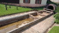
On the site of the current Auberge du Lac stood, in the 19th century, an ‘ice house’ which was used to store ice cut into cubes from the lake in winter. The stock thus built up enabled the region’s breweries and restaurants to be supplied with ice for refrigeration all year round, before the advent of artificially produced ice.

The Monceau Fortification
Built in 1889, this fortification, intended for an infantry company, consists of a concrete barracks, a semi-circular earthwork rampart and a triangular-shaped moat. This fortification is the only structure in the
site that utilised water for its defence. It is the only first-generation fortification in Belfort preserved in its original state. The site is not open to visitors.

The François Mitterrand Cycle Path
Among the greenways of the Territoire de Belfort, the François Mitterrand cycle path, which links the Malsaucy site to Belfort town centre, is perhaps the most idyllic. Once past the Belfort urban area, the route opens out onto sumptuous landscapes of wild meadows with the Southern Vosges in the background.

Reviews and comments

4.6 / 5
Based on 3 reviews

Reliability of the description
4.7 / 5
Ease of following the route
4.7 / 5
Route interest
4.3 / 5
User 14903829

Overall rating : 4.7 / 5

Date of your route : Oct 13, 2025
Reliability of the description : ★★★★★ Very good
Ease of following the route : ★★★★★ Very good
Route interest : ★★★★☆ Good
Very busy route : Yes

Machine-translated

Nath25
Nath25

Overall rating : 5 / 5

Date of your route : Aug 18, 2025
Reliability of the description : ★★★★★ Very good
Ease of following the route : ★★★★★ Very good
Route interest : ★★★★★ Very good
Very busy route : Yes

A pleasant hike even in the summer sun, as many sections are shaded by vegetation. Part of the trail is a cycle path (there were lots of bikes on 17 August). Please note that dogs are apparently not allowed on this trail, but we were a group of five dogs and didn't encounter any problems. No issues to report

Machine-translated

Conseil Départemental 90

Thank you for your message
I have made a slight amendment to the description to take your comments about the wooden footbridge into account.

Machine-translated

corna54
corna54

Overall rating : 4 / 5

Date of your route : Oct 25, 2023
Reliability of the description : ★★★★☆ Good
Ease of following the route : ★★★★☆ Good
Route interest : ★★★★☆ Good
Very busy route : No

A pleasant walk, though there was a bit of confusion at the first wooden bridge – you mustn’t cross it; the bridge over the Savoureuse is further on. We passed through the town briefly before reaching the Verbotè path, where we enjoyed the view before heading back down to the car park.

Daniel

Machine-translated

Other walks in the area

For more walks, use our search engine .

The GPS track and description are the property of this route's author. Please do not copy them without permission.