Country:

 City:
City:


(S) Start from the Marie le Franc car park in the hamlet of Banastère.
Red and white GR® 34 markings
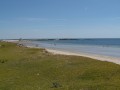
Walk south along the beach. After passing a car park next to a lake, continue for about 300 metres.
End of red and white markings
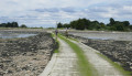
(1) Turn right onto the path that runs alongside a second lake. Follow this Chemin de Béduco for about 1 km until you reach the houses.
(2) Take the path on the left.
Yellow markings
At the end of the path, turn right onto Rue du Mur du Roy (hamlet of Penvins). Continue straight ahead and, at a bend where the road meets Route de la Grée Penvins, continue in the same direction (west) until you reach a crossroads where there is a branch of Sarzeau Town Hall.
(3) Continue in the same direction (west), leaving the hamlet of Penvins. Further on, pass a campsite on the right and turn left to enter the hamlet of Landrezac.
(4) Walk straight through the hamlet and, at the crossroads where there is a well, turn left towards the south to descend to the coast.
End of yellow markings, red and white markings
(5) Turn right and walk along the beach.
End of red and white markings, yellow markings
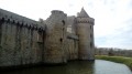
After the car park, leave the GR® by turning right towards Suscinio Castle.
(6) At the junction, the castle is about 500 metres off the route: to get there, turn right and return via the same path.
(6) On the way back, continue along the wetland area towards the west, then turn left at the junction with a road.
(7) At the junction after the houses, turn right. Pass through the hamlets of Calzac Haut and then Calzac Bas until you reach the roundabout.
(8) Go under the D780 and follow the Route de l'Ancienne Gare for about 700 metres until you reach a large crossroads.
(9) Take the first right onto Rue de l'Océan, then Rue de Poulménac'h.
(10) At the junction by the church, turn left onto Rue du Maréchal Leclerc. Follow this road and, at the next roundabout, take the first right onto Rue Paul Helleu, which you should follow to the right. Continue until you reach Impasse de la Grée, which you should turn into on the left. Continue straight ahead, passing the cemetery on your left, to complete this 5-day journey ::A::.
 Visorando Member
 Easy
Easy