Tour of the Pénerf Peninsula

A short walk that circles the pretty little Pénerf Peninsula.
Warning! According to a hiker, the path is currently closed beyond the Tour des Anglais.
(It seems you can continue by heading inland. Happy walking!)

Fiche technique

580275
Creation:
Last update:
Last review:
  • trace_mode_pedestrian
    Activité: trace_mode_pedestrian
  • ↔
    label_distance: 3.21 mi
  • ◔
    Durée calculée: 1h 30 
  • ▲
    Difficulte: Facile

  • ⚐
    Retour point de depart: Oui
  • ↗
    label_elevation_gain: + 7 ft
  • ↘
    label_elevation_loss: - 7 ft

  • ▲
    label_highest_point: 20 ft
  • ▼
    label_lowest_point: 7 ft
  • ⚐ Pays: France
  • ⚐
  • ⚐ Commune: Damgan (56750)
  • ⚑
    Départ/Arrivée: N 47.513852° / O 2.622554°
  • ❏
    Carte(s) IGN: Ref. 0921OT, 0921OTR, 1021SB, 1022OT
  • Météo détaillée heure par heure

Photos

Description of the walk

(S/E) You start the walk by heading between the harbour office and the charming chapel, towards the south-west. You have the sea on your right and the land on your left. Follow the coastal path.

(1) Do take the time to make a round trip to the flat Pointe de Dibenn. Return to continue along the coastal path.

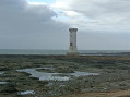
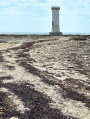
(2) You reach the white Tour des Anglais, built to watch for enemy arrivals by sea. Continue eastwards.

(3) When you reach a cemented stone breakwater, follow the road. You’ll pass a first junction. When your small road curves to the right, take the lane on the left (give way sign).
Very soon, you’ll reach a Fork in the road. Take the left-hand branch. Your narrow lane turns into a fairly wide grassy path.

(4) When you come to a crossroads with three metal field gates, take the inconspicuous path leading off to your right. It widens quite quickly. As it winds between houses, you’ll emerge onto a fairly wide road. Cross it and continue straight ahead.

(5) When your lane curves to the left, take the path leading off to the right (sign: Port de Pénerf – 800m). Follow the coastal path back to the port (S/E).

Points de passages

  1. D/A : mi 0 - alt. 13 ft - Pénerf Port Office - Penerf (cours d'eau et un estuair)
  2. 1 : mi 0.83 - alt. 10 ft - Pointe de Dibenn
  3. 2 : mi 1.28 - alt. 10 ft - Tour des Anglais
  4. 3 : mi 2.15 - alt. 16 ft - Cut-stone sea wall
  5. 4 : mi 2.46 - alt. 16 ft - 3 gates, path on the right
  6. 5 : mi 2.69 - alt. 13 ft - Sign for Port de Pénerf 800m
  7. D/A : mi 3.21 - alt. 13 ft - Pénerf Port Office

Informations pratiques

Park at the port of Pénerf, west of Damgan, not far from the port office, which is the starting point for the walk.

This walk is very easy.

The route is described in an anti-clockwise direction (provided you have a watch with hands...)

After the Tour des Anglais, the path has been destroyed by the sea. You therefore have to walk along the beach. This means that, at very high tides, this walk is not feasible at high tide.

A proximite

Port de Pénerf and its charming chapel.
La Pointe du Dibenn
The Tour des Anglais
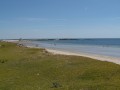
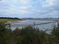
The wild coast of the peninsula

Reviews and comments

4.5 / 5
Based on 17 reviews

Fiabilité de la description
4.5 / 5
Facilité à suivre l'itinéraire
4.6 / 5
Intérêt du circuit de randonnée
4.3 / 5
visonadine
visonadine

Note globale : 4 / 5

Date de la randonnée : Jun 22, 2026
Fiabilité de la description : ★★★★☆ Bien
Facilité à suivre l'itinéraire : ★★★★★ Tres bien
Intérêt du circuit de randonnée : ★★★☆☆ Moyen
Circuit très fréquenté : Oui

Easy to do

translation_auto

Utilisateur 11122930

Note globale : 4.7 / 5

Date de la randonnée : Mar 16, 2026
Fiabilité de la description : ★★★★★ Tres bien
Facilité à suivre l'itinéraire : ★★★★★ Tres bien
Intérêt du circuit de randonnée : ★★★★☆ Bien
Circuit très fréquenté : Non

Thank you for organising such well-planned walks.

translation_auto

louis35
louis35

Note globale : 5 / 5

Date de la randonnée : Nov 03, 2025
Fiabilité de la description : ★★★★★ Tres bien
Facilité à suivre l'itinéraire : ★★★★★ Tres bien
Intérêt du circuit de randonnée : ★★★★★ Tres bien
Circuit très fréquenté : Non

A pleasant little walk where you can explore both the ocean side
the Gulf side and the port of Penerf. With the new layout, there is only a very short stretch on the sand, which is definitely worth doing again and again.

translation_auto

Utilisateur 17540423

Note globale : 5 / 5

Date de la randonnée : Jun 16, 2025
Fiabilité de la description : ★★★★★ Tres bien
Facilité à suivre l'itinéraire : ★★★★★ Tres bien
Intérêt du circuit de randonnée : ★★★★★ Tres bien
Circuit très fréquenté : Non

We were able to complete the entire route, with riprap being placed in several locations to restore the passage, sometimes crossing private property. There is still one section that has not been restored near the campsite, which requires walking on the beach (for 80 metres). Access to the English Tower is possible.

translation_auto

Yannick_Josset
Yannick_Josset

Thank you for this information.
Yannick

translation_auto

Cofo
Cofo

Note globale : 3 / 5

Date de la randonnée : May 02, 2024
Fiabilité de la description : ★★★☆☆ Moyen
Facilité à suivre l'itinéraire : ★★☆☆☆ Decevant
Intérêt du circuit de randonnée : ★★★★☆ Bien
Circuit très fréquenté : Non

The trail is closed by municipal order from the English tower onwards, following the destruction of the path by Storm Céline.

translation_auto

Jean-Marc P2.
Jean-Marc P2.

Note globale : 5 / 5

Date de la randonnée : Apr 15, 2024
Fiabilité de la description : ★★★★★ Tres bien
Facilité à suivre l'itinéraire : ★★★★★ Tres bien
Intérêt du circuit de randonnée : ★★★★★ Tres bien
Circuit très fréquenté : Non

A pleasant, easy walk around Pénerf and along its river.
Please note: the section between Pénerf beach and the Anglais tower is particularly eroded.

translation_auto

JJ BADEN
JJ BADEN

Note globale : 4.7 / 5

Date de la randonnée : Jul 25, 2022
Fiabilité de la description : ★★★★★ Tres bien
Facilité à suivre l'itinéraire : ★★★★★ Tres bien
Intérêt du circuit de randonnée : ★★★★☆ Bien
Circuit très fréquenté : Non

A beautiful blue sky, lots of boats on the horizon, an easy walk, no need to wear heavy hiking boots.
The walk takes less than two hours. If you set off at 10 a.m., you'll arrive in Penerf just in time for lunch, where there are at least three restaurants to choose from.
We continued on to Pointe de Keroyal in the afternoon, just to make up for the short distance covered in the morning!

translation_auto

alain gaudron
alain gaudron

Note globale : 4 / 5

Date de la randonnée : Oct 18, 2021
Fiabilité de la description : ★★★★☆ Bien
Facilité à suivre l'itinéraire : ★★★★☆ Bien
Intérêt du circuit de randonnée : ★★★★☆ Bien
Circuit très fréquenté : Non

A pleasant short walk allowing you to discover this small village and its excellent oyster producers.
The path circles the village along the coast. An easy walk.

translation_auto

PACPAC
PACPAC

Note globale : 3.7 / 5

Date de la randonnée : Sep 20, 2020
Fiabilité de la description : ★★★★☆ Bien
Facilité à suivre l'itinéraire : ★★★★☆ Bien
Intérêt du circuit de randonnée : ★★★☆☆ Moyen
Circuit très fréquenté : Non

The hike starts well, ends well, but overall there is little excitement

translation_auto

kartavan
kartavan

Note globale : 4.7 / 5

Date de la randonnée : Sep 07, 2020
Fiabilité de la description : ★★★★★ Tres bien
Facilité à suivre l'itinéraire : ★★★★★ Tres bien
Intérêt du circuit de randonnée : ★★★★☆ Bien
Circuit très fréquenté : Non

a lovely route around the peninsula—short but very pleasant

translation_auto

yannherbert
yannherbert

Note globale : 4 / 5

Date de la randonnée : Jun 04, 2020
Fiabilité de la description : ★★★★☆ Bien
Facilité à suivre l'itinéraire : ★★★★☆ Bien
Intérêt du circuit de randonnée : ★★★★☆ Bien
Circuit très fréquenté : Non

Hello

A very easy family walk with beautiful views and an interesting historical monument: the English Tower.

PLEASE NOTE: Between points 2 and 3, the customs officers' path has been damaged by erosion, so you will need to walk along the beach.

translation_auto

@lice
@lice

Note globale : 4.3 / 5

Date de la randonnée : Mar 07, 2020
Fiabilité de la description : ★★★★☆ Bien
Facilité à suivre l'itinéraire : ★★★★★ Tres bien
Intérêt du circuit de randonnée : ★★★★☆ Bien

A lovely, easy and pleasant route around the peninsula.
Be careful, though. We went along grassy paths which, after weeks of rain, were completely flooded. As the grass is very tall, you don't realise that the puddles are getting deeper and deeper, and we ended up with water and mud up to our shins... In any case, it will make for some great memories!

translation_auto

sylpot
sylpot

Note globale : 5 / 5

Date de la randonnée : Jan 06, 2020
Fiabilité de la description : ★★★★★ Tres bien
Facilité à suivre l'itinéraire : ★★★★★ Tres bien
Intérêt du circuit de randonnée : ★★★★★ Tres bien

very pleasant family outing

translation_auto

mamyclaudy
mamyclaudy

Note globale : 4.3 / 5

Date de la randonnée : Sep 06, 2019
Fiabilité de la description : ★★★★☆ Bien
Facilité à suivre l'itinéraire : ★★★★☆ Bien
Intérêt du circuit de randonnée : ★★★★★ Tres bien

A pleasant little stroll

translation_auto

Other walks in the area

For more walks, use our search engine .

Les descriptions et la trace GPS de ce circuit restent la propriété de leur auteur. Ne pas les copier sans son autorisation.