The Park Circuit and Pointe de Penvins

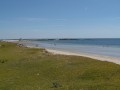
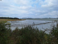
A short circular walk, then a return leg of the Tour du Golfe du Morbihan (TGM): from the village centre of Tour-du-Parc to Pointe de Penvins, in the municipality of Sarzeau. Views over the Tour-du-Parc marshes, the mouth of the River Penerf, Damgan, the coast at Piriac-sur-Mer, and the ocean towards the Ponant Islands. Swimming is possible, weather permitting.
There are a few options for extending this lovely walk; see the ‘Nearby’ section.

Details

n°63227493
Creation:
Last update:
Last review:
  • Walking
    Activity: Walking
  • ↔
    Distance: 8.89 mi
  • ◔
    Average duration: 4h 05 
  • ▲
    Difficulty: Easy

  • ⚐
    Back to start: Yes
  • ↗
    Ascent: + 36 ft
  • ↘
    Descent: - 36 ft

  • ▲
    Highest point: 43 ft
  • ▼
    Lowest point: 3 ft

Photos

Description of the walk

In the village centre, around the church, there is a fairly large car park. Public transport runs there.

(S/E) From the car park, head towards Rue Res Ker Eugène, keeping the church on your left, heading north. The path is signposted as a Grande Randonnée (GR®34®). When you reach a cul-de-sac and a footpath, turn left heading north. This path leads to the ‘Petit Verger’ housing estate. Walk through the estate to reach the Boderharff cul-de-sac.

(1) Turn left onto Chemin de Toulgueri. Ignore the road on the right; about 150 metres further on, turn 90° to the right, heading due east. Follow the marshes until you reach Rue de Beguero.

(2) There are two options:
1) Turn left for an alternative route: see “Nearby”.
2) Turn right, as shown on the map, to join Rue de Pencadenic, then continue right along Rue de Castel until you reach the coastal path at an oyster farm.

(3) Turn right, heading west, pass a small sluice gate connecting the marshes to the sea, then follow a slightly rockier slope to reach Rouvran Beach. Leave Rue de la Plage and the municipal campsite on your right, and follow the Chemin de Roch Vran to the Banastère bridge (D324).

(4) Cross the bridge and immediately turn left onto the coastal path which runs alongside Rue Marie le Franc, then Rue des Chardons Bleus. The path then heads towards Pointe de Penvins via Pointe de Becudo. When you reach the headland, cross the car park to admire the ocean and go for a swim if the weather permits.

(5) There are two options:
1) Take a short detour by walking round the tip of Penvins: see ‘Nearby’.
2) Head back along the route you took on the way there, in the opposite direction, as far as the Banastère Bridge.

(4) Continue straight on for about a hundred metres after the bridge, then turn left onto a Promenade and Hiking Trail (PR®) which passes by the Banastère fishpond. At the end, this path reaches Rue de Toulcaden; turn right onto it, then cross Rue de Benester and turn immediately left onto Chemin de Liorh Bras. This joins Chemin du Roy.

(6) Follow this on the right until you reach Rue de la Plage, which you take to the left to reach the centre of the village and the church, walking alongside the cemetery, before returning to the car park (S/E).

Waypoints

  1. S/E : mi 0 - alt. 39 ft - Église Saint-Vincent Ferrier (Le Tour-du-Parc)
  2. 1 : mi 0.3 - alt. 30 ft - Crossroads – Impasse de Boderharff
  3. 2 : mi 1.14 - alt. 10 ft - Junction of the path with Rue de Beguero
  4. 3 : mi 1.74 - alt. 7 ft - Oyster farm on Rue du Castel
  5. 4 : mi 3.36 - alt. 13 ft - Banastère Bridge
  6. 5 : mi 5.56 - alt. 20 ft - Pointe de Penvins
  7. 6 : mi 8.46 - alt. 33 ft - Chemin de Liorh Bras x Chemin du Roy
  8. S/E : mi 8.89 - alt. 39 ft - Église Saint-Vincent Ferrier (Le Tour-du-Parc)

Notes

The walk is very easy and can be done in ordinary trainers. Walking shoes, or even boots, are preferable in wet weather. Bring water with you as there is very little shade in fine weather. You can top up your water supplies and find public toilets at Pointe de Penvins.
This walk can be done all year round. However, do take care in the event of rough seas and strong winds. In summer, particularly from mid-July to mid-August, the path and beaches can be very busy.

Worth a visit

Weather permitting, you can go for a swim, at least at Rouvran and Penvins beaches. Depending on the tide, other swimming spots may also be available. There are places to eat in the village of Tour-du-Parc, near the Banastère bridge and at Pointe de Penvins. During the high season, remember to book in advance, and out of season, check whether they’re open!

(2) To extend the walk, we recommend the alternative route, which involves turning left onto Rue de Beguero and following it until you reach the end of Rue de Pencadenic. This route takes you past the marshes and then a whole series of oyster farms. There are several places to sample oysters along the way. To rejoin the main route, simply follow Rue de Pencadenic until it crosses Rue de Castel, which you’ll take on the left. However, we’d even recommend – at low tide and in dry weather – walking to the end of Rue de Beguero as far as the slipway, and following the foreshore to the point (3). The foreshore is, however, muddy and very slippery in places. Another way to extend the walk is to walk around the Pointe de Penvins.
For more information, visit the Golfe du Morbihan Vannes Tourisme website.

(5) The Tour de la Pointe de Penvins is a variation on the “Vue sur l’océan” route offered by Vannes Tourisme.

Take your time to admire the scenery, particularly the light at sunrise and sunset!

Always be cautious and plan ahead when you're outdoors. Visorando and the author of this route cannot be held responsible for any accidents occurring on this route.

The GR® and PR® markings are the intellectual property of the Fédération Française de Randonnée Pédestre.

Reviews and comments

3.8 / 5
Based on 2 reviews

Reliability of the description
4 / 5
Ease of following the route
4 / 5
Route interest
3.5 / 5
baca
baca

Overall rating : 3.3 / 5

Date of your route : Nov 19, 2025
Reliability of the description : ★★★☆☆ Average
Ease of following the route : ★★★★☆ Good
Route interest : ★★★☆☆ Average
Very busy route : No

Hike done in November, no one around, average scenery.

Machine-translated

Bguil
Bguil

Overall rating : 4.3 / 5

Date of your route : Apr 21, 2025
Reliability of the description : ★★★★★ Very good
Ease of following the route : ★★★★☆ Good
Route interest : ★★★★☆ Good
Very busy route : No

We went at the end of April; there were very few people about. A lovely and very interesting walk. Especially the headland with the chapel 👍

Machine-translated

Other walks in the area

For more walks, use our search engine .

The GPS track and description are the property of this route's author. Please do not copy them without permission.