From the Col de la Colombière to the Pointe d’Almet via a series of ridges

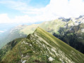
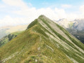
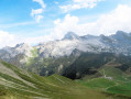
I’d like to suggest a lovely, almost circular route, the aim of which is to reach the Pointe d’Almet from the Col de la Colombière, mainly along ridges via ‘unofficial’ paths. All along the way, there are some very pretty views to enjoy.
Please note: there are two tricky, steep sections which require caution (see the description below).
This hike is not recommended for those who are not sure-footed or who suffer from vertigo.

Details

3992392
Creation:
Last update:
Last review:
  • Walking
    Activity: Walking
  • ↔
    Distance: 7.46 mi
  • ◔
    Duration according to the author: 4 hrs 
  • ▲
    Difficulty: Very difficult

  • ⚐
    Back to start: Yes
  • ↗
    Ascent: + 2,917 ft
  • ↘
    Descent: - 2,900 ft

  • ▲
    Highest point: 7,283 ft
  • ▼
    Lowest point: 5,217 ft

Photos

Description of the walk

Access via Cluses (A40 motorway) and Le Reposoir (RD 4 road), or via Le Grand-Bornand (RD 4 road) from La Clusaz and Thônes.

The starting point is at the Col de la Colombière (where you may find it difficult to find a parking space).

(S/E) To the right of the “Cadeaux-souvenirs” chalet (opposite the bar-restaurant and the chapel) and at the start of a small road (which you’ll follow on the return journey), take a path heading almost straight uphill through alpine pastures.

(1) Not far on, you’ll reach a fork: continue straight on along a fairly steep path. You’ll reach the summit of the Pointe de la Botte (panoramic view).

(2) Carry on straight ahead for a relatively short but steep descent (take care). You’ll reach a small pass: head left towards the Tête d’Auffrand (as indicated by the sign). The slope, which is quite steep at first, then becomes moderate. It steepens again as you approach the ridge: turn sharply left and follow the ridge eastwards (watch out for the ravine on the left).

(3) You have reached the Tête d’Auffrand: continue along the ridge until you reach a fairly flat section.

(4) Leave the path which veers left downhill and continue along a small ridge on a barely visible track. The route then becomes more visible as it follows the ridge line without any significant change in elevation (watch out for ravines). You will reach the Pointe de Deux Heures; from here, you can make out the outline of the route to follow.

(5) Continue east-southeast. Thefirst challenge comes in the form of a rocky outcrop. Personally, I avoided the bulk of the difficulty by descending to the right (southern side) for a few metres down a grassy, steep slope, then continuing through a clearly visible but narrow passage beneath the rock; finish the descent with a few steps of downclimbing along the ridge line. Take your time here, especially as the rock quality is poor in this section.

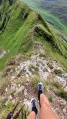
The rest of the route is then easier, with little change in elevation but a few narrow sections here and there flanked by ravines. Follow the path carefully, avoiding a few rocky sections along the way. The slope then becomes steeper – though not excessively so overall – on a fairly pleasant route (with various lovely views along the way). You’ll reach the Pointe de Grande Combe.

(6) Esecond challenge arises during a short but tricky descent: you can either descend straight down the ridge in a moderately stable rocky environment, or descend to the left (north side) through a rather grassy area. Take your time in this section too.
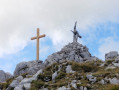
The route continues with a fairly steep climb over a few steps. You’ll reach the Croix d’Almet, topped by a small cross.

(7) Continue along the ridge on a gentle, unchallenging descent. Just before the final ascent to the summit, note a moderately visible path on the left (which you should take on the return journey).

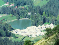
(8) Continue eastwards, staying on the ridge. After a short climb, you’ll reach the summit of the Pointe d’Almet. Enjoy the beautiful panoramic views (notably the Pointe Percée and the Aravis range to the east, and the former Chartreuse du Reposoir monastery below).

(9) Continue east-north-east along the long ridge towards the Cime de Février (visible below), on a route that is not too difficult, until you reach two peaks a few metres apart: this is the Pointe de Chavenet (the slope then becomes significantly steeper as you descend).

(10) Return via the same route as on the way up, passing by the Pointe d’Almet.

(8) Shortly after beginning the descent, take the path on the right that you followed on the way up. Head slightly below the Croix d’Almet (which you visited earlier); the route is fairly gentle at first, but then becomes steeper. After veering left towards the valley, the route then continues down a few steep and slippery sections over stony ground. Please take care, as this section is prone to rockfalls.

(11) Once you reach the bottom of the Combe des Fours, head right to take a wide path downwards. Follow a few hairpin bends, then traverse north-north-west directly below the Auferrand hill. You will reach the Chalets d’Aufférand.
Caution: just past the halfway point of this section, the path has collapsed over a few metres and access is via a narrow, exposed section

(12) Continue along the tarmac road and follow it to the Col de la Colombière (S/E).

Waypoints

  1. S/E : mi 0 - alt. 5,276 ft - Col de la Colombière
  2. 1 : mi 0.15 - alt. 5,453 ft - Junction
  3. 2 : mi 0.33 - alt. 5,902 ft - Pointe de la Botte
  4. 3 : mi 1.2 - alt. 6,483 ft - Tête d'Aufferand
  5. 4 : mi 1.46 - alt. 6,381 ft - Junction
  6. 5 : mi 1.71 - alt. 6,572 ft - Pointe de Deux Heures
  7. 6 : mi 2.79 - alt. 7,169 ft - Pointe de la Grande Combe (Aravis)
  8. 7 : mi 2.9 - alt. 7,267 ft - Croix d’Almet - Pointe d'Almet
  9. 8 : mi 3.15 - alt. 7,113 ft - Path junction
  10. 9 : mi 3.28 - alt. 7,274 ft - Pointe d'Almet
  11. 10 : mi 3.58 - alt. 7,162 ft - Pointe de Chavenet
  12. 11 : mi 5.02 - alt. 5,840 ft - Combe des Fours
  13. 12 : mi 6.83 - alt. 5,236 ft - Aufferand Chalets
  14. S/E : mi 7.46 - alt. 5,276 ft - Col de la Colombière. Near the source of the - Foron du Reposoir (cours d'eau) - Affluent du Giffre

Notes

Good walking boots and walking poles are recommended.

This route is best tackled on dry ground and is accessible between June and November, excluding periods of snow. The main areas prone to late snow are as follows:
-- below the Tête d’Aufferand, whilst crossing a steeply sloping couloir,
-- on the northern edge of the ridges,
-- on the return route, after the ‘8 ’; if access is difficult, you can climb up to the Croix d’Almet (7), then descend to the right, following the descending ridge but without veering too far to the left (a few visible tracks at the start); further down, you rejoin the path in an open area in the Combe des Fours

The starting point of the walk can be seen here.

Alternative route:
After (1), it is possible to take a route (slightly longer in distance) that avoids the summit of the Pointe de la Botte and its rather steep approach: take the path on the right, which then joins the route at (2).

The route is generally easy to follow, but signposts and markings are rather scarce.
The entire route takes place in grassy terrain, though it is not without danger due to the presence of ravines, particularly along the ridgelines. In addition, two sections require a degree of caution:

  1. : Descent from the Pointe des Deux Heures: in this description, I suggest taking the southern route (to the right), then continuing to the left beneath the rock to reach the ridge line, which requires a few steps down a rocky slope. NB: I have read elsewhere of another (untested) option: this involves retracing your steps, then skirting round the summit some twenty metres below via a path, and then climbing back up towards the ridge.
  1. : Descent from the Pointe de Grande Combe with two suggested routes:


* 2 - 1: Head north (to the left) with a few steps down grassy terraces, then access the ridge on the right,

  • 2 - 2: Continue along the ridge line via a slightly more exposed route requiring a few steps of downclimbing in a moderately stable rocky environment.

Here is a description of the difficulties encountered by section (the route is not uniform):
- green: fairly straightforward terrain with no significant elevation changes or difficulties.
- blue: the slopes and/or elevation changes are more pronounced on a well-marked route.
- Orange: sections presenting some technical difficulties and/or poor route conditions (markings or visibility of the path).
- Red: a difficult route due to significant changes in elevation, which may require some climbing, in an environment presenting certain hazards.
- Black: a route on a fairly difficult trail and/or involving imminent dangers.
- White: routes through very challenging technical terrain requiring specific equipment.

From (S/E) to (2): Orange difficulty
At the start, the path is moderately visible. The ascent to the Pointe de la Botte is quite steep and may require the use of your hands.

From (2) to (3): Blue difficulty
The short descent from the summit is also steep. The route then becomes easier along a well-marked path. On the ridge, the approach to the Tête d’Auferrand is straightforward.

From (3) to (5): Blue difficulty
The route to the Pointe de Deux Heures presents no difficulty

From (5) to (6): Red difficulty
The descent from Pointe de Deux Heures is tricky (see above). The route then becomes considerably easier (at most a few exposed sections with sheer drops to the right and left)

From (6) to (7): Red difficulty
Thesecond difficult section is encountered in the Pointe de Grande Combe area (see above). The route is then less difficult as you make your way to the Croix d’Almet.

From (7) to (10): Blue difficulty
The route does not present any major difficulties. At most, it should be noted that the path to the Pointe d’Almet includes a few narrow sections (on the northern side, on the left-hand side).
After the summit, the route along the ridge, there and back, presents no difficulty.

From (8) to (11): Orange difficulty
After a short descent, the route along the path on the right is not very visible at first but becomes much clearer a little further on. The initial section is fairly easy but becomes much more challenging further on, over terrain that is at times steep and slippery in a stony environment. Please be aware that this section is prone to rockfalls.

From (11) to (12): Blue difficulty
A fairly easy walk along a good path.
Caution: part of the path has collapsed over a few metres and the narrow passage requires a degree of caution given the exposure.

From (12) to (S/E): Green difficulty
A very easy route along a small tarmac road

The route is generally quiet.

You may come across some chamois.

Take care to avoid flocks of sheep and goats as much as possible. In such circumstances, you may well come across Patou dogs as well.

Worth a visit

Chartreuse du Reposoir: a monastery founded in 1151 by the Carthusian monks and occupied continuously until the French Revolution, then again between 1866 and 1901. Since 1932, a community of Carmelite nuns has occupied the premises.
To find out more: read here and here.

Reviews and comments

4.8 / 5
Based on 2 reviews

Reliability of the description
5 / 5
Ease of following the route
4.5 / 5
Route interest
5 / 5
Biboon74
Biboon74

Overall rating : 5 / 5

Date of your route : Jun 19, 2026
Reliability of the description : ★★★★★ Very good
Ease of following the route : ★★★★★ Very good
Route interest : ★★★★★ Very good
Very busy route : No

A lovely walk; the ridge sections are magnificent.
The ‘very difficult’ rating is justified; the two sections involving downclimbing are exposed. It’s a shame – if there were a bit of rope or cable to provide even minimal safety, the walk would be accessible to more hikers.

Machine-translated

User 15365346

i had to turn back, there were sheep and sheepdogs on the path.

Machine-translated

Chou 25
Chou 25

Overall rating : 4.7 / 5

Date of your route : Oct 22, 2023
Reliability of the description : ★★★★★ Very good
Ease of following the route : ★★★★☆ Good
Route interest : ★★★★★ Very good
Very busy route : No

A stunning view. A trail along the ridges with a few challenging sections.

Machine-translated

Other walks in the area

For more walks, use our search engine .

The GPS track and description are the property of this route's author. Please do not copy them without permission.