From the Col d’Astún to the Col des Moines

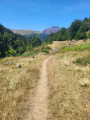
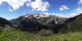
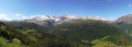
If you’re in the Col du Somport area and the weather is clear (and safe), this short circular route will delight you in no time. Thanks to the chairlift, you’ll reach the starting point quickly, and the ridge walk will allow you to admire the surroundings at your leisure in a unique way. The route is unmarked but clearly defined.

Details

60726647
Creation:
Last update:
Last review:
  • Walking
    Activity: Walking
  • ↔
    Distance: 3.43 mi
  • ◔
    Average duration: 2h 20 
  • ▲
    Difficulty: Moderate

  • ⚐
    Back to start: Yes
  • ↗
    Ascent: + 883 ft
  • ↘
    Descent: - 912 ft

  • ▲
    Highest point: 7,513 ft
  • ▼
    Lowest point: 6,841 ft
  • ⚐ Country: Spain
  • ⚐
    Area: Pyrenees
  • ⚐ City: Jaca 
  • ⚑
    Start/End: N 42.814426° / W 0.491281°
  • ❏
    IGN map(s): Ref. 1547OT, 1547OTR
  • Hour-by-hour weather

Photos

Description of the walk

Access: Astún ski resort (2 km from the Col du Somport); take the ‘Lakes’ chairlift (telesilla de los Lagos). We recommend buying a return ticket, as the descent from Ibón de Escalar to Astún is a bit of a slog.

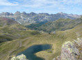
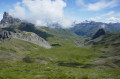
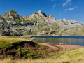
(S/E) On arrival, take the path leading towards the lake. The Lac des Truites is a good spot to rest and have a picnic, but you won’t be tired just yet!

(1) The path climbs gently towards the Astún Pass, becoming a little steeper towards the end.

(2) This pass is on the border and leads to several paths: towards Lac de Houer (south-east), towards Punta Malacara (south) and towards Pico de Astú (north-west). We’ll take the latter, climbing up the ridge.

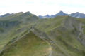
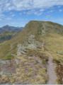
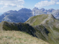
(3) The first peak already offers a lovely viewpoint, but carry on – there’s even better views to come. A short descent, then another climb, still following the ridge. There are a few rocky sections where you’ll need to use your hands, but nothing too difficult.

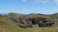
(4) You’ll reach a beautiful summit, the Pic d’Astún, below which lies a curious cave carved into the red sandstone. An excellent vantage point.
The descent from the peak includes a section where you’ll need to use your hands; it’s nothing too complicated or dangerous, but it’s best to be wearing sturdy footwear.
Carry on in this way, still following the ridge. A final summit then comes into view, and is easily crossed (Trampolingeles, 2,278 m), before you begin another descent.

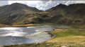
(5) The Col des Moines is usually a very busy spot, so there’s no need to linger. Set off again downhill (to the left, heading west); the path leads you to the edge of the Ibón de Escalar.

(6) If you’re planning to walk down to Astún, turn right here. Otherwise, the path leading straight up will do. After a short climb, you’ll find yourself on a dirt track that’s almost level.

(7) The chairlift is in sight! Ignore the shortcut straight ahead, which is unnecessarily steep, and go round to reach the chairlift at the boarding point (and the refreshment kiosk) (S/E).

Waypoints

  1. S/E : mi 0 - alt. 7,041 ft - Telesilla de los Lagos
  2. 1 : mi 0.18 - alt. 6,965 ft - Ibon de Astun (Truchas)
  3. 2 : mi 0.66 - alt. 7,188 ft - Astún Pass (2,185m)
  4. 3 : mi 1.07 - alt. 7,454 ft - Pic d’Astú (2,277 m)
  5. 4 : mi 1.56 - alt. 7,513 ft - Pico de Astún (2,283 m)
  6. 5 : mi 2.16 - alt. 7,126 ft - Col des Moines
  7. 6 : mi 2.59 - alt. 6,893 ft - Ibon de Escalar
  8. 7 : mi 3.24 - alt. 6,965 ft - Almost at the chairlift!
  9. S/E : mi 3.43 - alt. 7,041 ft - Telesilla de los Lagos

Notes

  • Sturdy footwear is recommended.
  • Do not walk along the ridge in stormy weather (risk of being struck by lightning).
  • If you miss the last chairlift down, head back in the opposite direction towards Ibón de Escalar, where the path on the left will take you to Astún.
  • It is difficult to say exactly where on the route you are in France or Spain, but you should treat the area as part of the Pyrenees National Park, with the associated regulations: no litter, no dogs, no picking of plants, etc.

This route passes through a protected area, which may be subject to special regulations:

Worth a visit

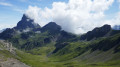
From the Col d’Astún, it is very easy to climb Punta Malacara (2,261 m). Magnificent views over the Canal Roya and the Pic d’Anayet (and, of course, the Pic du Midi d’Ossau).

From the Col des Moine, it is fairly easy to climb the Pic des Moines (2,349 m), with an easy climbing section near the summit. An excellent vantage point overlooking the three valleys and all the surrounding peaks.

Reviews and comments

4 / 5
Based on 1 review

Reliability of the description
Not used
Ease of following the route
Non utilisé
Route interest
4 / 5
Gisèle 94
Gisèle 94

Overall rating : 4 / 5

Date of your route : Jul 27, 2026
Reliability of the description : Not used / Not applicable
Ease of following the route : Not used / Not applicable
Route interest : ★★★★☆ Good
Very busy route : Yes

As the section along the ridges seemed a bit too challenging for our fitness level, we just went from the top of the chairlift to the Col des Moines (and back).

This short, easy ‘walk’ is definitely worth it.
Stunning panoramic views.
The view of the Ossau valley as you reach the Col des Moines is magnificent.
We saw a large flock of griffon vultures and other birds of prey.

It’s a shame that, due to the drought, the lakes were very low and flowers were few and far between...

Machine-translated

Other walks in the area

For more walks, use our search engine .

The GPS track and description are the property of this route's author. Please do not copy them without permission.