Country:

 City:
City:


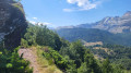
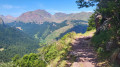
The start point is just above the Chalet Cadier, opposite the Peyrenère pastoral complex. There is a car park right there, in a former quarry.
Signposts (provided by the National Park), right at the small pass where the road crosses, show you two possible directions: left towards Urdos, downhill, and right towards the Refuge de Larry, uphill.
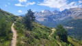
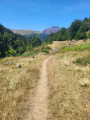
(S/E) Take the path on the right, which climbs gently and runs partly through woodland.
(1) After the first stretch through the woodland, the slope becomes steeper and the path crosses a horizontal rock ledge. Don’t worry: this path has been cut into the rock with a pickaxe; it is wide enough and free of obstacles.
(2) Shortly afterwards, you’ll reach a series of six hairpin bends that make it easy to climb a grassy slope (rhododendrons). Don’t try to cut across the bends! Instead, take a moment to admire the vast landscape. Then, you’ll cross through woodland once more.
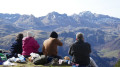
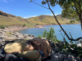
(3) You’ll cross a scree slope with ease: thanks to frequent use, the path is now well cleared of all pebbles and stones. Continue through the woodland. As you emerge from the woods, you’ll come to a ridge and then a flat area, ideal for a picnic and a nap. Take the time to admire the scenery and take some photos.
The Plateau de la Gentiane itself lies a little further on (200 m to the north), below the path. This is a quiet haven for the capercaillie, a protected and endangered species: it is best not to disturb this beautiful bird. You can also continue along the path to the Cabane d’Arnousse and beyond, but it will take longer!
(4) Turn back and follow the same route you took on the way there to return to the car park (S/E).
 Visorando Member

 Easy
Easy 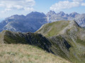
 Difficult