From Les Tonelles to Conac Castle

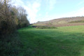
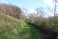
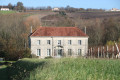
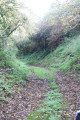
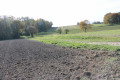
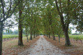
A pleasant walk around Saint-Thomas-de-Conac, near the Gironde, which allows you to discover not only the peaceful countryside—where vineyards, farmland and a few woods lie side by side—but also the ruins of Conac Castle, the church of Saint-Thomas-de-Conac and some fine examples of traditional architecture.

Details

1855294
Creation:
Last update:
Last review:
  • Walking
    Activity: Walking
  • ↔
    Distance: 5.91 mi
  • ◔
    Average duration: 3h 15 
  • ▲
    Difficulty: Easy

  • ⚐
    Back to start: Yes
  • ↗
    Ascent: + 568 ft
  • ↘
    Descent: - 581 ft

  • ▲
    Highest point: 256 ft
  • ▼
    Lowest point: 20 ft

Photos

Description of the walk

Park in the town hall car park.

(S/E) Leave the car park by carefully crossing the D145. Walk past the church and take Rue de l’Église. Just as the road bends sharply to the left to go round the back of the church, continue straight ahead along a farm track until you rejoin the D145. Turn right and follow this road with care until you reach the junction at the corner of the cemetery on your right.

(1) Turn right onto Rue du Bois de Pageot, then turn left shortly afterwards onto a track heading south towards the hamlet of Boniteau. On arrival, the track joins the road; follow it to the left to cross the hamlet.

(2) At the end of the road, turn right onto the track that runs through the woods, skirting the edge of the woods and the sewage treatment plant on your left. Continue straight on until you reach Route du Trésor.

(3) Turn right and follow this road carefully until you reach the first track on the left, just before a vineyard plot.

(4) Turn left onto the farm track which winds its way between vineyards before reaching a junction of three roads and three tracks.

(5) Take the second road on the right, heading north-east towards the hamlet of Chez Flandrais. Once at the hamlet, continue straight on along the track which passes through a wooded area before reaching the Route du Marais. Take this road carefully, turning right. At the next junction, turn left onto the Route de l’Île Sèche, which joins the D145.

(6) Turn left into Impasse de la Croix and you will see the Croix windmill on the other side of the D145. At the end of the cul-de-sac, pass between two large buildings – a house on the right and farm sheds on the left. Continue straight ahead into a wooded area. As you leave this area, the path joins a farm track (Rue de la Parée), which you follow to the left. Continue straight on until you reach the Moulin de la Parée.

(7) The path turns left and joins the Route Basse at a place called La Trigale. Turn right and follow the road carefully through the hamlet until you reach the first farm track on the right.

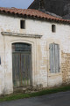
(8) Turn right onto this farm track, known as Basse Rue, which leads towards the ruins of Conac Castle on your left. Turn left onto the first track, which joins the Impasse du Château. On reaching it, turn right to join the Route Verte (D145). Follow it carefully to the right until you reach the first farm track on the left. As you go, you’ll see fine examples of traditional architecture on both sides of the road.

(9) Cross the Route Verte with care and take the farm track heading north. Continue straight on until you reach the Route de l’Amandier. Take this road to the right, heading north. Pass by the hamlet known as Le Petit Pas. Continue straight on, cross the Ruisseau des Joncs and take the first farm track on the right.

(10) Turn onto this farm track and continue straight on towards the east, following the Ruisseau des Joncs until you reach a small road. Take this road by turning right towards the hamlet of Chez Juillard. At the first junction where three roads meet, take the middle one, called Rue de Chez Juillard, which runs through the hamlet. Continue to a junction with a track on the right just before a right-angled bend to the left.

(11) Take the farm track on the right. This joins the road leading towards the village of Saint-Thomas-de-Conac. Follow it carefully due south. As you approach the village, it becomes Rue du Stade; the route runs alongside the stadium on the right-hand side. Rue du Stade leads onto the Route Verte, near the town hall on your right. Turn right and return to the car park (S/E).

Waypoints

  1. S/E : mi 0 - alt. 236 ft - Town Hall car park
  2. 1 : mi 0.27 - alt. 236 ft - Cemetery
  3. 2 : mi 0.57 - alt. 95 ft - Junction of road and footpaths at Boniteau (Y-junction)
  4. 3 : mi 1.25 - alt. 30 ft - Route du Trésor
  5. 4 : mi 1.4 - alt. 105 ft - Crossroads – Road
  6. 5 : mi 1.87 - alt. 43 ft - Junction
  7. 6 : mi 2.47 - alt. 246 ft - D45
  8. 7 : mi 3.18 - alt. 131 ft - Moulin de la Parée
  9. 8 : mi 3.49 - alt. 26 ft - Junction of Route Basse and Chemin Basse Rue
  10. 9 : mi 3.85 - alt. 167 ft - Junction of the Route Verte and the footpath
  11. 10 : mi 4.45 - alt. 26 ft - Junction of road and farm track
  12. 11 : mi 5.41 - alt. 66 ft - Road–path junction at Chez Juillard
  13. S/E : mi 5.91 - alt. 236 ft - Town Hall car park

Notes

The car park is located near the Town Hall. Alternatively, you can park in the car park of the village hall, situated behind the Town Hall (go round to the west side of the Town Hall). There is also a car park near the church.

This walk across varied terrain requires suitable footwear.

The entire route is signposted: GR®360 – GRP® de Saintonge orPR®. Consequently, it is advisable to follow the directions in the description and on the map, whilst also paying close attention to the landscape. The waypoints (with their GPS coordinates and the distance from the starting point) serve as aids for walkers exploring the route for the first time.

Hike completed by the author on 28 November 2023

Worth a visit

Saint-Thomas-de-Conac
The commune of Saint-Thomas-de-Conac consists of 94 per cent agricultural land, which is mainly devoted to viticulture (the production of Cognac brandy and Pineau des Charentes) and, to a lesser extent, to cereal farming (maize and wheat in particular). Six per cent of the commune’s territory is covered by forests and semi-natural habitats.
The presence of numerous migratory birds in the marshes and reed beds bordering the estuary explains why 42 per cent of the commune is part of a Special Protection Area and is covered by the Birds Directive. A further 49 per cent is also covered by the Habitats Directive.

Saint Thomas’s Church

__The Château du Roc
Le Château du Gendreau
Coudret Castle
Logis de La Chapelle__

Cônac Castle

An interesting article on ‘the Gironde estuary: SAINT-THOMAS DE-CÔNAC’

Always be cautious and plan ahead when you're outdoors. Visorando and the author of this route cannot be held responsible for any accidents occurring on this route.

The GR® and PR® markings are the intellectual property of the Fédération Française de Randonnée Pédestre.

Reviews and comments

4.2 / 5
Based on 3 reviews

Reliability of the description
4.3 / 5
Ease of following the route
4 / 5
Route interest
4.3 / 5
Duran Thérèse
Duran Thérèse

Overall rating : 4 / 5

Date of your route : Jul 21, 2024
Reliability of the description : ★★★★☆ Good
Ease of following the route : ★★★★☆ Good
Route interest : ★★★★☆ Good
Very busy route : No

There is only one place where we sought our way, with uncut grass and signposts

Machine-translated

victorien didier
victorien didier

Overall rating : 4.3 / 5

Date of your route : Jul 08, 2024
Reliability of the description : ★★★★☆ Good
Ease of following the route : ★★★★☆ Good
Route interest : ★★★★★ Very good
Very busy route : No

The description becomes less clear towards the end.

Machine-translated

Cypraea
Cypraea

Overall rating : 4.3 / 5

Date of your route : Apr 22, 2024
Reliability of the description : ★★★★★ Very good
Ease of following the route : ★★★★☆ Good
Route interest : ★★★★☆ Good
Very busy route : No

Very good; easy to import into a Garmin 750i sat-nav.

Machine-translated

Other walks in the area

For more walks, use our search engine .

The GPS track and description are the property of this route's author. Please do not copy them without permission.