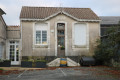
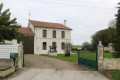
Les Bénissons in Soubran

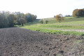
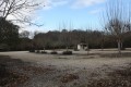
This short route takes you into the heart of the mysteries of the peat bog, a sensitive, astonishing and exotic natural environment with its lake surrounded by pines, white-trunked birches and aspens with golden foliage in autumn. The pleasant, shaded route continues along roads and forest tracks before descending towards the peat bog, where you can follow the nature trail to discover the plant and animal species detailed on the information boards along the boardwalks.

Details

125708
Creation:
Last update:
Last review:
  • Walking
    Activity: Walking
  • ↔
    Distance: 2.34 mi
  • ◔
    Average duration: 1h 10 
  • ▲
    Difficulty: Easy

  • ⚐
    Back to start: Yes
  • ↗
    Ascent: + 151 ft
  • ↘
    Descent: - 151 ft

  • ▲
    Highest point: 335 ft
  • ▼
    Lowest point: 230 ft
  • ⚐ Country: France
  • ⚐ City: Soubran (17150)
  • ⚑
    Start/End: N 45.365346° / W 0.52945°
  • ❏
    IGN map(s): Ref. 1533SB, 1534SB
  • Hour-by-hour weather

Description of the walk

Starting point: Étang des Bénissons car park, beside the D730.

(S/E) Head south and you’ll soon reach the lake.

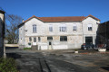
(1) Walk along the edge of the pond to the right, past the peat bog. At the far end of the pond, a first path climbs to the right; ignore it and carry on for a few metres. Take the second small forest track to the right; once at the top, follow the signpost to the left, then a few metres further on another signpost indicates you should turn right to climb up to a sandy track running alongside a renovated house called ‘Les Bénissons’. At the junction with the tarmac road, turn left, then after 200 metres, turn right.

(2) When you reach the road at a place called ‘Chez Quillet’, turn left and follow the road for 650 metres to the crossroads.

(3) Turn left towards Soubran. Follow the road for 750 metres.

(4) At the crossroads, veer left towards Les Joyelles, then, before reaching the hamlet, take the path on the right and head back down towards the pond. Walk along the left-hand side of the pond.

(1) Carry on straight ahead to quickly reach the car park (S/E).

Waypoints

  1. S/E : mi 0 - alt. 272 ft - Pond car park – D730 road
  2. 1 : mi 0.08 - alt. 236 ft - Étang des Bénissons
  3. 2 : mi 0.83 - alt. 289 ft - On the left, before Chez Quillet
  4. 3 : mi 1.25 - alt. 289 ft - Turn left towards Soubran.
  5. 4 : mi 1.72 - alt. 335 ft - Turn left towards Les Joyelles,
  6. S/E : mi 2.34 - alt. 272 ft - Pond car park – D730 road

Notes

Picnic table at Les Bénissons.

Yellow signpost 13A.

Worth a visit

The Pottery Museum in Soubran (information available from the Mirambeau Tourist Office).

Reviews and comments

4.4 / 5
Based on 3 reviews

Reliability of the description
4.7 / 5
Ease of following the route
4 / 5
Route interest
4.7 / 5
Daniel LEGAIGNEUR
Daniel LEGAIGNEUR

Overall rating : 4.7 / 5

Date of your route : Sep 11, 2023
Reliability of the description : ★★★★★ Very good
Ease of following the route : ★★★★☆ Good
Route interest : ★★★★★ Very good
Very busy route : Yes

A short but pleasant walk,
The second path on the right wasn’t very easy to find; the GPS was a bit off.

Machine-translated

bibi
bibi ★

Thank you for your contribution.
Kind regards

Machine-translated

Haute-Saintonge
Haute-Saintonge

Hello, I’ll go and check the marker and update the description afterwards. Thank you, and enjoy your walk.

Machine-translated

bibi
bibi ★

Thank you, I’ve sent a message to the Haute-Saintonge Tourist Office asking them to have a look at their description so they can add that information.
Thank you

Machine-translated

Gillou17150
Gillou17150

That’s right… we headed up into the woods thinking we were doing the right thing, and we ended up at the road at the top…

Machine-translated

bibi
bibi ★

Thanks for that information – so you haven’t actually found the spot where you need to leave the lakeside? If I’ve understood correctly.
Kind regards

Machine-translated

Gillou17150
Gillou17150

At the start, there are clear signs telling you to go round the lake on the right, but after that there’s nothing visible… so we ended up taking quite a detour before finding the path again…

Machine-translated

bibi
bibi ★

Thank you for your comment. What details should be added at the start of the walk? Thank you for your help.
Kind regards

Machine-translated

Gillou17150
Gillou17150

Overall rating : 3.7 / 5

Date of your route : Jan 23, 2017
Reliability of the description : ★★★★☆ Good
Ease of following the route : ★★★☆☆ Average
Route interest : ★★★★☆ Good

A gentle one-hour walk
pleasant setting
Lack of detail at the start of the walk

Machine-translated

les limousins
les limousins

Overall rating : 5 / 5

Date of your route : Oct 30, 2016
Reliability of the description : ★★★★★ Very good
Ease of following the route : ★★★★★ Very good
Route interest : ★★★★★ Very good

A family walk with a child; a superb starting point by the lake, followed by a stretch through the forest where the chestnut trees welcome you with their branches outstretched.

Read the description carefully, follow it to the letter and take a bit of care on the section along the road.

A brilliant family outing and a place well worth discovering!!!!

Machine-translated

Other walks in the area

For more walks, use our search engine .

The GPS track and description are the property of this route's author. Please do not copy them without permission.