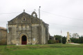
From Saint-Ciers-du-Taillon to the vicinity of Château d’Orignac

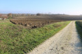
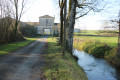
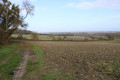
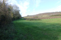
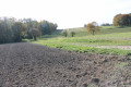
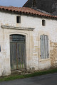
A pleasant walk through the vineyards around Saint-Ciers-du-Taillon and, in particular, around Château d’Orignac to the north. The route offers the chance to explore the beautiful countryside of Saintonge, with lovely views of the vineyards, farmland and small woods. Along the way, there are a few notable examples of traditional architecture.

Details

n°1531619
Creation:
Last update:
Last review:
  • Walking
    Activity: Walking
  • ↔
    Distance: 5.73 mi
  • ◔
    Average duration: 2h 45 
  • ▲
    Difficulty: Easy

  • ⚐
    Back to start: Yes
  • ↗
    Ascent: + 157 ft
  • ↘
    Descent: - 151 ft

  • ▲
    Highest point: 187 ft
  • ▼
    Lowest point: 56 ft

Photos

Description of the walk

Park behind the church in Saint-Ciers-du-Taillon (and/or to the side).

(S/E) Leave the car park by walking round the west end of the church. Head towards Avenue de la République (D730).
Cross with care and take Rue de la Mairie opposite, following it to its junction with Rue du Moulin de la Fuie. Continue straight on along a farm track heading north.

(1) Turn right onto the farm track, which joins the D146 a little further on. Turn left and follow the road carefully for about a hundred metres.

(2) Turn right onto the farm track just before the hamlet of La Croix. At the first junction, turn left between two vineyard plots. Continue straight on until you reach a small road leading to the hamlet of Chez Robin. Turn right and follow this road for about fifty metres.

(3) Turn left and carry on straight ahead until you reach a ‘Y’-shaped junction of farm tracks within a small wood

(4) Turn left and follow the path through the woodland until you reach the D146. Cross it carefully and take the farm track opposite. Follow it until you reach the small road leading to the hamlets of Chez Chagneau and Chez Sedeau.

Turn right, pass the hamlets of Chez Chagneau and Chez Sedeau, then the T-junction, continuing straight on towards Chez Bugeau. Carry on to the crossroads where two small roads meet, a short distance further on.

(5) Turn left towards the hamlet of Les Grands Milliers, pass through it and continue along the farm track which follows on from the road after the last house.
Carry on straight ahead to the Combe des Pères, where an intermittent stream flows. The track runs alongside the stream (ditch) on your left and reaches a crossroads where four paths meet.

(6) Turn left onto the track that winds its way towards the Sarmadelles plots. Turn right onto the farm track that passes through La Bugeaudrie, where it becomes a small road. Follow this road until you reach the D730.
Turn left and follow the D730 road carefully for about thirty metres.

(7) Turn right onto a road leading towards the hamlet of La Motte, passing under a building. Then pass through the hamlet of La Motte, after which the road becomes a farm track. At the T-junction, turn left and continue straight on until you reach a crossroads, just before Chez Legay.

(8) Turn left between two vineyard plots, on a slight rise. Continue to Rue des Lavandières. When you reach it, turn left, cross the Taillon and carry on to Avenue de la République.
Turn left and follow Avenue de la République for about fifty metres. Turn left into Rue de l’Église.
When you reach the church, go round it on the left to reach the car park which marks the end of this walk (S/E).

Waypoints

  1. S/E : mi 0 - alt. 62 ft - Car park behind the church or on the eastern side
  2. 1 : mi 0.39 - alt. 121 ft - Junction, turn right
  3. 2 : mi 0.61 - alt. 148 ft - Before the cross, take the path to the right
  4. 3 : mi 1.22 - alt. 157 ft - At Robin’s, on the left
  5. 4 : mi 1.68 - alt. 151 ft - Y-junction, turn left
  6. 5 : mi 2.73 - alt. 164 ft - Crossroads, turn left
  7. 6 : mi 3.84 - alt. 59 ft - Path, on the left
  8. 7 : mi 4.58 - alt. 56 ft - D730, turn right towards La Motte
  9. 8 : mi 5.29 - alt. 102 ft - Junction, turn left
  10. S/E : mi 5.73 - alt. 62 ft - Car park behind the church or on the east side

Notes

The car park is located behind the church at Saint-Ciers-du-Taillon (and/or to the side)

This walk across varied terrain requires suitable footwear.

This walk is not signposted. Consequently, it is advisable to follow the directions in the description and on the map, whilst paying close attention to the landscape. The waypoints (with their GPS coordinates and the distance from the starting point) serve as aids for walkers exploring the route for the first time.

Please note:
After the waypoint (7), the route follows a road that passes beneath an old porch-like building – a remarkable sight, incidentally – then reaches a farm and runs between the main house on the eastern side and the outbuildings set back on the western side. Please be considerate whilst walking through this area so as not to disturb the local residents. Dogs must, of course, be kept on a lead. This is an essential requirement to ensure this route remains accessible to all walkers.

Walk undertaken by the author on 14 December 2018

Worth a visit

Orignac Castle

History of the Estate
For at least eight centuries, Orignac has been a vibrant, productive and lively place. Over the years, it has never failed to make an impression on those who have lived there. It has imparted to them all the energy generated by such a majestic and timeless place. The history of the Orignac estate dates back to the year 1200, when Yhtier d’Orignac, a knight and lord of the manor, married Sybille, daughter of Hélies, Lord of Virrolet.
The building took on its present appearance when it was “rebuilt in the modern style by Monsieur de Saint-Légier, around 1840”, set amongst avenues, groves and gardens to make it “one of the most pleasant residences”, according to a text from 1864. As for the outbuildings, they were rebuilt in a classical style, further to the north, as a three-part farm complex centred around a large courtyard.
In the last century, Mr Paul Gros acquired the estate from the descendants of the Baron de Saint-Légier and passed it on to his eldest daughter, Hélène. An ingenious and enterprising man, he had imported rootstocks from the United States that were resistant to the phylloxera pest which destroyed French vineyards at the end of the 19th century. Traditional vines grafted onto these American rootstocks brought the crisis to an end.
In 1930, Hélène Gros married a young naval officer, Hubert Meyer. Over the years, they lived in many different towns depending on the Navy’s postings, returning to Orignac, their home base, whenever possible.
At the end of the war, the man who would become Admiral Meyer was tasked by his superiors with negotiating the liberation of the port of La Rochelle, which he carried out with all the rigour and integrity of a seaman; he later served as mayor of Royan in the 1960s.
Orignac inspired a number of vocations: two of his children became agricultural engineers, whilst the third became a teacher of Natural Sciences. Following Hubert Meyer’s death, his daughter Odile, an agricultural engineer, managed the estate for 20 years.
Today, Hervé Meyer, having taken early retirement, has taken over from his sister by moving onto the estate; with the help of his son Yvan, an oenologist in Bordeaux, they are continuing the work of their predecessors with enthusiasm and dedication, ensuring that the wines of Château d’Orignac remain the jewels of our Charente region.

The Vineyard
The Château d’Orignac vineyard is situated at the heart of the ‘Fins Bois’ appellation, on clay-limestone hilltops bordering the Gironde estuary.
It is on this exceptional terroir that the red grape varieties – Merlot Noir and Cabernet Sauvignon, used in the production of Pineau – are meticulously cultivated, alongside Ugni Blanc and Colombard, the preferred grape varieties for the great Cognacs.
Source: Château d’Orignac’s official website (excerpts)
Editor’s note: as the Château is privately owned, the route does not pass through the estate at the owner’s request.

Saint Ciers du Taillon

Saint Ciers du Taillon is a pretty and vibrant little village (population 564) situated in Charente-Maritime. It forms part of the Haute Saintonge community of communes. Its inhabitants are known as the Taillonnaises and Taillonnais.
Under the Ancien Régime, the parish of Saint-Cyr-de-Taillac belonged to the County of Cosnac.
In the 18th century, the parish was known as Saint-Ciers-de-Cônac.

Places and monuments
A wayside cross, with a base dating from 1651, was listed as a Historic Monument by decree of 11 October 1963.

Saint Cyriacus was a Roman martyr under Maximilian. Saint Cyriacus was a Roman martyr under Maximilian.
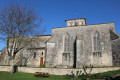
The Church of Saint-Cyriaque in Saint-Ciers-du-Taillon is an imposing building dating from the 12th century, almost entirely rebuilt during the Gothic period. It is laid out in the form of a Latin cross with double transepts.
The gabled façade features, at its centre, a semicircular portal surmounted by a pointed arch with voussoirs resting on small columns and carved capitals. Above this, a mullioned window is set in the style of those in the bell tower. A blind rose window adorns the top of the gable.
The three-bay nave was re-vaulted with ribbed vaults in the 19th century, as evidenced by the inscription dating from 1888 on a keystone.
The south side wall features a small, narrow Romanesque window. A walled-up seigneurial door with an ogee lintel is curiously decorated with geometric engravings.
The square bell tower is attached to the north side wall. Built in the Gothic style, it is elegantly inspired by the Romanesque style. Its base forms a porch, with a door on its north side featuring deep mouldings in a pointed arch, emphasised by a string course and surmounted by a long, narrow window.
The upper storeys are adorned on each side with a series of pointed-arch arcades. The central mullioned window is flanked by blind arches and separated by slender columns with capitals. Each storey is separated by a cornice supported by modillions.
The present bell dates from 1922. The previous one had been cast in 1833 and was cracked in 1918 whilst being rung to mark the armistice.
The double chancel, rebuilt in the 15th century, forms a broad gable pierced by two large pointed-arch windows with tracery.
The choir, which is doubled on the south side, is extended by a chapel. This is known as the Orignac Chapel. Indeed, in the mid-14th century, Lord Ithier d’Orignac requested to be buried alongside his mother in the church.
Vaulted with ribbed vaults, the ribs rest on columns on the south side and on clusters of columns with small foliage capitals on the north side.
Three undated boats of different types adorn the north wall of the church.
A finely carved white marble altar.
Sources: Wikipedia and the website http://www.eglises-en-charente-maritime.... (excerpts)

Reviews and comments

3.8 / 5
Based on 2 reviews

Reliability of the description
3.5 / 5
Ease of following the route
4.5 / 5
Route interest
3.5 / 5
MichelPAV
MichelPAV

Overall rating : 3.7 / 5

Date of your route : Jun 29, 2025
Reliability of the description : ★★★★☆ Good
Ease of following the route : ★★★★☆ Good
Route interest : ★★★☆☆ Average
Very busy route : No

Hello, I'm just going to repeat what has already been mentioned in previous messages, and more.
I went to check out the route this morning. I have to let you know that there is a problem.
At point 7, where you enter under the porch at La Motte, there is now a large sign
"private property/no trespassing", along with a private road.
This part of the route must therefore be removed. When trying to pass before the porch on the left, we were greeted by a dog.
I tried to take the first path on the left (the walls) heading from La Gare towards Sainte Ramée, to pass above the La Motte property, but there is a no entry sign except for residents. The message is clear: watch out for the watchtowers!

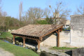
So, for my part, I will start with my friends by going around the church, then along Rue des Lavandières to the wash house, and I will turn back to rejoin Rue de la Mairie and continue the route.
After that, I'll take a detour to the opposite point, landmark 5, where instead of turning left towards Les Grands Millet, I'll continue to Quésant and Plumenail. At the Plumenail crossroads, I will turn left until I reach the grassy path 250 metres on the left, which I will take. This will allow me to catch a glimpse of the Moulin de la Colle.
Then rejoin the route on the right above La Valadière.
At point 6 to 7, do not turn towards point 7 towards La Bugeauderie, but continue to reach landmark 1.

There is also an electric wire at point 4. This morning, as there was no low wire, I passed under the high wire.
In principle, these fences are intended to keep game from nibbling on crops!

Best regards
Michel

Machine-translated

Sarah Tristan
Sarah Tristan

Hello,

Thank you for your very prompt reply, the information it provides and the additional suggestion you have put forward.
I’d just like to point out that, as things stand (in July 2022), there are now two ‘private property’ signs beyond the building we pass under at point 7… Whilst remaining very polite, we’ve obtained permission from the owners to continue our walk (effectively between their house and their farm building), but they turn hikers away when they feel there are too many of them. So do plan a detour if necessary…
Enjoy the rest of your summer on the trails. I also wish you some wonderful walks.
Kind regards

Machine-translated

pgetrochon
pgetrochon

Hello,

Thank you for your message and the information it contained.
As for the section in the forest at the point (4), this may be due to fewer people using certain routes or paths as a result of the pandemic, meaning that nature is reclaiming its territory very quickly.
As for the path after the waypoint (7), I have checked this with a moderator. The road beneath the old building and the farm track that follows it are not registered in the land registry and are therefore not private. The route does not pass through the farm’s garden but runs between the residential house on the east side and the farm buildings set back on the west side. Furthermore, when I surveyed this route in December 2018, there were no signs indicating private property.
Therefore, access cannot be prohibited. This route is inspired by other hiking websites, which are undoubtedly less popular than Visorando, and I thought it would be worthwhile making it available to hikers using Visorando.
However, I shall amend my route description to state that it is advisable to pass through discreetly, keeping any dogs on a lead, so as not to disturb the local residents.
Kind regards. Happy hiking.
Pascal

Machine-translated

Sarah Tristan
Sarah Tristan

Overall rating : 4 / 5

Date of your route : Jul 30, 2022
Reliability of the description : ★★★☆☆ Average
Ease of following the route : ★★★★★ Very good
Route interest : ★★★★☆ Good
Very busy route : No

This is a lovely route – thank you for putting it together – but there are two issues along the way that need to be sorted out as soon as possible.

1) Before stage 4, it is impossible to enter the forest, which is a hunting reserve surrounded by electric fences; you therefore have to take a different path to rejoin the rest of the route.
2) At stage 7, after passing under a building as indicated, walkers find themselves on private property, and the owners are no longer at all happy about being frequently disturbed – ever since this walking route was created – by visitors crossing their garden without knowing where to go.
It would therefore be advisable to correct these two errors for future walkers.

With my thanks in advance
Kind regards

Machine-translated

Other walks in the area

For more walks, use our search engine .

The GPS track and description are the property of this route's author. Please do not copy them without permission.