Around Saint-Ciers-du-Taillon

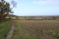
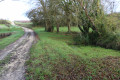
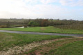
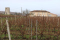
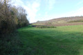
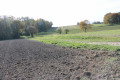
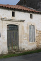
A pleasant walk south of Saint-Ciers-du-Taillon, mainly through vineyards but also amongst the local farmland and small woods. A lovely spot in the countryside, perfect for a stroll. There are a few points of interest, such as the church at Saint-Ciers-du-Taillon, two mills and, along the route, examples of the local built heritage.

Details

n°1531538
Creation:
Last update:
Last review:
  • Walking
    Activity: Walking
  • ↔
    Distance: 6.92 mi
  • ◔
    Average duration: 3h 30 
  • ▲
    Difficulty: Moderate

  • ⚐
    Back to start: Yes
  • ↗
    Ascent: + 322 ft
  • ↘
    Descent: - 292 ft

  • ▲
    Highest point: 246 ft
  • ▼
    Lowest point: 49 ft

Photos

Description of the walk

Car park behind the church and/or to the side.

(S/E) Leave the car park heading eastwards and, before reaching Avenue de la République, turn right onto Rue de l’Église. At the end of this street, turn right onto Avenue de la République until you reach the junction with Rue des Lavandières on the right.

Turn right and follow Rue des Lavandières (D252) with care until you reach a sharp left-hand bend, after crossing the Taillon. As you cross the river, look down to your right at the magnificent covered wash house.

(1) At the bend, take the farm track opposite on the right, known as Chemin du Lavoir. A little further on, this track runs between two plots of vineyards. Pass a crossroads and, at the next fork, take the track on the left, known as Chemin Chez Généraux.

Carry on straight ahead, passing the hamlet of Les Généraux on your left, set slightly back from the track, and then do the same for the locality known as Le Moulin Rompu. Further on, the track reaches the edge of a woodland after passing between two vineyard plots.

(2) At this point, carry on straight ahead along a farm track heading south-west, with a woodland on your right, then between two vineyard plots. Carry on straight ahead until you reach the small road known as the ‘Route du Shepherd's Hut’.

(3) Cross the road carefully and continue along the path opposite. This path runs alongside a vineyard on the right and overlooks a pond on the left.
At the corner of the vineyard plot, take the grassy path branching off to the right, heading downhill, and continue until you reach a farm track.

(4) When you reach it, turn left to cross the stream flowing out of the pond you saw a little earlier and view the nearby spring.
Turn back and follow the farm track towards the hamlet of Chez Vieuille until it joins a small road.
Turn left and follow the road carefully until you reach the second junction on your right (ignore the two property entrances also on the right).

(5) Turn right onto the small road known as Chez Vieuille. Shortly afterwards, it reaches a crossroads with a farm track opposite. This crossroads is situated between the hamlets of Le Petit Moine on the left and Chez Vieuille on the right. Take the track opposite, which heads north-west.

Carry on straight ahead; the track then heads due west until it reaches the Sainte-Ramée road. When you reach it, turn left and follow the road for about twenty metres.

(6) Turn right onto the farm track which leads towards a woodland after a small plot of vines on the right-hand side. This track runs alongside the edge of the Bois de Potier on the left-hand side.

Shortly afterwards, you’ll reach a ‘Y’-shaped junction of farm tracks. Take the track on the left, which passes between narrow plots of vines and trees before running alongside the Bois de Potier on your left once more, with a plot of vines on your right.

At the end of the woodland, at a crossroads, turn right and then immediately left onto a farm track lined with a hedge of trees on the left-hand side at the start (do not go towards the hamlet of Chez Raguenaud).
Carry on straight ahead until you reach a small road. Turn right and follow the road carefully for about four to five hundred metres.

(7) Turn left onto a track which soon leads to a farm building in a clearing in the Bois du Moine. Continue until you go round a small plot of vines on your left and reach a T-junction (with an altitude of 21m).

Turn right and carry on straight ahead until you reach the small road linking the hamlet of Moinier with Virecourt. Turn right towards Virecourt.

(8) In Virecourt, at the crossroads, turn left and carefully follow the small road which passes Chez Fruine, then the hamlet of Le Carrefour, before reaching Sainte-Ramée. Along this entire stretch, look out on the left for the hamlet of Le Moulin (aptly named) and, further on, the Moulin de Chez Guillet (see the section ‘During the walk or nearby’).
Walk straight through Sainte-Ramée and, at the T-junction, turn left towards the hamlet of Les Murs.

(9) On arrival, turn right onto a farm track. At the first junction (altitude 27m), turn left towards the hamlet of La Motte. On reaching the hamlet, the track becomes a small road.

Pass through La Motte and continue straight on until you reach the D730 road. Carefully follow this road to the left for about thirty metres.

(10) Turn right onto a small road leading to the hamlet of La Bugeaudrie. After the hamlet, the road becomes a farm track. Continue to a T-junction (altitude 31m).
Turn right and follow the farm track heading eastwards until you reach a T-junction, at the corner of a vineyard plot.

(11) Turn right and follow the farm track to a T-junction formed by Rue du Moulin de la Fuie and Rue de la Mairie.
Take Rue de la Mairie straight ahead. Continue to Avenue de la République (D730) and cross it with care.

Take the path opposite that runs alongside the church and return to the car park, which marks the end of this walk (S/E).

Waypoints

  1. S/E : mi 0 - alt. 62 ft - Car park behind the church and/or to the side
  2. 1 : mi 0.22 - alt. 66 ft - Junction of road and footpath
  3. 2 : mi 1.52 - alt. 220 ft - T-junction
  4. 3 : mi 1.75 - alt. 217 ft - Junction of farm track and crossroads
  5. 4 : mi 1.92 - alt. 151 ft - Junction towards the spring
  6. 5 : mi 2.28 - alt. 223 ft - Crossroads
  7. 6 : mi 2.55 - alt. 184 ft - Junction of road and footpath
  8. 7 : mi 3.86 - alt. 72 ft - Junction of road and footpath
  9. 8 : mi 4.49 - alt. 95 ft - Crossroads in Virecourt
  10. 9 : mi 5.29 - alt. 59 ft - Les Murs
  11. 10 : mi 5.96 - alt. 56 ft - D730 junction
  12. 11 : mi 6.53 - alt. 121 ft - Crossroads
  13. S/E : mi 6.92 - alt. 62 ft - Car park behind the church and/or to the side

Notes

The car park is located behind the church in Saint-Ciers-du Taillon (and/or to the side of it)

This walk across varied terrain requires suitable footwear.

This walk is not signposted. Consequently, it is advisable to follow the directions in the description and on the map, whilst also using your ability to read the landscape. The waypoints (with their GPS coordinates and the distance from the starting point) serve as aids for walkers exploring the route for the first time.

Hike completed by the author on 10 December 2018

Worth a visit

Saint-Ciers-du-Taillon

Saint-Ciers-du-Taillon is a pretty and lively little village (population 564) situated in Charente-Maritime. It forms part of the Haute Saintonge community of communes. Its inhabitants are known as the Taillonnaises and Taillonnais.
Under the Ancien Régime, the parish of Saint-Cyr-de-Taillac belonged to the county of Cosnac.
In the 18th century, the parish was known as Saint-Ciers-de-Cônac.

Places and monuments
A wayside cross, with a base dating from 1651, was listed as a Historic Monument by decree of 11 October 1963.
Saint Cyriacus was a Roman martyr under Maximilian. Saint Cyriacus was a Roman martyr under Maximilian.
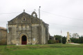
The Church of Saint-Cyriaque in Saint-Ciers-du-Taillon is an imposing building dating from the 12th century, almost entirely rebuilt during the Gothic period. It is laid out in the form of a Latin cross with double transepts.
The gabled façade features, at its centre, a semicircular portal surmounted by a pointed arch with voussoirs resting on small columns and carved capitals. Above this, a mullioned window is set in the style of those in the bell tower. A blind rose window adorns the top of the gable.
The three-bay nave was re-vaulted with ribbed vaults in the 19th century, as evidenced by the inscription from 1888 on a keystone.
The south side wall features a small, narrow Romanesque window. A walled-up seigneurial door with an ogee lintel is curiously decorated with geometric engravings.
The square bell tower is attached to the north side wall. Built in the Gothic style, it is elegantly inspired by the Romanesque style. Its base forms a porch with, on its north side, a door featuring deep mouldings in a pointed arch, emphasised by a string course and surmounted by a long, narrow window.
The upper storeys are adorned on each side with a series of pointed-arch arcades. The central mullioned window is framed by blind arches and separated by slender columns with capitals. Each storey is separated by a cornice supported by modillions.
The present bell dates from 1922. The previous one had been cast in 1833 and was cracked in 1918 whilst being rung to mark the armistice.
The double chancel, rebuilt in the 15th century, forms a broad gable pierced by two large pointed-arch windows with tracery.
The choir, which is doubled on the south side, is extended by a chapel. This is known as the Orignac Chapel. Indeed, in the mid-14th century, Lord Ithier d’Orignac requested to be buried alongside his mother in the church.
Vaulted with ribbed vaults, the ribs rest on columns on the south side and on clusters of columns with small foliage capitals on the north side.
Three undated boats of different types adorn the north wall of the church.
A finely carved white marble altar.
Sources: Wikipedia and the website http://Eglises-en-Charente-Maritime.fr.c... (excerpts)

The Sainte Ramée Mill
The windmill known as ‘Chez Guillet’, built in 1803, ceased operation in 1919. A bakery and an oven were installed in the house adjoining it.
The mill and its mechanism; the façades and roofs of the dwelling, including the rooms of the former bakery (cadastral numbers A 867, 864, 934): listed by order of 13 November 1989
Periods of construction: first quarter of the 19th century
Private property
Source: Monumentum and Wikipedia (excerpts)

Reviews and comments

4 / 5
Based on 2 reviews

Reliability of the description
4 / 5
Ease of following the route
4 / 5
Route interest
4 / 5
19Beatrice61
19Beatrice61

Overall rating : 4 / 5

Date of your route : Feb 21, 2022
Reliability of the description : ★★★★☆ Good
Ease of following the route : ★★★★☆ Good
Route interest : ★★★★☆ Good
Very busy route : Yes

As for me, I just extended it as I headed towards the Gironde estuary

Machine-translated

tatee42 pepe4217
tatee42 pepe4217
• Edited:

Overall rating : 4 / 5

Date of your route : Dec 01, 2019
Reliability of the description : ★★★★☆ Good
Ease of following the route : ★★★★☆ Good
Route interest : ★★★★☆ Good

A lovely walk. A bit tricky given the weather over the last few days. There was a lot of water and mud on the farm tracks. Although the map is very accurate, there is still a lack of signposting in places. We had to avoid a few sections because of flooding caused by surface runoff following the recent spell of rain.

Machine-translated

Other walks in the area

For more walks, use our search engine .

The GPS track and description are the property of this route's author. Please do not copy them without permission.