From Les Lames d’Arçon to the Col de l’Aiguille

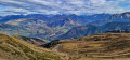
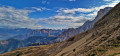
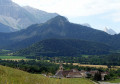
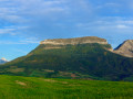
A magnificent hike with breathtaking views of the Vercors massif and the Trièves. The crossing of the Lames d’Arçon is impressive, with a long, exposed section. The arrival at the Col de l’Aiguille takes your breath away with an exceptional panorama of the Obiou, the Dévoluy, the Taillefer and the Écrins. There’s a high chance of encountering herds of chamois on the foothills of the Rattier.

Details

66087540
Creation:
Last update:
Last review:
  • Walking
    Activity: Walking
  • ↔
    Distance: 8.05 mi
  • ◔
    Duration according to the author: 7 hrs 
  • ▲
    Difficulty: Very difficult

  • ⚐
    Back to start: Yes
  • ↗
    Ascent: + 3,835 ft
  • ↘
    Descent: - 3,819 ft

  • ▲
    Highest point: 6,565 ft
  • ▼
    Lowest point: 3,317 ft

Photos

Description of the walk

Coming from Saint-Baudille-et-Pipet via the D216b, park in the car park near the ford, close to Longueville. The car park is easily accessible by car: please note that the entrance to the track is right on a bend and is very difficult to spot.

(S/E) Cross the ford over the Torrent de la Vanne and take the forest track which climbs steeply towards the south-east.

(1) At La Chauri, leave the track and follow the faint path on the left, which, further on, takes a hairpin bend to the right.

(2) Cross a forest track and continue straight ahead on the path, which soon turns due east and winds, on a gentler slope, through the forest, making tight hairpin bends.

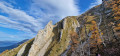
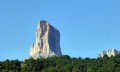
(3) Ignore the path that climbs to the left towards the Cabane de Rochassac, but continue along the path that descends slightly towards the east, then south, in the direction of Laraïs. You’ll reach the magnificent Arçon rock formations, a geological feature likely shaped by erosion.

(4) Caution: exposed section – take great care. You may need to turn back if you suffer from vertigo. Cross the rock formations and reach a junction marked by a signpost.

(5) Turn left onto the balcony path heading towards the Col de l’Aiguille. As you walk, you may spot large herds of chamois on the slopes of the Rattier.

(6) Pass the path on your left – which could serve as a shortcut to the Cabane de Rochassac – and continue straight on to the Col de l’Aiguille.

(7) At the pass, there is a magnificent view of the Écrins massif, Valgaudemar, Valbonnais and Lac du Sautet. Head down to the left, following the contour lines, to reach the Sentier de l’Hirondelle: the meadow is quite steep, but poses no real danger.

(8) Once on the path, turn left. To get out of the gully (small ravine), use the metal cable provided. Then continue across the slope.

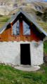
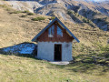
(9) Ignore the shortcut coming from the left and continue straight on to reach the Cabane de Rochassac. This hut, which has recently been restored, is open to walkers. It has a dormitory sleeping around ten people and a wood-burning stove. A water source is available, as well as toilet facilities. Join the path leading uphill.

(3) Turn left and follow the outward route in the opposite direction to return to the car park (S/E).

Waypoints

  1. S/E : mi 0 - alt. 3,320 ft - Car park (VL)
  2. 1 : mi 0.49 - alt. 3,760 ft - Crossroads: track and footpath
  3. 2 : mi 0.85 - alt. 4,157 ft - Junction
  4. 3 : mi 1.54 - alt. 5,318 ft - Rochassac Hut junction
  5. 4 : mi 2.73 - alt. 6,033 ft - Lames d’Arçon
  6. 5 : mi 3.04 - alt. 6,565 ft - Junction, signpost
  7. 6 : mi 4.11 - alt. 6,148 ft - A shorter route is possible
  8. 7 : mi 4.99 - alt. 6,444 ft - Col de l’Aiguille
  9. 8 : mi 5.22 - alt. 5,945 ft - Wire Rope
  10. 9 : mi 5.92 - alt. 6,020 ft - Shortcut to the finish
  11. 10 : mi 6.33 - alt. 5,548 ft - Rochassac Hut
  12. S/E : mi 8.05 - alt. 3,317 ft - Car park (VL)

Reviews and comments

4.7 / 5
Based on 2 reviews

Reliability of the description
4.5 / 5
Ease of following the route
4.5 / 5
Route interest
5 / 5
bibi
bibi ★

Overall rating : 5 / 5

Date of your route : Sep 28, 2025
Reliability of the description : ★★★★★ Very good
Ease of following the route : ★★★★★ Very good
Route interest : ★★★★★ Very good
Very busy route : No

The route was completed in reverse to allow time for a hunt to finish, so the challenging section was covered on the way down, which is a little more slippery. No particular difficulty, the path is well marked (pink/red spray paint). You need to be careful, but there's no need to use your hands. However, if you fall, it's a dizzying drop. I didn't do the section between 7 and 8.

Machine-translated

Jemzolo
Jemzolo

Overall rating : 4.3 / 5

Date of your route : Jul 06, 2025
Reliability of the description : ★★★★☆ Good
Ease of following the route : ★★★★☆ Good
Route interest : ★★★★★ Very good
Very busy route : No

A beautiful hike, but I have a few comments:

- It's a shame not to mention Pascal Sombardier. (See Jean-René Bouvier's post)

- I would add a waypoint between 3 and 4 – at km 3.8 – where the trail branches off to the left. Without GPS, I would surely have continued straight ahead.

- It's a shame to stop at the Col de l'Aiguille! By continuing for 700 metres with only 70 metres of elevation gain on an easy trail, you can quickly reach the summit of the Aiguille, where the view is much nicer!

Machine-translated

bouvierjr
bouvierjr ★

This route follows that described by Pascal Sombardier to the letter, with the exception of the shortcut at the end. Visorando’s policy is to – at the very least – cite its sources (with URLs).
Note to the moderator: once the issue has been resolved, this message may be removed.

Machine-translated

Other walks in the area

For more walks, use our search engine .

The GPS track and description are the property of this route's author. Please do not copy them without permission.