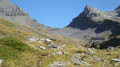
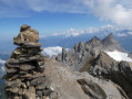
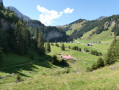
Dent du Signal from the Barme chalets

Visible from afar thanks to the light colour of their rock (hence their name), the Dents Blanches form one of the most interesting mountain ranges in the Valaisan Chablais and offer a wild and beautiful setting. This challenging hike, which includes some tricky sections, takes you to the highest point in the west of this range, from where you can enjoy a superb panorama.

Details

n°3095890
Creation:
Last update:
–
Last review:
  • Walking
    Activity: Walking
  • ↔
    Distance: 6.72 mi
  • ◔
    Duration according to the author: 7 hrs 
  • ▲
    Difficulty: Very difficult

  • ⚐
    Back to start: Yes
  • ↗
    Ascent: + 4,078 ft
  • ↘
    Descent: - 4,088 ft

  • ▲
    Highest point: 8,182 ft
  • ▼
    Lowest point: 4,908 ft

Description of the walk

Start from the Barme chalets, at the end of a road leading from the Grand Paradis site in Champéry.

Signposts at major junctions

(S/E) Head west towards Luibronne and the Col de Bossetan. Walk alongside the Torrent de Barme on your left. Pass the Chalet de la Latieurne, cross the torrent and continue gently uphill through the valley, dominated to the south by the Dents Blanches massif.

(1) Just before the track crosses the torrent again, take a path on the left towards the Col de Bossetan via the Pas de la Bide. Head south towards a rock face, then turn right. Climb more steeply (chained section) and reach the foot of the rock face.

(2) Then turn sharply left onto the path, which becomes very narrow along the edge of the rock face (exposed sections equipped with chains). Reach the Pas de la Bide, a narrow passage between the rock face and a flake that has broken away from it.

(3) There are two options for crossing this section, depending on your build and confidence:
- Go through the inside, taking off your rucksack if necessary.
- Go round the outside (exposed).
Continue along the path until you emerge at the bottom of the Combe de Filipindin.

(4) Climb up the valley, which is grassy at first but then becomes very stony. Navigate numerous switchbacks that become increasingly steep. On a sort of flat section, veer to the right (south-west) and cross a maze of rocks. You’ll emerge onto a ridge and quickly reach the Col de Bossetan (spelled Bostan in France) on the left.

(5) Head south along the border ridge. A little further on, leave the ridge and veer left to go round the Pointe de la Golette. You’ll emerge at the bottom of a valley and climb south-southeast through the scree.

(6) Then turn left (east-north-east) and climb up a wide, stony slope. Manage this ascent as best you can; it is tricky due to the steepness and instability of the scree (some walkers prefer to keep to the right-hand side, along a small rock face). You’ll emerge onto a ridge and immediately reach the summit of the Dent Occidentale (labelled ‘Première Dent’ on the Swiss map).

(7) Continue eastwards and descend a narrow, very exposed ridge. Then climb back up the rocky ridge to the summit of the Dent du Signal.

(8) The return journey follows the same route, with the same tricky sections, back to the Barme chalets (S/E).

Waypoints

  1. S/E : mi 0 - alt. 4,918 ft - Chalets de Barme
  2. 1 : mi 1.42 - alt. 5,535 ft - Luibronne
  3. 2 : mi 1.66 - alt. 6,181 ft - At the foot of a rock face
  4. 3 : mi 1.72 - alt. 6,099 ft - Pas de la Bide
  5. 4 : mi 1.86 - alt. 6,335 ft - Bottom of the Combe de Filipindin
  6. 5 : mi 2.52 - alt. 7,461 ft - Col de Bostan
  7. 6 : mi 3.07 - alt. 8,087 ft - At the foot of a stony slope
  8. 7 : mi 3.18 - alt. 8,097 ft - Dent Occidentale
  9. 8 : mi 3.36 - alt. 8,136 ft - Dent du Signal
  10. S/E : mi 6.72 - alt. 4,918 ft - Chalets de Barme

Notes

Good walking boots are essential. Warm clothing and rainwear are required.

Bring your own water supplies.

A detailed map is required (at the very least the one accompanying this description). A compass may be useful.

Warnings:
- Given the nature of the terrain and certain features of the walk, only undertake it in good, stable weather conditions. In the event of persistent fog or rain, do not go ahead!
- This walk includes several tricky and exposed sections: between (2) and (4), between (6) and (7), and between the two peaks (7) and (8). These sections require constant attention and this walk is not suitable for those prone to vertigo.

Alternatives:
Avoiding the exposed section between the two summits – It is, of course, possible to stop at the first summit, the Dent Occidentale (7), from where the view is already magnificent.
Ascent from the French side, from Samoëns or Morzine – Start with the Tête de Bostan walk via the Pas de la Latte. From the summit of the Tête de Bostan, head eastwards back to the pass of the same name. Then follow this route from its starting point (5).

This route has been completed twice by the author, the first time on 7 August 1972 and the second on 27 August 1978.

Worth a visit

- A variety of landscapes and atmospheres, ranging from mountain pastures to a wholly rocky environment.
- A very wild setting from the Combe de Filipindin (4).
- From each of the two summits, sweeping views over the Dents du Midi (very close by), the peaks of the Chablais and Haut Giffre, and the Mont Blanc massif.

Reviews and comments

5 / 5
Based on 1 review

Reliability of the description
5 / 5
Ease of following the route
5 / 5
Route interest
5 / 5
jplenzi
jplenzi
• Edited:

Overall rating : 5 / 5

Date of your route : Aug 15, 2023
Reliability of the description : ★★★★★ Very good
Ease of following the route : ★★★★★ Very good
Route interest : ★★★★★ Very good
Very busy route : Yes

Today's hike took in some magnificent scenery and chamois, a real treat. All the tricky sections were equipped with chains, so apart from a fear of heights, there's nothing to fear on this route...
Great walks to all

Machine-translated

Other walks in the area

For more walks, use our search engine .

The GPS track and description are the property of this route's author. Please do not copy them without permission.