Country:
 City:


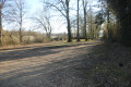
Park on Rue de la Mantelière in Sepvret in the market hall car park (a sort of long wooden covered area).
(S/E) Leave the car park by turning left onto Rue de la Mantelière. Walk uphill to the junction and turn left into Impasse des Ouzines.
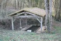
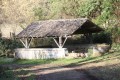
(1) Head downhill opposite along the path to the Lavoir de la Fontaine des Ouzines, which you’ll leave on your left.
(2) Carry on, keeping to the right on the path. Turn left onto the road. Cross the bridge over the Sèvre Niortaise and carry on, keeping to the left on this small road. Enter Fonbedoire, then, when you reach a crossroads, take the path opposite. Continue along this path until you reach the next houses.
(3) At the crossroads, walk alongside the pond on your left and continue along Rue du Bois Bourdin to the Logis de Fonbedoire.
(4) At the Y-junction, turn right onto the path and continue to the Bois de la Roche.
(5) At the crossroads, carry straight on into the Bois de la Roche (the path on the right is private property). Carry on to a junction and turn left. Continue to the cemetery. Turn right onto the road and, at the Stop sign, turn left onto the D737 for 150 metres, towards Goux. Caution: take care as the road can be quite busy.
(6) Turn right onto a small, downhill path that winds through the vegetation. Please note that this path is not always very visible; it is located at the T-junction just before the entrance leading to the lake. A few metres further on, step off the path slightly to see, on the left, the source of the Lambon and its wash house. Return to the path.
(7) At the crossroads, turn left and, at the next junction, turn left again onto the path. Walk down to the Lambon and cross it via the small stone bridge. Continue to the wash house not far from the hamlet of La Fontaine. Walk up the path opposite. Cross the D737 with care.
(8) After a few metres, turn immediately right onto the grassy path, then 150 metres further on, at the crossroads, turn left onto the Chemin de l’Érable. Continue along the edge of the Bois de l’Érable until you reach a junction.
(9) Turn left into the woods and continue along the path to the crossroads. Carry on straight ahead along the grassy path. At the next junction, turn left. Carry on straight ahead along this white track to return to the Logis de Fonbedoire.
(4) Stay on the Route du Bois Bourdin and, immediately after the Logis de Fonbedoire, turn right onto the grassy path. Stay on this path.
(10) At the T-junction, head straight ahead and carry on. Further on, on your left, pass the Les Grandes Fontaines washhouse, first turning right then left onto the Route des Grandes Fontaines to continue along the path leading to La Fontaine du Coin (which has a picnic table). Carry on, crossing the small wooden bridge, and follow the path that runs alongside the Sèvre Niortaise (on your left).
(2) At the Lavoir de la Fontaine des Ouzines, retrace your steps along the route you took on the way there to reach the market hall car park (S/E).

 Visorando Member
 Moderate