Country:
 City:
City:


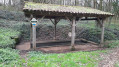
Park on Rue de la Mantelière in Sepvret in the car park in front of the school or in the market hall car park (a sort of long wooden covered area).
(S/E) From the car park in front of the school, walk down this street for a few metres, then turn left, passing in front of the long wooden covered area, and join Rue des Ouzines, turning right.
Just before you reach the first house, take the small path on the right, which leads back onto Rue des Ouzines. Walk uphill and, once at the top, turn right onto Impasse des Ouzines.
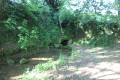
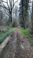
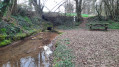
(1) At the end, turn left onto the gently sloping path. Carry on to the crossroads and head down to the left towards the Fontaine des Ouzines washhouse. Walk alongside it, cross the small wooden bridge and continue along the path towards the Fontaine du Chêne, the Fontaine du Coin (which has a picnic table) and the Les Grandes Fontaines washhouse.
(2) Leave the Les Grandes Fontaines washhouse on your right and continue along the path opposite. Further on, at the crossroads, carry straight on uphill and continue until you come out onto a road.
(3) Turn left onto Rue du Bois Bourdin and ignore the path opposite. Continue along the path, which is more or less lined with trees.
(4) At the Y-junction, take the path on the right and, at the crossroads where several paths meet, just before the woodland, turn onto the path on the right just before the row of trees. Continue along the edge of the woodland and then into the Bois de l’Érable, ignoring the paths branching off to the left and right.
(5) At the crossroads, turn left once you’ve entered the Bois de la Roche. This path continues along the edge of the woodland before becoming lined with trees. When you reach the T-junction, take the path on the right that goes uphill. Ignore the path coming from the left as you leave the woodland and continue downhill towards the hamlet of Le Clapier.
(6) Turn onto the path on the right just before the row of trees and the houses. Follow this path until you come out onto the Route de Bois de Circé.
(7) Turn left onto the road, cross it and, immediately, take the grassy path just before the first house in the hamlet of Le Bois de Ciré. Continue alongside the houses and, as you leave the hamlet, take the path on the right.
Carry on through the fields, leaving the path on the right a few metres further on; then, at the next junction, keep to the right along the path until you reach the entrance to the Bois du Pinier.
(8) Just as you enter the woods, at the crossroads of paths, turn onto the one on the right to head into the undergrowth. Carry on, passing a path branching off to the right. Leave the woods, then continue with a field on your right and a few buildings on your left, flanked by shrubs. When you reach the road, carry on straight ahead for a few dozen metres.
(9) At the Y-junction, turn left towards Brégion. Carry on along this long stretch of narrow road, which seems to go on forever. Pass the entrance to a farm on your right (two paths separated by a hedge) and carry on along the road until you come to the start of a path on the right beneath a transverse hedge that winds its way between two fields, signposted for the Circé and Brégion routes.
(10) Follow this path straight on (Circé route) until you reach a junction with several paths, one of which joins the Circé route on the right.
(11) Turn onto the path that climbs to the left into the Bois des Talles, towards Le Petit Moulin (brown wooden sign). Follow the path through the woods and, on emerging from them, continue between the buildings of Le Petit Moulin.
(12) Immediately after the wash house on your right, take the path up to the right (path reserved for pedestrians and walkers). Once past the first houses, follow Impasse de Baulouets to the left and, at the end, turn right. Carry on until you reach a path on the right, after passing the disused sheds on your left; this path is immediately after the EDF pole, before the house and the bend.
(13) Head down this grassy, tree-lined path on the right. Continue downhill to the left, towards the Grand Moulin. Once you’ve passed the two or three houses, take the path on the right towards the Pont de Sepvret and continue along this path, which winds through the woods or along its edge. The Sèvre Niortaise flows on your right.
(14) Cross the small wooden bridge over the Sèvre Niortaise and turn left immediately. Continue until you reach the road, this time with the river on your left. Turn left onto the bridge and cross the road to continue along the path just beyond the bridge, with the edge of the woods on your right and a field running alongside on your left.
Carry on along this path until you come out again at the Lavoir de la Fontaine des Ouzines, where you’ll rejoin the route you took on the way there; you should then follow it in the opposite direction.
(1) At the top of the path, head slightly to the left onto Impasse des Ouzines. At the Y-junction, turn right down Rue de la Mantelière and head for the Sepvret school car park (S/E).


 Visorando Member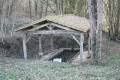

 Easy
Easy