Exploring Boissy, a hamlet of Saint-Laurent-La-Gâtine

Our village, with a population of 452, is situated in the Eure-et-Loir department and is close to Dreux, Chartres and
Rambouillet. It is easy to reach the Paris region by train or via the N12 road.
Our village comprises three hamlets: l’Aumône, Boissy and Saint-Laurent. The route showcases the remarkable heritage of the hamlet of Boissy, which is well worth exploring and deserves to be preserved.

Details

n°47360527
Creation:
Last update:
Last review:
  • Walking
    Activity: Walking
  • ↔
    Distance: 1.08 mi
  • ◔
    Average duration: 0h 30 
  • ▲
    Difficulty: Easy

  • ⚐
    Back to start: Yes
  • ↗
    Ascent: + 10 ft
  • ↘
    Descent: - 10 ft

  • ▲
    Highest point: 433 ft
  • ▼
    Lowest point: 413 ft

Photos

Description of the walk

Start from Boissy Town Hall

(S/E) With your back to the town hall, take the Allée du Château opposite. At the end of this, you will arrive near the network of ditches.

(1) Turn right onto Rue du Moulin à Vent and, at the junction, continue along Rue d’Amfreville to the right.
At the junction, turn left onto Rue de Biennouvienne until you reach the junction with Rue du Gland.

(2) Follow this street until you reach Chemin de Croisilles, which crosses the street.

(3) Turn right onto it, cross the Allée des Trembles and carry on until you reach Rue des Grandes Vignes and its well.

(4) Carry on to the right until you reach the end of the street at the ‘Mare de la République’ sculpture.

(5) Turn right, then left onto the Allée des Trembles. This will take you to the town hall (S/E)

Waypoints

  1. S/E : mi 0 - alt. 423 ft - Mairie de Saint-Laurent-La-Gâtine
  2. 1 : mi 0.13 - alt. 420 ft - Proximity to the network of ditches
  3. 2 : mi 0.36 - alt. 433 ft - Rue du Gland
  4. 3 : mi 0.58 - alt. 417 ft - Chemin de Croisilles
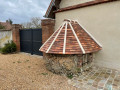
  5. 4 : mi 0.77 - alt. 420 ft - Well at Saint-Laurent-La-Gâtine
  6. 5 : mi 0.92 - alt. 430 ft - The Mare de la République
  7. S/E : mi 1.08 - alt. 423 ft - Mairie de Saint-Laurent-La-Gâtine

Notes

(S/E) The car park at the town hall in Boissy has space for around ten cars.

Worth a visit

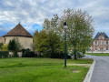
(S) The town hall and school, dating from 1900, stand on the site of the former castle of the Lords of Boissy, with its Place de Saint-Pôl surrounded by lime trees and its dovecote dating from 1786.

(1) The 120 km SIFAM inter-municipal network of ditches, dug by Moroccan prisoners during the German occupation of 1941, to reclaim uncultivated land and channel rainwater.

(4) Wells 14–17 metres deep, essential for supplying water to each farm until a water supply network was built in the 1960s.

(5) The Mare de la République, built in the late19th century to provide water for the village’s livestock.

Reviews and comments

4.7 / 5
Based on 1 review

Reliability of the description
5 / 5
Ease of following the route
5 / 5
Route interest
4 / 5
Régis H
Régis H

Overall rating : 4.7 / 5

Date of your route : Jul 31, 2025
Reliability of the description : ★★★★★ Very good
Ease of following the route : ★★★★★ Very good
Route interest : ★★★★☆ Good
Very busy route : No

The route will soon be marked out.
It is interesting to discover the village's points of interest

Machine-translated

Other walks in the area

For more walks, use our search engine .

The GPS track and description are the property of this route's author. Please do not copy them without permission.