


Refine your search for walks in Mairie de Saint-Laurent-La-Gâtine
Mairie de Saint-Laurent-La-Gâtine walks


 The route of the hamlets of Saint-Laurent-la-Gâtine
 Association / Club / Walk leader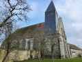
 4.54 mi
 +23 ft
 -20 ft
 2h 05
2h 05
 Easy
Easy
 Departure from Saint-Laurent-la-Gâtine (Eure-et-Loir)
Our village has a population of 452. Situated in the Eure-et-Loir department, it is close to Dreux, Chartres and Rambouillet, and it is easy to reach the Paris region by train or via the N12 road.
Our village comprises three hamlets: L’Aumône, Boissy and Saint-Laurent. The route allows visitors to discover the tranquillity of the countryside and the surrounding forests, as well as the remarkable heritage that is worthy of interest and preservation, thereby ensuring it is passed down from one generation to the next.
Walks near Mairie de Saint-Laurent-La-Gâtine
From Saint-Léger-en-Yvelines to Villiers-Saint-Frédéric
 Visorando Member12.35 mi
+482 ft
-702 ft
6h 05
Visorando Member12.35 mi
+482 ft
-702 ft
6h 05
 Moderate
Departure from Saint-Léger-en-Yvelines (Yvelines)
Moderate
Departure from Saint-Léger-en-Yvelines (Yvelines)
This is the penultimate stage of the GR®1. It takes you out of the Rambouillet Forest and to the Villiers-Saint-Frédéric RER station. Halfway along the route is the pretty medieval town of Montfort-l'Amaury. The ruins offer superb views of the surrounding area. Half of the stage is through forest, i.e. up to Montfort-l'Amaury. The other part of the stage is more rural.
From Orgerus to Mantes-la-Jolie following the Vaucouleurs
 14.10 mi
+413 ft
-725 ft
6h 50
14.10 mi
+413 ft
-725 ft
6h 50
 Difficult
Departure from Orgerus (Yvelines)
Difficult
Departure from Orgerus (Yvelines)
Fifth stage of the Grand Tour of Île-de-France on the GR®11, connecting Orgerus-Béhoust station to Mantes-Station, still through the Yvelines. This is a northbound route that joins the Seine valley at Mantes-la-Jolie, descending the valleys of the Flexanville and then the Vaucouleurs rivers. The route follows both paths at the bottom of the valley and paths on the adjacent plateaus.
From Orgerus to Beynes along the Avre underground aqueduct
 11.82 mi
+236 ft
-509 ft
5h 40
Difficult
Departure from Orgerus (Yvelines)
11.82 mi
+236 ft
-509 ft
5h 40
Difficult
Departure from Orgerus (Yvelines)
A walk from station to station, largely through cultivated plains. The underground Avre aqueduct runs alongside us halfway through the route and, towards the end, the Beynes National Forest offers pleasant paths. A few beautiful churches complete the picture.