Country:

 City:


Take the D43c, turning immediately right before the church when coming from Remiremont. Follow this road for just under two kilometres and continue slightly to the left without crossing the Viaux bridge. Park on the right after driving for about a hundred metres.
(S/E) The starting point is on the left-hand side of the road, opposite where you have parked. Start by taking a small flight of steps situated between two buildings of the former Xoulces factories and continue, following the ‘Blue Ring’ and ‘Red Triangle’ signposts, until you reach the Route du Brabant.
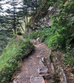
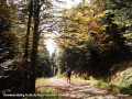
(1) Turn left onto this road for about fifty metres, then cross over to join a small tarmac road marked with a Red Triangle. After about 400 metres, leave this road and take a path on the right, following the Red Triangle markings. The path is wide at first and then narrows. At the old logging site, the path becomes less visible: ignore any paths coming from the right or left. Join the stony path leading to Notre-Dame de la Paix.
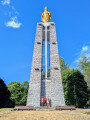
(2) Take this path on the left to reach Notre-Dame de la Paix, from where you can admire the panoramic view over the village of Cornimont.
(3) Then follow the Roger Jérôme trail, marked with a Red Ring, which heads due north on the right and continues straight on until you reach a road.
(4) Carry on straight along the road for about 300 metres.
(5) Take a path on the right marked with a Green Rectangle crossed by a White Rectangle, which winds its way up in hairpin bends to the Petites Alpes viewpoint.
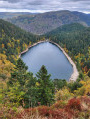
(6) Continue along this track until you reach a road and follow it: the signposting changes to a Green Rectangle (GR®533). The road ends at a farm and gives way to a fairly wide dirt track leading to the Roche de Minuit, which offers a beautiful panoramic view of the Bresse valley.
(7) Continue along the GR®533, signposted with a Green Rectangle, to the Col du Brabant.
(8) Cross the car park and the road to the right and take the path marked with a Red Triangle opposite. Walk past a few houses.
(9) Cross the Route du Brabant and continue straight ahead onto the path marked with a Red Ring and a Red Triangle. Join the Route du Brabant again and follow it for about 200 m.
(10) Leave this road and turn left onto the path marked with a Red Triangle, known as the Chemin de la Bourrique. You’ll rejoin the tarmac road at a house and soon reach the Route du Grand Clos.
(11) Take a sharp right-hand bend and follow this road to the former factories at Xoulces, where the car park is located (S/E).
 Visorando Member
 Easy

 Very difficult