Lac des Corbeaux and Croix Louis via the belvedere

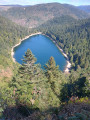
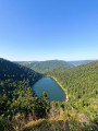
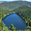
A lovely little hike with a beautiful view of Lac des Corbeaux and perhaps a welcome swim.

Details

14452
Creation:
Last update:
Last review:
  • Walking
    Activity: Walking
  • ↔
    Distance: 2.98 mi
  • ◔
    Average duration: 2h 05 
  • ▲
    Difficulty: Moderate

  • ⚐
    Back to start: Yes
  • ↗
    Ascent: + 778 ft
  • ↘
    Descent: - 774 ft

  • ▲
    Highest point: 3,665 ft
  • ▼
    Lowest point: 2,907 ft

Photos

Description of the walk

Park in the Lac des Corbeaux car park.

(S/E) Walk up the road on the right-hand side of the restaurant for about 20 metres.

(1) Take the path that climbs to the right (marked by a sign with a yellow ring) for about 700 metres until you reach the forest path.

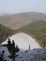
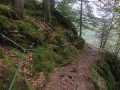
(2) At the path, turn right and continue straight ahead until you reach Roche du Lac. Please note that before you reach this viewpoint and at the viewpoint itself, the rocks can be slippery in wet weather. There is a handrail attached to the rock, but caution is advised.

(3) At the Roche du Lac viewpoint, take the opportunity to take some photos, then, with your back to the lake, take the path that climbs up in front of you. At the top of the climb, turn right and you will soon reach a fork in the path.

(4) Turn left and descend to a track.

(5) Follow it to the left and you will reach Croix Louis and the refuge chalet of the same name, located south of Croix Louis.

(6) At Croix Louis, turn back (or go to the refuge for shelter or lunch) and continue for 1600 m on the forest road to reach the stele of the small pass of Mansuy.

(7) At the crossroads, continue straight ahead and follow the path downhill to the starting point (S/E).


Waypoints

  1. S/E : mi 0 - alt. 2,907 ft - Departure - Lac des Corbeaux
  2. 1 : mi 0.08 - alt. 2,940 ft - Fork in the path. Take the path on the right.
  3. 2 : mi 0.42 - alt. 3,202 ft - Track
  4. 3 : mi 0.85 - alt. 3,428 ft - Viewpoint at Roche du Lac.
  5. 4 : mi 1.05 - alt. 3,661 ft - Fork in the road
  6. 5 : mi 1.19 - alt. 3,550 ft - Track
  7. 6 : mi 1.6 - alt. 3,524 ft - Croix Louis
  8. 7 : mi 2.41 - alt. 3,461 ft - Small pass Mansuy and Stèle
  9. S/E : mi 2.98 - alt. 2,907 ft - Lac des Corbeaux

Notes

(4) You can shorten the route by continuing straight on the path that leads to the small pass Mansuy memorial.

Refreshments are available at the starting point of the hike. Restaurant and picnic areas.
Shelter and snacks available at the Croix Louis refuge.

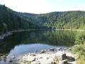
If the weather is nice, don't hesitate to take a dip in the lake. Don't forget your swimsuits; I don't think naturism is tolerated.

Please note that this hike is easy, but the trail is slippery in places, which may make it difficult for those who are less fit. Hold children by the hand.

Worth a visit

Lac de Blanchemer and its floating peatlands by heading back along the RD34d to Retournemer.
The Col de la Schlucht mountain pass.
Meurthe source.

and much more besides...

Reviews and comments

4.5 / 5
Based on 97 reviews

Reliability of the description
4.5 / 5
Ease of following the route
4.4 / 5
Route interest
4.5 / 5
phclaude
phclaude

Overall rating : 4.7 / 5

Date of your route : Sep 10, 2026
Reliability of the description : ★★★★★ Very good
Ease of following the route : ★★★★☆ Good
Route interest : ★★★★★ Very good
Very busy route : No

A lovely walk – a few tips: make sure you wear good walking shoes; no children (some sections are tricky); as for the dog, we didn’t have any problems – ours followed us very well – and the view over the lake is superb. A well-deserved dip in the lake to round it off 😁

Machine-translated

User 25349468

Overall rating : 4.3 / 5

Date of your route : Aug 06, 2026
Reliability of the description : ★★★★☆ Good
Ease of following the route : ★★★★☆ Good
Route interest : ★★★★★ Very good
Very busy route : No

A superb hike in the hills above the lake with some stunning views. The route isn’t always easy and can even be dangerous in places (a ledge with a rope running along the rock face).
Suitable only for experienced walkers or those who are physically fit.

Machine-translated

User 27967641

Overall rating : 5 / 5

Date of your route : Aug 17, 2026
Reliability of the description : ★★★★★ Very good
Ease of following the route : ★★★★★ Very good
Route interest : ★★★★★ Very good
Very busy route : Yes

A lovely little walk, perfect for a short morning outing. The climb up to the viewpoint is a bit challenging but fairly short, and you’re well rewarded for your efforts. After that, there’s an easy, wide path for a while, followed by a descent towards the lake which is quite steep and rocky. A dip in the crystal-clear lake is delightful after the exertion (don’t forget your swimwear). You can skip the round trip to the Croix Louis.
Please note that the ascent and descent aren’t suitable for very young children.

Machine-translated

agnesmamangâteau
agnesmamangâteau

Overall rating : 5 / 5

Date of your route : Aug 03, 2026
Reliability of the description : ★★★★★ Very good
Ease of following the route : ★★★★★ Very good
Route interest : ★★★★★ Very good
Very busy route : Yes

Quite steep ascents and descents. A lovely view at the top of the lake. Lots of rocks. A truly beautiful view. The Croix Louis is of little interest. Following the GPX track, we didn’t see a mountain hut. You can head straight to the Collet Mansuy memorial without going via the Croix Louis.

Machine-translated

gazok54
gazok54 ★

Hello, and thank you for your feedback.
Provided the dogs are kept on a lead, as they all should be, there is no danger to them.

Machine-translated

User 29079191
• Edited:

Overall rating : 4 / 5

Date of your route : Aug 13, 2026
Reliability of the description : Not used / Not applicable
Ease of following the route : ★★★★☆ Good
Route interest : ★★★★☆ Good
Very busy route : Yes

It’s a nightmare – a dangerous stretch of road, and although nothing’s specified, it’s not suitable for dogs!
And as a result, the people there are really rude!
Avoid this place if you’re with your pooches
Apparently, it’s not allowed to take them up there 🤬😤

Machine-translated

FURETTE1959
FURETTE1959

Overall rating : 4 / 5

Date of your route : Oct 01, 2025
Reliability of the description : ★★★★☆ Good
Ease of following the route : ★★★★☆ Good
Route interest : ★★★★☆ Good
Very busy route : No

A lovely hike to do in dry weather and to enjoy the shade. I agree with other reviews: the first part of the hike is not accessible to everyone, but more for those who enjoy a bit of exercise.
There is a beautiful view of the lake when you reach the lookout point, but it's a shame you don't see it more often during the hike.

Machine-translated

Denis26
Denis26 ★

Overall rating : 5 / 5

Date of your route : Sep 07, 2025
Reliability of the description : ★★★★★ Very good
Ease of following the route : ★★★★★ Very good
Route interest : ★★★★★ Very good
Very busy route : No

A lovely walk with a magnificent view from the rock.

Machine-translated

User 3538760

Overall rating : 5 / 5

Date of your route : Aug 05, 2025
Reliability of the description : ★★★★★ Very good
Ease of following the route : ★★★★★ Very good
Route interest : ★★★★★ Very good
Very busy route : No

A very pleasant walk with a magnificent view from the rock. Sturdy footwear is highly recommended as there are some more technical sections. We went as far as the cross, but it wasn't particularly interesting. At the end of the walk, we added a tour of the lake.

Machine-translated

User 14827938

Overall rating : 4.7 / 5

Date of your route : Aug 09, 2025
Reliability of the description : ★★★★★ Very good
Ease of following the route : ★★★★★ Very good
Route interest : ★★★★☆ Good
Very busy route : Yes

We did this hike in the middle of summer. The shaded route allowed us to enjoy a lovely walk in the shade. There is also a magnificent view of the Lac des Corbeaux halfway along the route. Be sure to wear good walking shoes as there are a few rocky sections. It took us 1 hour 15 minutes instead of 2 hours. I highly recommend it.

Machine-translated

User 26583764

Overall rating : 4.3 / 5

Date of your route : Jul 18, 2025
Reliability of the description : ★★★★☆ Good
Ease of following the route : ★★★★☆ Good
Route interest : ★★★★★ Very good
Very busy route : Yes

Beautiful hike, the description matched the terrain well. Just one thing to note: this walk is described as easy, but given some of the rough sections, I think it would be wise to bump it up a notch 😀 Thank you Visiorando, see you soon!

Machine-translated

gazok54
gazok54 ★
• Edited:

Oh dear, this trail is one of the easiest I've ever described. Given the large number of hikers who use this route, the trail is easy to find, even without a description.
Thanks for the feedback.

Machine-translated

User 26265284

Overall rating : 2.3 / 5

Date of your route : Jun 23, 2025
Reliability of the description : ★★☆☆☆ Disappointing
Ease of following the route : ★☆☆☆☆ Very disappointing
Route interest : ★★★★☆ Good
Very busy route : Yes

The route was not easy to follow. The difficulty level was much higher than that specified on the website.

Machine-translated

gazok54
gazok54 ★

Not at all, you are entirely free to give your opinion, even if it's negative. I just don't quite understand why my description is rated very disappointing.
I would, however, add your comment about not venturing out if it's freezing.

Machine-translated

RB62
RB62

You're asked to give your opinion.
But as I understand it, you only have to give it if it's positive.

Machine-translated

Other walks in the area

For more walks, use our search engine .

The GPS track and description are the property of this route's author. Please do not copy them without permission.