Malplaquet 1709

From the Baladavesnois collection, here is the Malplaquet 1709 walk. Suitable for the whole family, this walk takes young and old alike in the footsteps of the soldiers who fought in the bloodiest battle of the 18th century.

Adventure guaranteed! Louis Ambroise will guide you along this walk, which features questions and games.

Details

1326852
Creation:
Last update:
Last review:
  • Walking
    Activity: Walking
  • ↔
    Distance: 6.08 mi
  • ◔
    Average duration: 2h 50 
  • ▲
    Difficulty: Easy

  • ⚐
    Back to start: Yes
  • ↗
    Ascent: + 43 ft
  • ↘
    Descent: - 43 ft

  • ▲
    Highest point: 509 ft
  • ▼
    Lowest point: 466 ft

Photos

Description of the walk

Park at the Maison des Associations, 69 Route de Mons, D932, in Taisnières-sur-Hon.

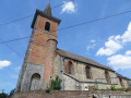
(S/E) Turn left and follow the left-hand pavement. Head towards Saint-Michel Church in Malplaquet.

(1) Cross the road carefully and turn right onto Chemin de la Voie Blanche. At the junction, turn left. You’ll come to the plaque commemorating the Royal Artillery Regiment. Take Chemin des Grosses Haies on your right.

(2) At the next junction, turn left. You will see the Swiss regiments’ memorial on your right.

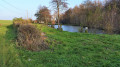
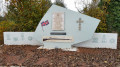
(3) Turn right towards the fishponds. Then continue on your way towards the memorial to the English regiments.

(4) Retrace your steps.

(3) Turn right to join the departmental road. Please take care when crossing this busy road. Turn right and walk alongside it, keeping to the left-hand verge.

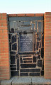
Pass the shed on your left, carry on for a few metres, then turn round to look at the mural. Please take great care along the D932, which is very busy; stay on the left-hand verge and then cross the road in front of the memorial.

(5) With your back to the monument, cross back over and carefully head right along the D932 towards Belgium, then take the first path on the left. At the junction, carry straight on, passing the gas metering station on your right, then turn right to go round it. Ignore a path branching off to the right.

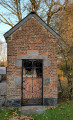
(6) Turn left. At the next junction, turn right onto the Chemin de la Bondoise to enter the hamlet of Camp Perdu. At the junction, turn right and walk a few dozen metres to see the private chapel dedicated to Our Lady of the Seven Sorrows.

(7) Retrace your steps and head straight ahead. At the junction, turn right onto the Grand Chemin de Mons to reach the memorial to Marshal Villars.

(8) After the monument to Marshal Villars, continue straight on, then take the first path on the left, the Chemin de la Voie Blanche.

(1) When you reach the next junction, turn left to reach the final stop at Malplaquet Cemetery. To do this, continue along the left-hand pavement until you reach the junction by the ‘Aux Arcades’ café, then cross the road carefully and head to the right. Malplaquet Cemetery is a few metres further on, on the left.

(9) Retrace your steps.

(1) Turn left to return to the starting point (S/E).

Waypoints

  1. S/E : mi 0 - alt. 466 ft - Maison des Associations
  2. 1 : mi 0.18 - alt. 492 ft - Crossroads at the end of the circular loop
  3. 2 : mi 0.99 - alt. 502 ft - At the junction, turn left
  4. 3 : mi 1.47 - alt. 489 ft - Turn right towards the fish ponds
  5. 4 : mi 1.75 - alt. 479 ft - Memorial to the English regiments
  6. 5 : mi 2.38 - alt. 502 ft - Memorial stone
  7. 6 : mi 3.42 - alt. 489 ft - Junction, turn left
  8. 7 : mi 3.93 - alt. 486 ft - Chapel of Our Lady of the Seven Sorrows
  9. 8 : mi 4.52 - alt. 502 ft - Marshal Villars Memorial
  10. 9 : mi 5.71 - alt. 509 ft - Malplaquet Cemetery
  11. S/E : mi 6.08 - alt. 466 ft - Maison des Associations

Notes

Worth a visit

Reviews and comments

3.5 / 5
Based on 4 reviews

Reliability of the description
3.8 / 5
Ease of following the route
3.8 / 5
Route interest
3 / 5
Dan94
Dan94

Overall rating : 1.3 / 5

Date of your route : May 24, 2021
Reliability of the description : ★★☆☆☆ Disappointing
Ease of following the route : ★☆☆☆☆ Very disappointing
Route interest : ★☆☆☆☆ Very disappointing
Very busy route : No

Very poorly signposted, especially at the start.

Machine-translated

Yves Leroy
Yves Leroy

Overall rating : 3.7 / 5

Date of your route : Feb 20, 2021
Reliability of the description : ★★★★☆ Good
Ease of following the route : ★★★★☆ Good
Route interest : ★★★☆☆ Average
Very busy route : No

A cross-border walk. A fairly monotonous, flat route. Little vegetation; almost nothing but fields. Interesting historical information boards.

Machine-translated

vdidry1
vdidry1

Overall rating : 5 / 5

Date of your route : Jun 27, 2020
Reliability of the description : ★★★★★ Very good
Ease of following the route : ★★★★★ Very good
Route interest : ★★★★★ Very good
Very busy route : No

A beautiful and interesting walk across the site of a little-known battle.
Plenty of monuments. Comprehensive information boards

Machine-translated

junkersdorf
junkersdorf

The change to the route is not a mistake; it is simply different from the one on your website. It is, in fact, displayed at the starting point along with a map
Best regards,

Machine-translated

PNR de l'Avesnois
PNR de l'Avesnois

Hello,

Thank you for reporting this issue. We are forwarding your message to the town hall and to the Culture Patrimoine Malplaquet association in Taisnières-sur-Hon so that they can resolve it.
Kind regards

Machine-translated

junkersdorf
junkersdorf

Overall rating : 4 / 5

Date of your route : Dec 07, 2019
Reliability of the description : ★★★★☆ Good
Ease of following the route : ★★★★★ Very good
Route interest : ★★★☆☆ Average

This route is currently very well signposted. The only difference is that the signposts do not take you back to point 3 but lead you straight to point 5
There are a few muddy patches due to the recent rain and the tractors having been through

Machine-translated

Other walks in the area

For more walks, use our search engine .

The GPS track and description are the property of this route's author. Please do not copy them without permission.