Country:
 City:
City:


The route starts at Saint-Nom-la-Bretèche-Forêt de Marly station.
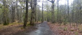
(S) On leaving the station, turn left to cross the tracks at the level crossing. Walk uphill and then take the bridge over another set of railway tracks. At the turning circle for buses, take theGR® on the right and follow the railway line.
(1) At the junction (with a small stone-built fountain on the right), turn left. Walk uphill and continue straight on at the next few junctions.
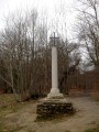
(2) At the top of the hill, turn right towards the Croix Saint-Michel. Turn right again at the next junction. At the next two junctions, continue straight on. This will take you to the Croix Saint-Michel (a lovely viewpoint if the trees have been pruned).
(3) Head north. There are numerous junctions at this point: follow the red and white markings and the GPS route. Go downhill and then uphill again until you reach the D98.
(4) Carefully cross, in turn, a cycle path (with cyclists coming from the left), the road (which is very busy) and another cycle path (with cyclists coming from the right). Then carry on straight ahead along the GR®.
(5) At the junction with a tarmac forest road (Étoile des Berceaux), turn slightly right onto theGR®. At the next junction, turn left. A little further on, cross a forest road and continue straight ahead on the GR®. Continue straight ahead again at the next two junctions.
(6) At the junction (Étoile des Chasseurs), follow theGR® to the left (due west). At the next three junctions, carry straight on, then turn right at the fourth. Then turn left at the next two junctions until you reach the road at a bend: turn right to stay on the GR®.
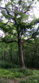
(7) At the Étoile du Chêne de Retz, turn right for a few metres, then turn left very quickly onto the GR®. Turn right again at the next junction, then left at the following one. Head down a slight slope before climbing back up on the other side. After this climb, turn left towards the Route Dauphine. When you reach this road, follow it to the right to pass under the A13.
(8) For those who wish, after about 200 m, turn left (off the marked trail) to quickly reach the ruins of Retz Castle. It’s not particularly spectacular; you can just make out the old moat. Retrace your steps.
(8) Continue along the forest track following the GR®.
(9) When the road bends to the left, turn right onto theGR®. Immediately afterwards, veer left to stay on the GR®. Keep left at the next five junctions. The path descends slightly towards a stream before climbing again. At the sixth and seventh junctions, keep right before turning left at the eighth junction. At the end of the path, turn right onto another path before turning left at the first junction. Follow the path again to its end (numerous junctions with the mountain bike track: GPS recommended) and turn right ontothe GR® which descends towards the Ru de Buzot. Cross the stream and follow it upstream for a few metres before returning to the same bank further upstream.
(10) At the Étoile du Silence (major junction), take the first path on the right. When you reach a narrow lane, turn left to walk alongside a fence. You will then come to another path; follow this to the left before quickly turning right at the first fork. Then take the third path on the right.
(11) At the roundabout, veer to the right and walk past the Chapelle Sainte-Gemme. Follow the road to the next roundabout.
(12) Opposite, take the Chemin de la Plaine du Moulin (C23). Continue straight on at every junction until you reach a sharp right-hand bend in the road.
(13) Then take a lane on the left (Rue des Cavées). Stay on this street until you reach the town hall. At the junction by the town hall with the Grande Rue, turn right onto the Grande Rue. Stay on this street until you reach the church
(14) At the foot of the church, take a narrow lane on the right. Then ignore another narrow lane coming from the left. Stay on the same road until you reach the bridge over the D30 (located just after a pond on the right). The path then turns into a track. At the junction just past the bridge, turn right. At the next crossroads, turn left. This track runs alongside an equestrian centre. At the far end of the centre, ignore a path on the right leading to a private property and turn left onto theGR®. Then, again on the right, ignore an inconspicuous path leading to a private property.
(15) At the next bend, veer to the right. You’ll come to a short shaded stretch followed by a long stretch through meadows. Continue straight on at every junction until you reach the Croix Sainte-Geneviève (in the shade of a clump of trees).
(16) Carry on straight ahead. Then cross the Route Royale and continue opposite into the meadows and fields. At the first junction, turn left.
(17) At the end of the track, turn right at the Flambertins d’Orgeval onto Rue de Feucherolles. Take the second track on the left, which runs alongside the Bois de la Garenne.
(18) At the next junction, head down to the right onto a track which gradually turns into a path as you approach the Moulin d’Orgeval.
(19) At the junction, turn right onto a path (Rue de la Garenne). At the end of this path, turn left onto Rue de Feucherolles.
(20) Ignore the first lane coming from the right and, at the second junction, take the path that starts between the houses. Then cross a stream. At the next junction, carry straight on. Stay on the same path until you reach the next road, then turn left onto theGR® which enters the Parc de la Brunetterie. Once inside the park, keep left at the first junction, cross the park, turn right at the next junction and arrive at a car park between two houses: join the road here and turn left onto Rue de Colombet. Then take the second street on the right (Chemin du Ru). Follow this path to a large car park: cross the car park to reach the church.
(21) Turn right to walk past the church, then take the first street on the left. Carry straight on at the first junction. At the next three junctions (with lanes and streets), carry straight on. Carry straight on again at the fourth junction, then at the fifth, turn right onto Rue de Fresnes. Carry on straight ahead at the end of the street along a track leading to the last houses in Orgeval. At the last house, stay on the track on the right, then, at the next fork, head left. Carry on straight ahead at the next two junctions.
(22) Then turn right at the next junction and begin a gentle descent. Carry on straight ahead at each junction, cross a stream and head back uphill.
(23) Cross the D113 with care and carry on straight ahead along Rue Sainte-Anne towards the Bures district. Pass under the A13 again and start climbing a hill. Take the first path on the left. Turn right at the first junction, then right again at the end of the street.
(24) Take the first path on the right to pass in front of a chapel. Turn left at the next junction. Go round a few bends and, about 600 to 700 metres after the junction, take the first path on the left, which climbs steeply past the houses. At the end of the path, carry straight on along a lane which turns back into a dirt track at its end. You will then begin the final section of the walk through the woodland.
(25) Take the first path on the right. The path ends at a track, which you should follow to the left. You’ll come to a path.
(26) Follow the track to the left to cross the Marsinval neighbourhood. Shortly after reaching the first houses in the neighbourhood, ignore the first track on the left.
(27) Shortly after this junction, take the second lane on the right, which quickly turns into a path that winds through woods and meadows. You will then reach a road.
(28) Follow the road to the left. Soon after, ignore a track coming from the right and, at the edge of the woods, take the first path on the right. Ignore the first two paths coming from the left; at the third, keep left onto the path which ends in a street in Vernouillet.
(29) Continue along the street and, at the next three junctions, carry on straight ahead. Just past the cemetery, take the first street on the right (Rue de la Fontaine Rome) and then the first street on the left again (Rue du Clos Thonesse). Stay on this street until it ends, then turn right onto Rue Aristide Briand.
(30) At the junction just in front of the church, turn left. Keep left at each junction until you reach Vernouillet Town Hall. At the town hall, stay on Rue Paul Doumer and pass in front of a château. Shortly after the château, keep right to stay on Rue Paul Doumer.
(31) At the roundabout, carry straight on along the other section of Rue Paul Doumer. At the end of the street, turn left onto Grande Rue. Then pass two roads on the right leading to blocks of flats and houses, and turn right at the third junction. Turn right again at the end of the street, then take the first left. Follow the road to Vernouillet-Verneuil station (E).


 Visorando Member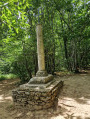
 Moderate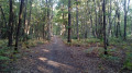
 Difficult
  Easy
Easy