Country:
 City:



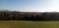
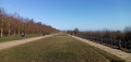

Starting point and access: Saint-Nom-la-Bretèche station – Marly Forest.
- Transilien – Line L, terminus of the section between Paris Saint-Lazare and Saint-Nom-la-Bretèche.
Take the only exit, at the front of the train.
Red and white markings
(S) At the end of the platform, turn left to cross the level crossing and head up the road.
No signposting
After about thirty metres, just before the old station, go down a flight of stairs on the right, carefully cross the tram track at the designated crossing and go up another flight of stairs.
Red and white + red and yellow markings
At the top, follow a gently sloping path to the right.
Red and yellow markings
(1) At the junction, carry on straight ahead (let the GR®1 head off to the left). Shortly afterwards, ignore a path coming from the left, cross a stream and head uphill. At the Étoile de la Maison Rouge, carry on straight ahead. Climb gently and ignore the tracks off to the sides. At a Fork in the road, keep to the right and continue on level ground.
(2) At the junction, turn left and climb slightly through a beautiful beech forest dotted with oak trees. At the top (plot no. 87), carry on straight ahead (north) along level ground. At two successive junctions, go straight ahead. Cross a forest track and carry on straight ahead.
(3) Cross the D98 with great care (a busy road flanked by cycle paths on both sides; no protected crossing). On the other side, walk a few metres and, at the junction, take the path on the right. Immediately afterwards, turn left onto the path, ignoring a track on the right, and head down alongside a beautiful beech forest on your right. Cross a stream and you’ll soon reach a crossroads.
(4) Then take the second path on the left and head uphill. At the two successive junctions, go straight on. Head downhill along a path. At the next junction, turn right and continue downhill. This will take you to the Étoile du Loup (a paved roundabout in the centre).
Unmarked
(5) Head roughly straight ahead along a wide, compacted track, passing a signpost on your right. Keep going straight on along this good track, ignoring all side paths. You’ll reach the Étoile de Montaigu (information board and map).
Red and yellow markings
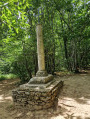
(6) Cross a tarmac road and continue along the path opposite. Keep going straight on (north-west) and ignore any tracks or paths off to the sides. You’ll eventually head downhill and reach a T-junction. Turn right here. Ignore a path on the right. Then take the first path on the left, pass between two stone markers and follow a fence on your left.
Red and yellow + yellow markings
(7) At the end (stone markers), follow a good path to the right and walk alongside a palisade, then a hedge, on your left. Ignore a small bridge on the left and walk alongside a stream on your left. At the corner of a fence, turn left and cross the stream. Walk up a concrete path and follow a low wall on your left. Continue along a narrow lane, still going uphill.
Yellow markings
(8) At the T-junction, turn right (let the GRP® head off to the left). When the road bends to the right, turn left onto the Sente de la Décharge de l’Aqueduc (on the IGN map, the purple line supposedly representing the PR® is out of date). Immediately ignore a path leading uphill to the left and continue on level ground between a wall on the left and gardens on the right. Carry on straight ahead, on roughly level ground, then turn right to head downhill and you’ll soon reach a T-junction.
(9) Turn left and head uphill between fences and walls. You’ll come out onto a narrow lane; follow it to the left. At the end, turn right at an acute angle and head slightly downhill. At the Stop sign, carry on straight ahead.
No signposting
(10) At the next junction, keep to the right (let the signposted PR® route go off to the left) and pass a dead-end road on the right. Go round a roundabout on the right and continue along the road ahead.
(11) Go round a large roundabout on the right to cross the N13 at the pedestrian crossing. Then first turn right then left to join the Allée de Pomone. Next, veer right and cross a hotel car park (admittedly not the most picturesque part of the walk). Look out for a discreet path at the far end of the car park, which starts at the foot of an EDF substation.
(12) Follow this path, which runs alongside a wire fence on the left-hand side. At a T-junction, turn left and wind your way through the undergrowth. You’ll emerge into open ground and walk alongside a plot of regenerating woodland on your right, ignoring all the paths on the right.
(13) At the corner of the regeneration plot, take a well-defined path on the right and follow a stand of high forest on your left. At the next corner of the regeneration plot, continue straight on through the forest. At the junction, turn right onto a wide, stabilised track. Note a fine pedunculate oak on the left-hand side. At the next junction, turn left and continue to a large crossroads.
(14) Then take the second track on the right. Immediately afterwards, just past a large oak bearing the inscription ‘A14 P/R’, turn left onto a discreet path. Wind your way through the coppice, then keep heading north-east along the path through a high forest. At a junction, go straight on. Further on, step over a pipe, leave the forest and cross a stony track. First turn right then left to reach the edge of the D190.
(15) Cross this road with great care (itis a busy road with a cycle path on both sides and no protected crossing). On the other side, follow the cycle path to the right (the path opposite, shown in purple, no longer exists). At the traffic lights, cross the N184 and then the tram tracks. Then turn left and follow the tracks on your left-hand side (you can use the grassy verge to the right of the cycle path).
(16) Opposite a ‘Cyclists dismount’ sign and at the corner of an EDF substation, turn right onto a tarmac path. Walk alongside the fence of a sports complex on your left. At the corner of the fence, a path branches off to the left, staying close to the fence. A few metres further on, look out for another path branching off to the left and take this one. Wind your way through the woodland. At a T-junction, turn left, rejoin the fence and follow it past an artificial handball pitch on your left. At the corner of the fence, continue straight on for a few dozen metres.
White signposts
(17) At the junction, take the second path on the right (not shown on the IGN map), which starts between two trees bearing white, raised > and < signs. Follow this faintly marked path, heading south-east, using these raised signs to guide you from time to time.
No signposting
At a T-junction, turn left. Shortly afterwards, you’ll come to a tarmac road; follow it to the left.
(18) At the end, carefully cross the D284 and then the tram tracks. On the other side, take a small road with a 30 km/h speed limit that veers off to the right: the Route des Mares (signposted further on). Carry on straight ahead: pass through a few forest gates, cross numerous paths and a small road. At the end, go through a gate and emerge onto the Terrasse de Saint-Germain. Then turn right and take either the central path or the path running alongside the balustrade. Continue in this way until you reach the orientation board.
(19) Carry on along the balustrade. At the end (note a patch of vineyard below), turn right and follow a very wide path. Walk past the foot of the Château de Saint-Germain-en-Laye. Go through a gate and leave the park. Cross the road at the pedestrian crossing and you’ll immediately find Saint-Germain-en-Laye station on your right (E).
To get back home:
- RER – Line A, towards La Défense and Paris.

 Visorando Member
 Very difficult
 Difficult
 Easy