Country:

 City:
City:


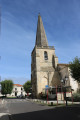
(S/E) Head west along Rue Marc Bourguedieu. Walk past the church to reach the junction with Rue du Général de Gaulle. Turn right to walk past the Town Hall and continue to Place Choteau.
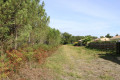
(1) Turn left to cross the square and continue to the right into Rue de Marcillannet. Head towards the forest, walking alongside detached houses. Continue along the path that runs alongside it. At the junction with a straight path, turn left towards the hamlet of Marcillannet (private property).
(2) In front of the property, take the path on the right and walk alongside a vineyard on your left. Walk until you reach the edge of the woodland, then follow it along, turning left. The path skirts the private property at Marcillannet before entering the woodland. A little further on, it emerges in front of the plots belonging to the Marcillan equestrian centre. The path passes between them, then in front of the main building on the right, before reaching a small road.
(3) Cross the road carefully and continue straight ahead along the path through the woodland. When you reach a medium-voltage power line, turn right and follow the line until you reach the next junction.
(4) Turn left and follow the path which passes by a house in a clearing on your left just before joining the D101 road. Continue straight ahead heading west until you reach the first houses.
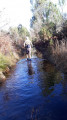
(5) Turn left onto the country lane leading to Rionet. After a straight stretch, it bends to the left as it approaches the Ruisseau de Villeneuve. Shortly afterwards, turn right and cross the Ruisseau de Villeneuve. You will arrive in Rionet. Follow Rue du Centre to the right before turning left about twenty metres further on onto a path between properties.
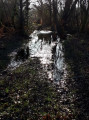
(6) At the T-junction, take the path on the right and, about fifty metres further on, turn left. Continue along this path, which soon heads west. Further on, immediately after a junction with a path coming from the right, the path reaches another junction. Turn left (south-west). Cross the Ruisseau de Maynon and arrive at a junction about 250 metres further on.
(7) Turn right onto the path heading west towards the Laplace track, DFCI path no. 10. Then turn left and join the road from Mourlan to Saint-Laurent-Médoc. Cross it and continue opposite along the Laplace track, DFCI path no. 11, heading south. Shortly afterwards, the track crosses over the Ruisseau de Peybaron. Carry straight on until you reach the junction with a path on the left at a place called Balaugue, where there is a ruin.
(8) Turn left onto the track, which now heads east towards Cartujac. After passing the long, narrow clearing at Périgne on your left, then a large farm shed on your right, the hamlet of Cartujac comes into view on the right.
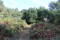
(9) Turn left onto a path overgrown with ferns before entering the woods. This path heads north-north-east. Further on, it curves to the right and crosses a crossroads of paths.
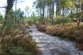
(10) Walk straight across the forest track and, about twenty metres further on, back in the woods, take the path on the left heading north-east. Follow it until it emerges from the woods behind the housing estate at a place called La Prairie.
Turn left and follow the garden fences. When you reach the last garden, turn right to go round it and you’ll soon reach Rue des Poètes. Continue almost straight ahead along this road until you reach the junction with Rue du Vieux Lavoir.
(11) Cross at the pedestrian crossing and take the path on the left leading towards the small park bordering the Jalle de l’Horthe. A little further on, take the path on the left which crosses the Jalle de l’Horthe via a small bridge near a children’s playground.
The path soon reaches Rue René Cassin. Follow it to the right until you reach Rue Camille Maumey at a T-junction. Turn left towards the church. Just before the church, turn right into Rue Saint Julien, follow it slightly past Rue de la Poste to reach the car park on the left (S/E).


 Visorando Member
 Easy
Easy