Saint-Laurent-Médoc
The commune of Saint-Laurent-Médoc is situated in the heart of the Médoc, between forests and vineyards, between the ocean and the estuary. This commune comprises 66 villages and inhabited hamlets. It thrives thanks to more than 50 associations (cultural, sporting, socio-cultural, etc.) as well as businesses, shopkeepers and craftspeople.
A brief history
The first dwellings were built alongside a Roman road constructed under Caesar in 56 BC. Laurentus, a martyr under the Roman Emperor Valerian, gave his name to the village.
Long before the capture of Jerusalem, the Order of St John, famous for its participation in the various Crusades, built a hospital and its chapel (now the sacristy of Benon Church) in Benon, where traces of the Knights Templar and the Knights of the Order of Malta can still be seen.
At the same time, Trinitarian monks occupied the centre of Saint-Laurent, as evidenced by the Place du 8 Mai 1945.
In the 12th century, Aquitaine came under English rule; the churches in the market town and in Benon bear, engraved in their stones, the marks of this presence, which was to last 300 years.
In 1653, Bordeaux was besieged by royal troops. The Prince of Condé and his men, threatened by famine during the siege of Bordeaux, pillaged the entire region on 8 June, including Saint Laurent. Its inhabitants managed to survive thanks to the solidarity of their neighbours, the ‘Parrains’, and perhaps also thanks to its wine, which was already highly prized.
In 1800, Benon was incorporated into Saint-Laurent, and in 1986, Saint-Laurent and Benon became Saint-Laurent-Médoc.
The heritage of Saint-Laurent-Médoc
The commune of Saint-Laurent-Médoc also boasts its own cultural, historical and architectural heritage. Few sources remain that mention these monuments, and many of them lie in ruins or no longer exist. However, you can explore sites such as the village church or the church in Benon, the Bernos fountain, certain châteaux, the lime kiln and the mills (ruins)… Here you will find a few stories about our monuments and our heritage.
The Village Church
The village church of Saint-Laurent-Médoc is named after a saint who was martyred in Rome in 258 and whose feast day is 10 August. Although worship of this saint is attested in Gaul during the 5th and 6th centuries, it does not appear to have been practised in Saint-Laurent until the 7th century.
The first mention of the parish dates from around 1175. The church and parish of Benon date from the same period but were originally part of a charitable foundation established by the Baron de Lamarque.
The present church was built between the 12th and 15th centuries. Its Romanesque apse and its 14th-century gate tower, with its 16th-century spire, are the elements listed as historic monuments. This building has been significantly altered over the centuries through a series of separate construction projects.
The major works that shaped the church’s present appearance date from 1841 and coincide with the troubadour or Neo-Gothic style of the 1830s–1840s, an aesthetic and literary movement marking a return to an idealised Middle Ages.
However, the main point of interest in this building lies in the appearance of its main entrance, situated in line with the sanctuary. It is almost certainly a chapel-over-door, built into a front tower and positioned directly above the passageway.
The Church of Notre-Dame-de-Benon
During the 19th century, Benon was a parish with its own church, a cemetery and a school, but above all a former commandery with a hospital.
The Church of Notre-Dame-de-Benon was built in two phases. In the 2nd century, the Chapel of Saint Catherine of Alexandria, dear to the hearts of the Knights of Saint John of Jerusalem. In the 12th century, the present church was erected under the patronage of Notre-Dame-de-Benon.
Today, although the parish hospital has been destroyed, this site serves as a stopping point for pilgrims travelling through the Médoc on the Way of St James.
The mills
There were once 11 windmills and 7 watermills in the commune of Saint-Laurent-Médoc. Some have been completely destroyed, others are still visible in ruins, whilst others have been preserved or even restored.
11 windmills:
4 mills in Saussac, the ruins of which still exist
1 in Sieujan, restored with a thatched roof; it is currently inhabited
1 in Villeuneuve, of which only the walls remain
1 in Larousse, now completely gone. This was the mill belonging to the Lord of SEMIGNAN
1 in Messadis, north of Sémignan
1 in Mourlan, 1799
1 in Ballogue-Garric, completely destroyed
1 in Bernada, completely gone
The Villeneuve Mill is a characteristic remnant of the 150 to 200 windmills that dotted the Médoc in the 18th and 19th centuries, of which the one at Vensac is the sole authentic survivor. They were almost all built to the same design and layout.
7 watermills:
1 mill in Saussac, owned by the Lord of Beychevelle, which became national property during the Revolution of 1789; it is still in good condition. It was used to grind flour from wheat supplied by the farmers and to make bread. During the Second World War, Mr Guy CRUZIN of Mourlan used to bring his wheat there with his cart and horse.
1 in Le Drap, owned and lived in by the Moricet family; its existence has been documented since the 12th century by its mention on the Belleyme map, and it is still in good condition
1 in Bernos, before the fountain; it has completely disappeared apart from a few ruins.
1 in Benon: ruins with a few remnants
1 in Lorthe, demolished during the construction of the sewage treatment works. It supplied electricity and powered the saws at the MEYNNIEU joinery, which manufactured grape-harvesting baskets.
1 known as ‘de Rionet’, in Jean-Louis VIAUD’s woodland before the old washhouse, on Rue du Vieux Lavoir.
Lime kilns
There were four lime kilns in the commune of Saint-Laurent-Médoc; three of them have disappeared, whilst the last one leaves us with a few ruins to admire.
Three in Villeneuve, one of which lies in ruins.
One in Saussac, on the route of the bypass, now gone
The Bernos fountain
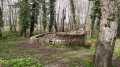
The name Bernos is thought to derive from the root ‘bern’, meaning ‘bear’. The village of Bernos, a hamlet of Saint-Laurent-Médoc, surrounds the fairground, a 6-hectare site planted with poplars and oaks; sheltered by the trees stands the Bernos Fountain.
This fountain, owned by the FOULD family and open to the public free of charge, seems timeless – a peaceful place full of mystery.
Of Gallic and Celtic origin, as indicated by its ogival shape, it is thought to have been used for Celtic and Druidic rituals. It is said that its water is rich in iron and is believed to relieve abdominal pain and treat eyesight problems.
Subsequently, throughout the ages right up to the 1990s, this legendary spot provided an exceptional setting for village gatherings such as the Bernos Fair, the oldest in the Médoc.
There is no doubt that this place has played a pivotal role in the development of Saint-Laurent-Médoc and its identity.
Legends associated with the fountain:
It is said that if a young girl in love throws two pins into the water and they cross at the bottom, she is sure to be loved in return,
It is said that a fairy comes here to quench her thirst in remembrance of her earthly origins,
A princess is said to watch over the fountain where she is said to have drowned, and her red hair is said to still colour the water to this day.
Source: the town’s official website



 Country:

 City:
City:







 Visorando Member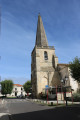
 Moderate