Country:
 City:
City:



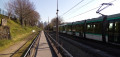
Starting point and access: Les Coteaux station.
- Tram – Line T2 (Les Coteaux stop).
Take Exit 2 (Place Santos Dumont), located at the front of the tram on the platform heading from Pont de Bezons to Porte de Versailles (please note that on this platform, the directional arrows for Exits 1 and 2 have been reversed). If arriving from the opposite direction, cross the tracks carefully at the designated crossing at the rear of the tram.
The route crosses or briefly follows signpostedPR®® trails. In this urban setting with signposted streets, the trail markings are not very useful and are therefore not mentioned in the description below.
(S) Climbthe steps leading up to the level of the old station and, at the top, turn right. Walk round the square where a sculpture stands in honour of the Brazilian aviator Alberto Santos-Dumont (1873–1932) and follow Avenue de Longchamp straight ahead. Walk gently uphill along this road, lined with beautiful houses. Cross the roundabout ahead and climb a flight of steps. At the top, cross a street and continue to the entrance of Val d’Or station.
(1) Then turn left and climb the steps leading to the footbridge over the railway line. Cross the footbridge and, on the other side, continue straight ahead along a street. At the end, first turn left then right to cross at the pedestrian crossing and continue along Rue Michel Salles towards the Saint-Cloud Racecourse.
(2) After about thirty metres, turn left into the Jardin des Tourneroches. At the three-way junction a few dozen metres further on, carry straight on, leaving the main gate on your left (a lovely view of Paris). At the next junction, take thesecond path on the right (thethird path, which goes straight on, is not shown on the map). When you reach a bench sheltered by a stone wall, turn right onto a paved path not shown on the map. Climb a few steps to reach a small rotunda.
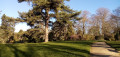
Head back down to the left. You’ll come out onto the path you left earlier and follow it to the right, alongside a wire fence on your left. Pass by the foot of a weeping cedar (on the right) and then below the estate’s former main house (on the left). Then turn right with the path. As you approach the main gate, turn left. Note the estate’s entrance house (barely visible from the other direction) and leave the garden via the same route you entered.
(2) Turn left onto Rue Michel Salles and ignore the entrance to a private residence on the right. Note a pseudo-tower on the left. Cross a boulevard at the traffic lights, continue straight ahead along Rue Michel Salles and walk alongside the Jardin de l’Avre on your left. At the end, cross a wide street at the pedestrian crossing on the left.
Then follow a gravel path to the right, running alongside the Saint-Cloud Racecourse. Pass a chicane, go past a small car park on the left and then a picturesque little house. Continue straight on and cross Avenue Francis Chaventon at the traffic lights.
(3) Follow the avenue to the left for a few dozen metres, along a tarmac path running parallel to it. Then turn right towards the Fouilleuse school complex. Pass a car park on the right, follow the Allée Nico Antonat, go past a chicane and continue along a path between some blocks of flats (on the left) and a school (on the right).
Pass a second chicane and turn immediately right onto Allée de la Fraternité, a pedestrian passage between two blocks of flats. Come out onto a street and follow it to the left. Take thefirst right, Allée des Cytises, and enter the Cité-Jardin de Suresnes (a housing estate featuring interwar architecture dominated by brick).
(4) At the junction, turn right onto Sente des Sorbiers. At the end, turn left onto Rue des Platanes. At the three-way junction, veer to the right. At the end, turn left and walk past a statue of Jean Jaurès. Go round the three-way junction on the left and cross Avenue Édouard Vaillant and then Avenue Jean Jaurès in turn.
Carry on straight ahead along Rue François Bougault, climb a flight of steps and you’ll arrive at the foot of the vast Marché Jean Jaurès. First turn left then right, and go straight on between a block of flats (on the left) and the market (on the right). Turn at the end, go through a metal gate and follow the road to the right. At the Fork in the road that appears shortly afterwards, turn left into Rue des Nouvelles.
(5) At the junction, turn left onto Rue de la Procession. Carry on straight ahead, passing two streets on your left. At the next crossroads, take thesecond right onto Rue du Point Haut and head gently uphill. At the next junction, carry on straight ahead and the climb becomes steeper. Halfway up the slope, turn left onto Rue des Vignes.
At the end, turn right, immediately ignore Rue de l’Avenir on your left (it’s a dead end!) and take the next left onto Rue Buffon. At the end, turn right and head uphill along Rue des Rosiers. At the junction, carry straight on along Rue des Landes, keeping a lawn on your left. Continue steadily uphill until you reach the esplanade of the Mémorial de la France Combattante.
(6) Take a concrete path which starts to the right of the steps on the eastern side of the esplanade. Follow this path (Promenade Jacques Baumel) and walk alongside the fort’s moat on your left. At the corner of the fort, turn left and continue alongside the moat. Move away from the fort once you’ve passed the main entrance and head downhill, keeping a road on your left. Then go down a flight of steps on the right leading to a car park. Turn left and walk alongside a boulevard on your right.
Go round the junction on the right, cross the D5 and then the D3 in turn, and you’ll come to a roundabout offering a viewpoint (the directions are engraved on the stone balustrade, but the view is now largely obscured by trees). Leave the roundabout via a hairpin bend and head down the ribbed path, which takes a sharp right-hand bend. At a sort of landing, turn sharply left and head down a tarmac path interspersed with steps.
At the bottom, continue straight on along Rue des Parigots. Take thesecond turning on the right, Rue Gabriel Philippe. At the end, turn left onto Rue Hoche and walk alongside a square on your left. At the end, first turn left then right onto Rue Maurice Payret Dortal. Walk alongside the brick-built Lycée Paul Langevin on your right and note the quotations engraved in large letters on its walls.
(7) At the junction on the corner of the school, carry on straight ahead for about fifty metres, until you reach the Chapelle Saint-Louis on the right-hand side. Retrace your steps.
(7) On your return, turn left onto Rue Claude Burgod. When the street bends to the right, veer left and walk gently downhill. Cross Rue Paul Bert, continue straight ahead, descending slightly, and finish by going down a flight of steps. At the bottom, cross the road at the pedestrian crossing on the right and turn left to head down towards an underpass (do not follow the road). Take the underpass beneath the railway lines (the Transilien line) and continue onto the footbridge that spans the tram tracks.
(8) At the end of the footbridge, go down the stairs on the right to reach the tram station platform. At the bottom, turn immediately right to cross (carefully) the tracks at the designated crossing. On the other side, turn right towards exits 4 and 5. Walk alongside the tram track on your right, either on the tarmac path protected by a railing, or on the gravel path running parallel to it on the left-hand side.
The two paths join further on; continue slightly uphill. At the top, turn left towards Exit No. 4 and go through the pedestrian tunnel under the Transilien tracks. On emerging, turn right and walk alongside the railway fence. At the junction, veer right, leaving the Voltaire Cemetery on your left. At the traffic lights, cross Rue des Bas Roger, follow it to the right and pass under the Transilien viaduct, then under the tram viaduct.
Take thefirst left, Rue Rouget de l’Isle, and walk alongside a grassy area on your left. At number 36, turn left into Passage Marianne. Climb the steps and pass under the railway tracks again. On the other side, turn right and follow a footpath running alongside the railway tracks (clearly separated by a wall). The path turns left and comes out onto a street: follow this to the right. At the crossroads, veer right and cross a square going downhill. At the bottom, cross a street and you’ll immediately reach Puteaux station (S/E).
To get back home:
- Transilien – Line L towards Paris Saint-Lazare, or Versailles Rive Droite, or Saint-Nom-la-Bretèche.
- Transilien – Line U towards Versailles-Chantiers and La Verrière.
- Tram – Line T2 towards Pont de Bezons or Porte de Versailles.

 Visorando Member

 Difficult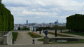

 Moderate