Country:
 City:
City:


Head to Blaisy-Bas. Drive up Rue de l’Église to park in the designated area, to the right of the town hall/post office, at the end of a cul-de-sac.
(S/E) Set off with your back to the town hall and walk down Rue de l’Église. Pass to the left of the public fountain, where many locals still come to fetch water. Opposite, take Rue d’Avau towards Val-Suzon. When you reach the “L’orée des Charmes” hotel, turn right onto Rue de la Gare.
(1) Walk alongside the railway line, keeping to the left. At the end of the street, when you reach a junction, continue straight ahead (just before the junction, the railway line disappears into an underpass). Follow a gravelled track suitable for vehicles, passing a motocross track, then climbing steadily through the woods. Well signposted, it winds twice (left, right) with a straight section in between. It ends in a narrow path leading onto a field track at a bend. Continue straight ahead to reach a T-junction.
(2) On the right-hand side of the junction is ventilation shaft No. VII. Head down the path through the woodland to the right; after a few hectometres, you’ll reach the Blaisy-Haut washhouse and drinking trough, dating from 1848. Picnic area.
(3) The washhouse was restored in 1988/1989. Retrace your steps back to the T-junction.
(2) At this point, continue straight on along the path, which becomes tarmac as you approach the first houses, heading up towards the village centre of Blaisy-Haut.
(4) When you reach a square, turn left onto Rue du Château. You’ll pass the war memorial and the Town Hall (on the left) and the church and cemetery (on the right). Directly ahead, at the end of the cul-de-sac, is the castle.
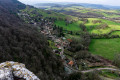
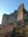
(5) A restored former stronghold, situated on a rocky outcrop, bearing the coat of arms of Claude II de Blaisy (1473–1503). There is a viewpoint if you take a detour to the left. Turn round to return to the square where you started.
(4) Head straight ahead along Rue de Charmoy. Shortly afterwards, at a left-hand bend as you leave the village, take the tarmac path on the right which climbs towards the forest. It turns into a gravel track at the edge of the woods. Wide and well-maintained, follow it all the way along without ever leaving it. At the edge of a wooded area bordering fields, the Blaisy-Haut weather radar is visible in the distance on the left (white dome). Pass close to ventilation shaft XIII, visible on the right, but also pass under a high-voltage power line shortly before reaching the D16. Cross the D16.
(6) Ventilation shaft XV is located by the roadside (it descends more than 200 metres to reach the tracks). You can climb up onto the water tank behind it to catch a glimpse of the surrounding landscape (Flavignerot radio mast). Return to the D16 at the finish point, then turn right to continue along the original path. A descending stony track. Take a sharp right-hand bend (ignore the path branching off to the left). Pass a shaft XVI (on the right). At the first junction of tracks, turn sharp left.
(7) A white, vehicle-accessible track that soon heads into the woods. Follow it all the way until you reach Baulme-La-Roche, visible in the distance halfway up the hillside. At the junction with a farm (on the right), the track becomes tarmac. Continue to pass under a medium-voltage power line just before emerging onto the D104c. Turn right.
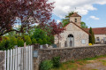
(8) Before heading up towards the rocky summit, enter the village of Baulme-La-Roche via the road. On the left, in succession: a picnic area, a pond and one of the village’s two wash houses (located at either end), not forgetting the source of the Douix; further on, on Rue Georges Clémenceau, opposite the Town Hall, the Lucan fountain and drinking trough dating from 1822, the Benedictine priory dating from 1502 (now a private lodge), and the 18th-century Church of Saint-Martin.
(9) After admiring these cultural treasures, retrace your steps back to the D104c.
Along the way, look up to take in the expanse of the limestone cliff.
(8) Turn right at a stone cross. The stony path climbs steadily until it joins the D104c. Walk about forty metres along this road before turning right onto the Chemin des Roches. This is a white-marked track suitable for vehicles, with a high-voltage power line on the left. After 200 metres, you’ll reach a car park reserved for disabled vehicles. Take the path on the right and keep hugging the right-hand side as you proceed until you reach an orientation table. Exceptional 180-degree panoramic view.
(10) Take a moment to look out over the horizon and, for those who aren’t afraid of heights, the village of Baulme at the foot of Les Roches (take care). Cross the dry grassy area to rejoin the original path. It continues as a fairly wide track through the woodland, with opportunities to get closer to the cliffs on the right (paragliding area). At the far end of the only clearing on the left, at the crossroads of tracks, continue along the same path. At the next crossroads, carry on straight ahead, heading downhill. At the following four-way junction, turn right onto a white-marked path (elevation 520). Shortly after a right-hand bend, there is a stone marker on the left. Turn left.
(11) A track marked with yellow markings and a signpost reading ‘Mâlain Sportif’. Pass under a medium-voltage power line and follow the track all the way until you reach a crossroads of tracks. Head straight ahead.
(12) Follow the path downhill, with a meadow on your right. Just after the meadow, at a sharp left-hand bend, leave the original path and head right. The path descends and enters the woods. It bends left twice. At the second bend, leave the path here too and head straight on along the track which crosses a dry meadow and overlooks Mâlain. It descends, sometimes steeply, until it joins the D104c. Turn right.
(13) Follow this road upwards, keeping an eye out for traffic, until you reach the Mâlain Viaduct.
(14) Pass under the viaduct and take the first tarmac track on the left marked ‘tunnel emergency access’. Follow the River Douix. At the next crossroads of tracks, turn left to reach the railway line. Take a few steps to the left so as to cross it away from a set of points.
(15) As there is no protection when crossing the two tracks, caution is essential. By convention, trains sound their horns both when entering and exiting a tunnel to warn of their passage, which is the case here. Go through the gate opposite on the left-hand side, then head straight ahead along the path through the woodland. Continue in this direction, ignoring any side paths, until you reach the D104g at an altitude of 445. Turn right.
(16) There is a stone cross at the junction. Follow this road carefully down towards Savigny-Sous-Mâlain via Rue de Mâlain. On the left, there is an old, renovated tower bearing a coat of arms (entrance to a private property). Take the first right, Rue Haute, to reach the church and the adjoining cemetery on the left.
(17) Enter the cemetery to see a 6-metre-high stone cross dating from the 16th century.
Leaving the cemetery, continue along Rue de la Jonchère – the route you took on arrival – then, just before it ends, keep to the right to join and walk up Rue du Garmois. Head away from Savigny via the VC2. On the left, there’s a beautiful view. Just after the second hairpin bend, you’ll see the Chapelle Saint-Antoine on the right, which also appears to date from the 16th century. A break is in order! Once you’ve caught your breath, carry on until you reach the junction with the D16. Cross it at the top of the hill.
(18) Head straight on along the continuation of the VC2 (Chemin de Savigny). Pass under two high-voltage power lines before skirting the Bois des Chouettes on the right. The road then enters the Bois du Laret and Bois de Boscul. Follow it all the way, taking care. Pass under another high-voltage power line on the descent leading to the entrance to Blaisy-Bas. At the junction with the D7, turn right.
(19) Take the left-hand pavement on Rue Durand to reach the village centre, passing the war memorial (on the left). Shortly afterwards, turn left, following the signs for the town hall and church. You’ll arrive at Place du Jet d’Eau (the public fountain seen at the start). Head up Rue de l’Église on the left to reach the town hall (S/E).

 Visorando Member
 Moderate
 Easy
Easy