From Nanteuil-sur-Marne to Château-Thierry

End of this Paris region section of the “Via Colombani”, a detour from the Way of Saint Columbanus which crosses no fewer than five European countries.
The identification of the Way of Saint-Colomban provided an opportunity to highlight his major role in the monastic foundations of early Christian Europe. The European Columbanian associations then set about mapping this monk’s route across Europe, marking the major sites along the way with a bronze plaque.

This walk is part of a multi-day hike: Le Chemin Européen de Saint-Colomban

Details

1872811
Creation:
Last update:
Last review:
  • Walking
    Activity: Walking
  • ↔
    Distance: 19.64 mi
  • ◔
    Duration according to the author: 6 hrs 
  • ▲
    Difficulty: Very difficult

  • ⚐
    Back to start: No
  • ↗
    Ascent: + 1,699 ft
  • ↘
    Descent: - 1,693 ft

  • ▲
    Highest point: 620 ft
  • ▼
    Lowest point: 184 ft
  • ⚐ Country: France
  • ⚐ City: Saâcy-sur-Marne (77730)
  • ⚑
    Start: N 48.97376° / E 3.220026°
  • ⚑
    End: N 49.038184° / E 3.409273°
  • ❏
    IGN map(s): Ref. 2513E, 2514SB, 2613O, 2614O
  • Hour-by-hour weather

Photos

Description of the walk

(S) On leaving Nanteuil-Saâcy station, follow theGR®14A(red and white markings) to the left (east). After running alongside the railway line, the path veers right between the fields and then turns left. Turn right at the edge of the woods. As you approach the road, turn left. You will arrive at the foot of Citry church.

(1) Turn left towards the railway line. Before the tunnel, take the path on the right and follow the railway line. At the second tunnel, follow the road to the right.

(2) Cross the small square and turn right onto Rue Michaud. At the end of the tarmac, follow the path which immediately turns left into the vineyards. At the T-junction, head diagonally left.

(3) At the next junction, go straight on and, at the fork that appears immediately, turn right. Enter the hamlet of Villaré via Rue de la Croix. Ignore a street on the left and then one on the right, and you’ll arrive at the foot of the water tower.

(4) Turn left twice and head east. Just before the road, veer slightly left. Cross the road and continue along the street opposite. At the fork, turn right onto Rue du Moulin à Vent.

(5) At the end, turn right onto a path that descends into a wood.

(6) Turn right (south-east) onto the embankment of the Dhuis underground aqueduct. Follow the aqueduct along the contour line, staying on theGR® (red and white markings). Cross the D82 road.

(7) At a crossroads, leave the aqueduct, turn right uphill and pass the ruins of the Baronnerie farm (still following theGR®). Go round the Marie farm on the left and head down into the woods.

(8) Take the first path on the right and continue along the edge of the woods. Carry on through the fields to the hamlet of Les Gravelles. Then head diagonally left downhill.

(9) We come to the Dhuis aqueduct and follow it to the right.

(10) Just before the D11, leave the aqueduct and take the path on the left. Pass below the cemetery and go straight on. At the junction, follow the Grande Rue to Nogent-l’Artaud station.

(11) Cross the Marne and immediately turn right to follow the river. After about a hundred metres, turn left into Rue du Bac. Cross the D969 then first turn left then right to follow Rue de Montoizelle. Head north along Chemin des Hiriots, passing a pumping station on the right and then a reservoir on the left (still following the red and white markings, between the vineyards).

(12) At the second junction, turn right. At the second junction (T-junction), turn right again, heading downhill through the vineyards.

(13) At the second junction, follow the Chemin des Maintenons to the left through the vineyards. Cross a small road and continue along Rue des Traversaines. At the end, turn left twice and head uphill to a reservoir.

(14) Leave the road and turn right onto the Murger Veron (still following theGR®14). At the next junction, continue straight ahead. Head north-north-east through the vineyards.

(15) Continue straight on (north) through the Bois de Romeny, ignoring the various side paths.

(16) Head back down to the right (GR® markings). Cross the D969 and follow it to the right (beware of fast-moving traffic). After about 150m, take a path on the left leading to the right bank of the Marne.

(17) Walk along the river on your right, ignoring all the paths branching off to the left.

(18) Just before the road bridge, take a sharp left-hand bend. Then head diagonally to the right and climb into the village via Rue du Bac. Cross the D969 and continue straight ahead into Rue de Gramont. Cross Rue de Derrière les Murs on the right-hand side.

(19) After about twenty metres, turn right onto a vineyard track, “Les Dons” (follow theGR®11A). Ignore a turn-off on the right. At the next junction, turn left, uphill between the vines, then ignore a turn-off on the left.

(20) At the T-junction, turn right. At the next junction, continue straight on. Head north, follow the red and white markings and ignore all side paths.

(21) At the junction of tarmac roads, turn left. Keep heading north-north-west along the tarmac road.

(22) At the end, at a crossroads, take the path on the right (north). At two closely following junctions, go straight on and cross through the vineyards again.

(23) At the T-junction, turn right. At the next junction, follow the Chemin des Godaux to the left. Ignore two turnings on the right and, at the crossroads, take the Rue de l'Abbaye straight ahead.

(24) At the junction at the foot of the church in Essomess-sur-Marne, turn left onto Rue du Jeu d'Arc. After about a hundred metres, take a small road on the right. Cross the Ru des Rochets and follow it to the right. Behind the school, turn left. At the next junction, turn left, leaving Rue de la Cote 204 on your left.

(25) Turn right at the next crossroads, then immediately left to head up towards the top of the vineyard.

(26) At the crossroads, turn right along the edge of the vineyards. Just before the end of a vineyard, turn left, then right with the path. Then go round the American monument on the right (memorial site, views).

(27) Follow the Chemin des Henry to the right and head down towards Courteau, following the signposts. You’ll come out onto a street; follow it to the left for about forty metres.

(28) At the T-junction, turn right twice and follow Rue de Courteau. At the crossroads, go straight on. At the fork that appears shortly afterwards, turn left onto Rue du Bas Courteau and cross the D1003. Take the first left and, at the fork, follow Rue Quentin Roosevelt to the right. Take the first right, Rue Vieille.

(29) At the end, turn left into Rue de la Mare Aubry. At the end, follow Avenue de Paris to the right. After about 40 metres, turn right onto the Ru Ganache path. At the end, follow Avenue d’Essomes to the right. After about 100 metres, turn left onto Rue de la Marne.

(30) Follow the towpath to the left and walk alongside the Marne on your right. Continue along the Promenade Docteur Jean Naudin. Pass a roundabout (post office) and continue along the Marne to the bridge.

(31) Cross the bridge over a branch of the Marne and step onto an island. Immediately turn left onto Quai Galbraith. At the eastern end of the island, cross a second branch of the Marne via a footbridge. Immediately turn right onto Quai Dupuy Delizy.

(32) After about a hundred metres, turn left onto Rue des Bains. When you reach Avenue de la République, first turn right then left to cross (carefully) the avenue and take Avenue Wilson. Continue straight on to Château-Thierry station (E).

Waypoints

  1. S : mi 0 - alt. 207 ft - Gare de Nanteuil-Saacy
  2. 1 : mi 1.11 - alt. 203 ft - église st Pons.
  3. 2 : mi 1.59 - alt. 200 ft - Village square
  4. 3 : mi 1.91 - alt. 315 ft - Crossroads
  5. 4 : mi 2.46 - alt. 554 ft - Villaré
  6. 5 : mi 2.9 - alt. 528 ft - End of Rue du Moulin à Vent
  7. 6 : mi 3.22 - alt. 400 ft - Aqueduc de la Dhuis
  8. 7 : mi 5.72 - alt. 420 ft - La Baronnie
  9. 8 : mi 6.56 - alt. 486 ft - Path on the edge of the woods
  10. 9 : mi 7.41 - alt. 410 ft - Underground aqueduct of the Dhuis
  11. 10 : mi 8.21 - alt. 413 ft - Junction
  12. 11 : mi 8.96 - alt. 197 ft - Nogent l'Artaud Bridge - Gare de Nogent-l'Artaud-Charly
  13. 12 : mi 9.63 - alt. 476 ft - Crossroads in the vineyards
  14. 13 : mi 10 - alt. 348 ft - Chemin des Maintenons
  15. 14 : mi 10.45 - alt. 299 ft - Reservoir - Start of the trail
  16. 15 : mi 11.06 - alt. 315 ft - Bois de Romeny
  17. 16 : mi 11.85 - alt. 243 ft - Junction
  18. 17 : mi 12.04 - alt. 194 ft - Right bank of the - Marne (la)
  19. 18 : mi 13.25 - alt. 194 ft - Place du Bac. Confluence of the Marne and - Dolloir (cours d'eau) - Affluent de ma Marne
  20. 19 : mi 13.48 - alt. 243 ft - Intersection
  21. 20 : mi 13.73 - alt. 315 ft - Crossroads halfway up the vineyards
  22. 21 : mi 14.48 - alt. 374 ft - Crossroads
  23. 22 : mi 14.73 - alt. 476 ft - Crossroads
  24. 23 : mi 15.55 - alt. 348 ft - T-junction
  25. 24 : mi 15.82 - alt. 217 ft - Church of Essomess-sur-Marne
  26. 25 : mi 16.21 - alt. 289 ft - Ref. 204
  27. 26 : mi 16.55 - alt. 538 ft - Crossroads - Vignobles dessus de la Borde
  28. 27 : mi 17.11 - alt. 551 ft - American monument
  29. 28 : mi 17.45 - alt. 354 ft - T-junction
  30. 29 : mi 17.87 - alt. 217 ft - Rue de la Mare Aubry
  31. 30 : mi 18.26 - alt. 197 ft - Chemin de Halage - Marne (la)
  32. 31 : mi 18.92 - alt. 210 ft - Bridge over the - Marne (la)
  33. 32 : mi 19.38 - alt. 203 ft - Rue des Bains
  34. E : mi 19.64 - alt. 207 ft - Gare de Château-Thierry

Notes

Shops in Saâcy-sur-Marne, Nogent l'Artaud, Essomes-sur-Marne and Château-Thierry.
Make sure you bring plenty of water; the route is exposed to the sun and temperatures can be high in summer.

Pays Fertois Tourist Office; 5 Grande Place 77640 Jouarre; contact: 01 60 22 64 54
Les Portes de la Champagne Tourist Office: 2 Place des États Unis, 02400 Château-Thierry
contact: 03 23 83 51 14

https://www.chambres-hotes.fr/; https://www.cybevasion.fr/; https://www.gites-de-france.com/fr; https://www.airbnb.fr; https://www.campingfrance.com; https://www.camping.fr

From Château-Thierry station:
- Transilien Line P, towards Meaux and Paris-Est.
- TER and Intercités lines towards Reims and Strasbourg.

Worth a visit

We continue to follow the Marne, which reveals villages with richly decorated churches, reflecting the devotion of the inhabitants of Brie on the border with the Aisne.
The route winds along the Marne between the cool towpaths and the windswept heights overlooking the valley.
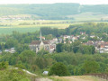
Citry-sur-Marne: The village square, where we can admire the distinctive layout of a Brie village (castle, church, town hall, Brie-style houses). The vineyards.
Pavant: Farmhouse, dovecote and church.
Nogent l’Artaud: castle, station, banks of the Marne.
Azy-sur-Marne: church, banks of the Marne.
Château-Thierry: American Memorial, banks of the Marne, Jean de la Fontaine’s house, medieval castle.

Always be cautious and plan ahead when you're outdoors. Visorando and the author of this route cannot be held responsible for any accidents occurring on this route.

The GR® and PR® markings are the intellectual property of the Fédération Française de Randonnée Pédestre.

Reviews and comments

4.6 / 5
Based on 4 reviews

Reliability of the description
4.8 / 5
Ease of following the route
4.8 / 5
Route interest
4.3 / 5
virgule
virgule

Hello,

A night by the Marne? Right in the middle of the grape harvest – you’re brave!

Machine-translated

yanntb
yanntb

Overall rating : 4.3 / 5

Date of your route : Aug 27, 2020
Reliability of the description : ★★★★★ Very good
Ease of following the route : ★★★★★ Very good
Route interest : ★★★☆☆ Average
Very busy route : No

A family hike (17-year-old, 22-year-old and the parents), split into two parts (10 hours is too long) with a night by the Marne. We actually started in La Ferté-sous-Jouarre, which is handy, as the route follows the train line (Paris-Est to Château-Thiérry). We left the car near the station, walked, then once we reached our destination we took the train. The path winds through forests and vineyards, going up and down along the banks of the Marne, passing a few hamlets. Refreshments available in Nogent, otherwise nothing. Best done in the autumn, after the grape harvest, otherwise there are quite a few tractors and other vehicles about.

Machine-translated

ageep
ageep

Yes, with temperatures like this, a bit of a cool breeze is just what the doctor ordered!

Machine-translated

tryphon02
tryphon02

Overall rating : 5 / 5

Date of your route : Jul 20, 2020
Reliability of the description : ★★★★★ Very good
Ease of following the route : ★★★★★ Very good
Route interest : ★★★★★ Very good
Very busy route : No

You can also get back by following the Marne. It’s a bit shorter.

Machine-translated

virgule
virgule

I’m also keeping an eye out for comments on my routes, but at the moment we’re waiting in vain for the customer

Machine-translated

ageep
ageep

Especially during lockdown 🙈😷
A lovely day to enjoy the scenery.
Enjoy your walks

Machine-translated

virgule
virgule

Hello everyone

31 km in a day – I don’t think anyone’s going to be rushing to join me...

Machine-translated

virtuel99
virtuel99
• Edited:

Overall rating : 5 / 5

Date of your route : Feb 16, 2020
Reliability of the description : ★★★★★ Very good
Ease of following the route : ★★★★★ Very good
Route interest : ★★★★★ Very good

A lovely walk
No closed or inaccessible paths
Over 27 km, I stopped at Essomes; we passed through woodland, along the banks of the Marne and through vineyards.
Be careful, the sections at La Dhuys are a bit tricky, especially after rain when it’s muddy.
I had the app on my smartphone, so I never got lost. The signposting is perfectly adequate.
I agree, the ‘very difficult’ rating seems a bit overrated to me.
Well done and thank you.

Machine-translated

virgule
virgule

Hello,

The blue and yellow markers visible in the Marne Valley running east-west are those of the Reims-Paris route. It is signposted by the same association as the Via Campaniensis towards Vézelay.

http://www.randonneurs-pelerins.com/joom...

Machine-translated

ovil
ovil

I zoomed in on the map and looked at it again, and realised where I’d gone wrong. I left the aqueduct at the first track near Pavant, when I should have carried on a little further.

Machine-translated

ovil
ovil

Overall rating : 4 / 5

Date of your route : May 21, 2019
Reliability of the description : ★★★★☆ Good
Ease of following the route : ★★★★☆ Good
Route interest : ★★★★☆ Good

A long walk in perfect weather – sunny but not too hot.
The walk along the Dhuys aqueduct is pleasant.
We had a bit of trouble finding Les Gravelles. I didn’t see any GR markings when we left the aqueduct to head up into the woods; just the very occasional yellow and blue Santiago de Compostela markers. We ended up in Salnove, where a local resident pointed us in the right direction. It was about 3 km further on, which meant we arrived in Nogent l’Artaud after the shops had closed.
Seeing our distress, a local woman heated up one of her baguettes from her freezer so we could have a picnic.
The climb to the American memorial at the end of the route isn’t easy for what we now call ‘seniors’.
The descent and the walk along the Marne allow us to recover before reaching the station.

Machine-translated

ageep
ageep

Yes, it’s surprising!
As soon as it gets a bit long, the route becomes really tough.
I’d love to explore Verviers 😻👍

Machine-translated

pasdid88
pasdid88

I know this route very well, having done it several times, so I really can’t understand why it’s classifiedas ‘very difficult’!!!
Admittedly it’s long, but there’s really nothing difficult about it for a keen hiker.
Come and visit us in the Vercors or the Dévoluy and you’ll see what a “very difficult” hike really is...

Machine-translated

virgule
virgule

Something to do one day, returning by TER.

Machine-translated

Other walks in the area

For more walks, use our search engine .

The GPS track and description are the property of this route's author. Please do not copy them without permission.