From Maroilles to Landrecies

From Maroilles to Landrecies via the Basse-Maroilles.

Details

n°1765476
Creation:
Last update:
Last review:
  • Walking
    Activity: Walking
  • ↔
    Distance: 8.34 mi
  • ◔
    Average duration: 3h 55 
  • ▲
    Difficulty: Moderate

  • ⚐
    Back to start: No
  • ↗
    Ascent: + 108 ft
  • ↘
    Descent: - 141 ft

  • ▲
    Highest point: 531 ft
  • ▼
    Lowest point: 433 ft
  • ⚐ Country: France
  • ⚐
    Area: Avesnois
  • ⚐ City: Maroilles (59550)
  • ⚑
    Start: N 50.139653° / E 3.762475°
  • ⚑
    End: N 50.13445° / E 3.695734°
  • ❏
    IGN map(s): Ref. 2706OT, 2707O
  • Hour-by-hour weather

Photos

Description of the walk

Start from the accommodation on Rue des Juifs.

(S) Head down Rue des Juifs to the left. Take the footpath. Continue to the junction with Chemin Dame-Marguerite. Here, you’ll rejoin theGR®.

Red and white markings forthe GR®655

(1) Turn left. You’ll come out onto a cross-road, near the Pont de la Croix-Robosse.

(2) Turn left onto Rue du Lieutenant. Continue to the Place de la Mairie de Maroilles.

(3) Turn right onto the Grande Rue, then turn left into the Cour de l’Abbaye. At the end, turn right and then immediately left down a flight of steps leading to a small road.

Turn left onto this road. Cross the Helpe Mineure via a bridge and continue along the small road, Rue de la Basse. At the end of this road, join the D32. You will reach a junction at Basse-Maroilles.

(4) Take the right-hand road, Rue de la Basse (D32). At the next fork, turn right again (D32) and you’ll come to a bend in the road.

(5) Carry straight on along a small tarmac road, Chemin de Cerfmont. Cross the Ruisseau Marion via a bridge and continue. Pass the first dirt track on the right and take the next one.

(6) Turn right onto the dirt track, Chemin du Quemineau. Reach the D959 and follow it to the right for a few metres. Cross with care.

(7) Turn left onto a lane, Ruelle du Cruquet. Wind your way through the hedgerow, then emerge onto a small tarmac road

No signposting

(8) Turn left onto Chemin de Bruneau. Pass several access roads on the right until you reach the junction leading to Le Préseau.

(9) Turn right onto Chemin du Préseau until you reach the D959.

(10) Turn right and continue straight on until you reach the D934. Turn right onto it, staying on the pavement. Pass through the centre of Landrecies, Faubourg de France, Avenue Villars and Route du Général De Gaulle, until you reach a bridge over the Sambre-à-l’Oise Canal.

(11) Continue along Avenue de la Légion d’Honneur, then Avenue de la Marne. At the roundabout, turn right and take Faubourg Soyères, which runs parallel to the previous avenue. Turn left towards Les Etoquies and go straight on until you reach No. 37, Les Charmilles accommodation (E).

Waypoints

  1. S : mi 0 - alt. 518 ft - Rue des Juifs in Maroilles
  2. 1 : mi 0.55 - alt. 459 ft - Dame-Marguerite Trail
  3. 2 : mi 1.3 - alt. 433 ft - Rue du Lieutenant
  4. 3 : mi 2.32 - alt. 476 ft - Grande Rue
  5. 4 : mi 2.79 - alt. 446 ft - Rue de la Basse
  6. 5 : mi 3.25 - alt. 453 ft - Cerfmont Trail
  7. 6 : mi 3.61 - alt. 482 ft - Chemin du Quemineau
  8. 7 : mi 4.28 - alt. 502 ft - Ruelle du Cruquet
  9. 8 : mi 5.01 - alt. 443 ft - Bruneau Trail
  10. 9 : mi 5.6 - alt. 453 ft - Chemin du Préseau
  11. 10 : mi 6.27 - alt. 459 ft - Faubourg de France
  12. 11 : mi 7.3 - alt. 449 ft - Landrecies Canal Bridge - Canal de la Sambre à l'Oise
  13. E : mi 8.34 - alt. 499 ft - Accommodation at Les Charmilles

Notes

Red and white markings.

Worth a visit

Maroilles: Avesnois Regional NaturePark Visitor Centre in the former abbey.

Café Rando Nord
The abbey cellars in Maroilles
http://www.tourisme-avesnois.com/sejourn etc.

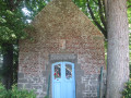
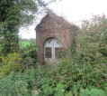
The 18th-centurySaint-Humbert Church, the 17th-century Abbey Millon the Helpe Mineure, chapels and oratories.
Cheese named after the village.

[A sensory tour of Maroilles
|http://www.tourisme-avesnois.com/voir-faire/sites-visiter/494299-le-parcours-des-sens].

Museums in Landrecies.

Accommodation:
Les Charmilles de Mormal in Landrecies.

Always be cautious and plan ahead when you're outdoors. Visorando and the author of this route cannot be held responsible for any accidents occurring on this route.

The GR® and PR® markings are the intellectual property of the Fédération Française de Randonnée Pédestre.

Reviews and comments

4.5 / 5
Based on 2 reviews

Reliability of the description
4.5 / 5
Ease of following the route
4.5 / 5
Route interest
4.5 / 5
Buzzrando
Buzzrando

Overall rating : 4 / 5

Date of your route : Mar 29, 2019
Reliability of the description : ★★★★☆ Good
Ease of following the route : ★★★★☆ Good
Route interest : ★★★★☆ Good

Not bad 👣👣

Machine-translated

jacques.cambray@sfr.fr

Overall rating : 5 / 5

Date of your route : Mar 26, 2019
Reliability of the description : ★★★★★ Very good
Ease of following the route : ★★★★★ Very good
Route interest : ★★★★★ Very good

very pleasant

Machine-translated

Other walks in the area

For more walks, use our search engine .

The GPS track and description are the property of this route's author. Please do not copy them without permission.